Exploring Shoreline Park, San Rafael with Michael – 5 June 2017

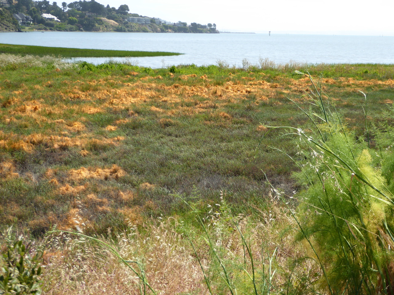
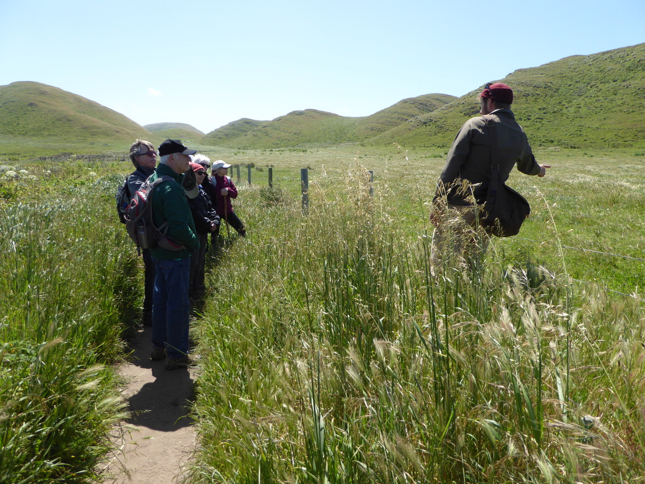
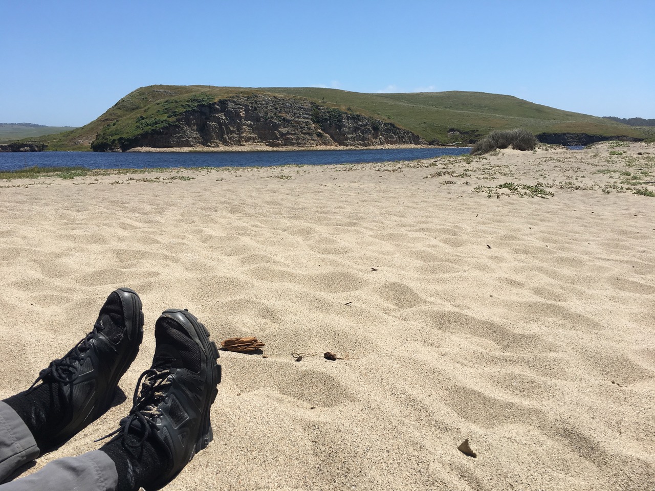
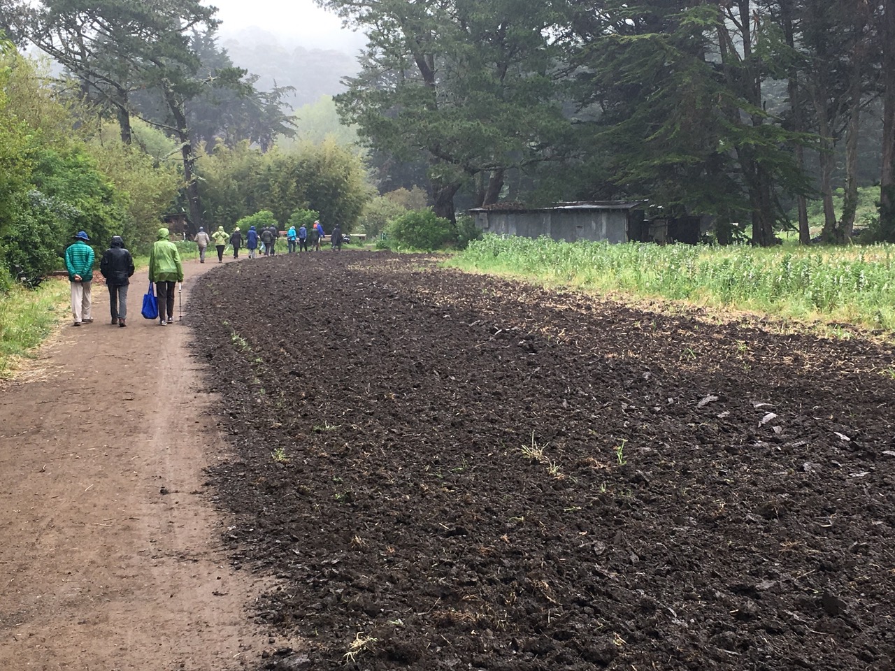
Traffic was light on 101lending a welcoming feeling to our penultimate hike for the 2017 spring season. We were here previously in March of 2013 when we explored Pickleweed Park as well as hiking on the Jean and John Starkweather Trail. Our hike today is along San Rafael Bay. San Rafael Bay is described in the Wikipedia entry with the lovely word “embayment” of San Pablo Bay. San Pablo Bay is in turn the northern part of the greater San Francisco Bay – all of it a bit like a Russian nesting (matryoshka) doll.

The Starkweathers moved from San Francisco to Marin in 1956 to raise their family and fell in love with this area. John was a professor of Medical Psychology at the University of California in San Francisco and a community leader. Jean supported John through graduate school at Northwestern in Illinois and then raised their three boys with him in the city followed by their move to a new home in Marin’s Terra Linda. It was those three boys that got her into community and conservation activism when a nearby hillside and haunt of the boys was about to be developed for housing. “One of her sons asked her what would happen to the burrowing owls living there. Jean decided to find out”

https://web.archive.org/web/20120422110012/http://www.marinwomenshalloffame.org/honorees/jean-starkweather-bio.html
https://www.youtube.com/watch?v=LuPuKsRHe1M – video interview with Jean Starkweather http://www.marinaudubon.org/pdf/TheRail_Jan2016_Web.pdf
http://www.marinij.com/article/NO/20151130/NEWS/151139977

Jean Starkweather is part of a memorable tradition of women’s conservation activism in Marin and the San Francisco Bay Area – she’s in great company. Here are just a few examples.

On our hike at Ring Mountain we read of Phyllis Ellman known as the ‘Mother of Botany” who led local conservationist groups to save the area from massive development. This location, the only place on earth where the Tiburon Mariposa Lily is found, was purchased by the Nature Conservancy and deeded over to the Marin County Open Space district in 1995. She was described was as “very knowledgeable and very dogged”. Her work continued in Sonoma County when they moved to Glen Ellen where she became a “founding mother” of the Bouverie Preserve Environmental Education Program . Two of our hikers, Inge and Kit working with 4th graders, are volunteers in this program.

Elizabeth Terwilliger “pioneered environmental education in Marin County. A legend in her time, she led school trips for children until she was 87.” She would come each year to Stinson Beach School where Pat was teaching Kindergarten to share her love of and enthusiasm for nature bringing along many examples of Marin fauna. Two others in our group, Rowena and Jeannie, volunteered in her program and hiked with her. While she accomplished so much more, she is often remembered for getting then President Regan to raise his arms in her “patented” V is for Vulture stance. http://www.terwilligerfilms.org/id2.html

In 1961, three University of California wives from the East Bay, Mrs.Kay Kerr, Mrs. Sylvia McLaughlin and Mrs. Esther Gulick “saw an Oakland Tribune illustration depicting San Francisco Bay mostly filled in and turned into a narrow shipping channel by 2020. Making phone calls, writing letters, holding meetings and collecting $1 from each of thousands of Bay Area residents they created the ‘Save San Francisco Bay Association’ beginning a successful movement to save the Bay from destruction.” They achieved a legislative moratorium against filling the Bay, closure of more than 30 city garbage dumps along the shoreline. (The area of our hike included many dumping areas for San Rafael. ) A halt to the practice of dumping raw sewage into the Bay and establishing a permanent state agency to regulate shoreline development and public access both became a reality. This Bay Conservation and Development Commission (BCDC) was the first-ever coastal zone management agency and a model for many others around the world.” https://www.savesfbay.org/history https://blog.savesfbay.org/2017/02/wetland-restoration-is-working-heres-how/ videos – We’ve hiked in both of these areas. http://www.foundsf.org/index.php?title=SAVING_SAN_FRANCISCO_BAY

In the 1930s, Sepha Evers, Caroline Livermore, Portia Forbes and Helen Van Pelt saved many of Marin’s open space treasures and founded Marin Conservation League which continues their activist tradition today. They worked with others to expand Mt. Tamalpais State Park from its 200 acre nucleus, created Tomales Bay State Park, and assisted in the creation of Golden Gate National Recreation Area and Point Reyes National Seashore. The MCL website highlights “one of the most dramatic chapters in MCL history was the battle to stop 8790 acres of Richardson Bay from being filled – by bull dozing the Tiburon hills and depositing the fill into the bay – turning it into a town for 10,000 people. Today it is the Richardson Bay Audubon Center and Sanctuary.
Another of their signal victories was stopping the commercialization of Angel Island when developers had plans that neither respected the nature of the island nor its important history. Caroline Livermore said of their 14 year campaign to preserve the island, “We really saved it from becoming a cheap Coney Island, which a Nevada firm hoped to develop.” Or can you imagine a resort hotel and yacht harbor in Bolinas Lagoon? It was another developer’s dream derailed.
http://marinconservationleague.org/about-us/history.html

http://www.goodreads.com/book/show/353145.National_Parks_and_the_Woman_s_Voice

===================================================

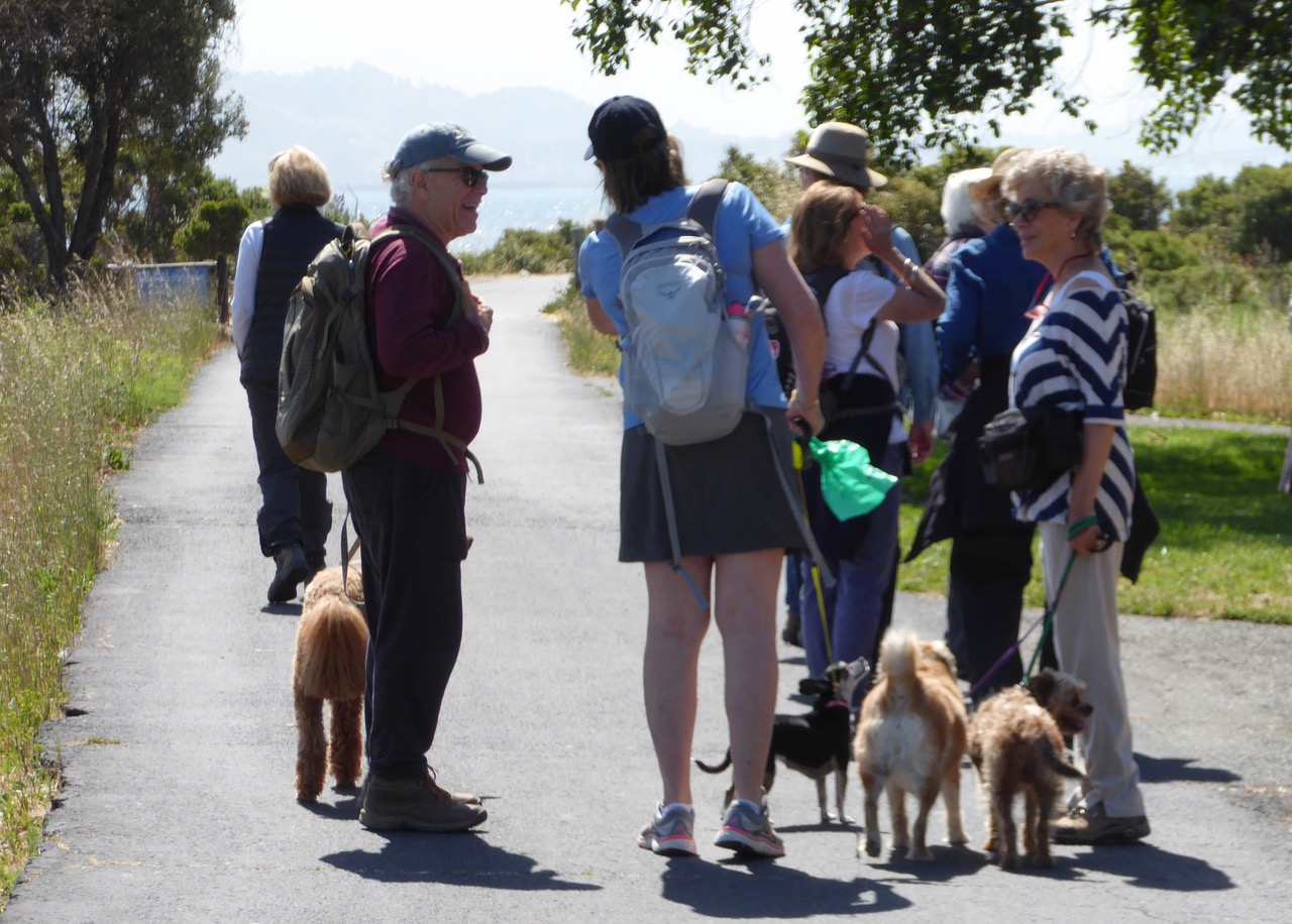
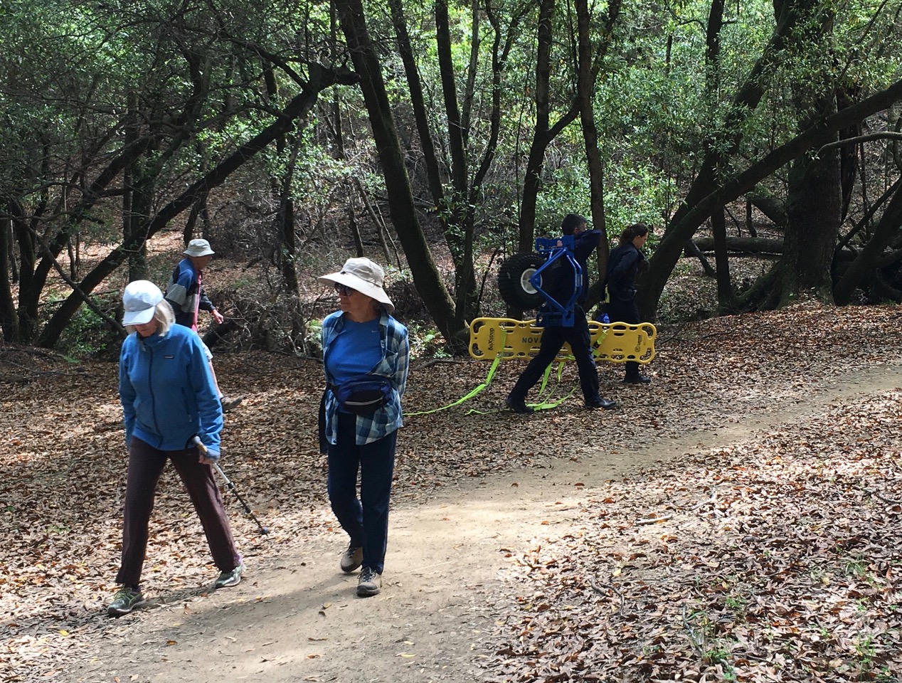
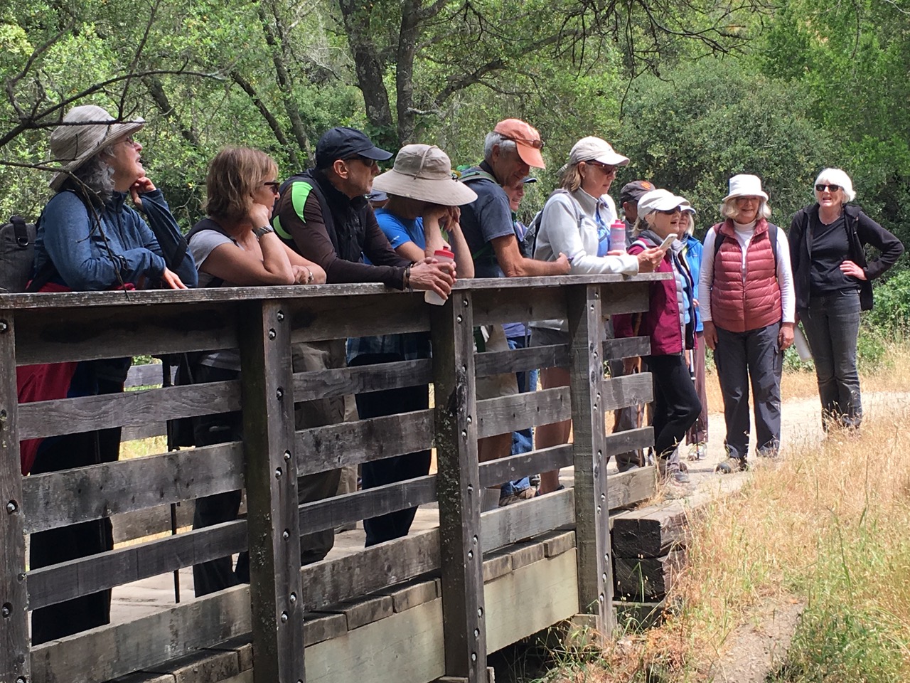
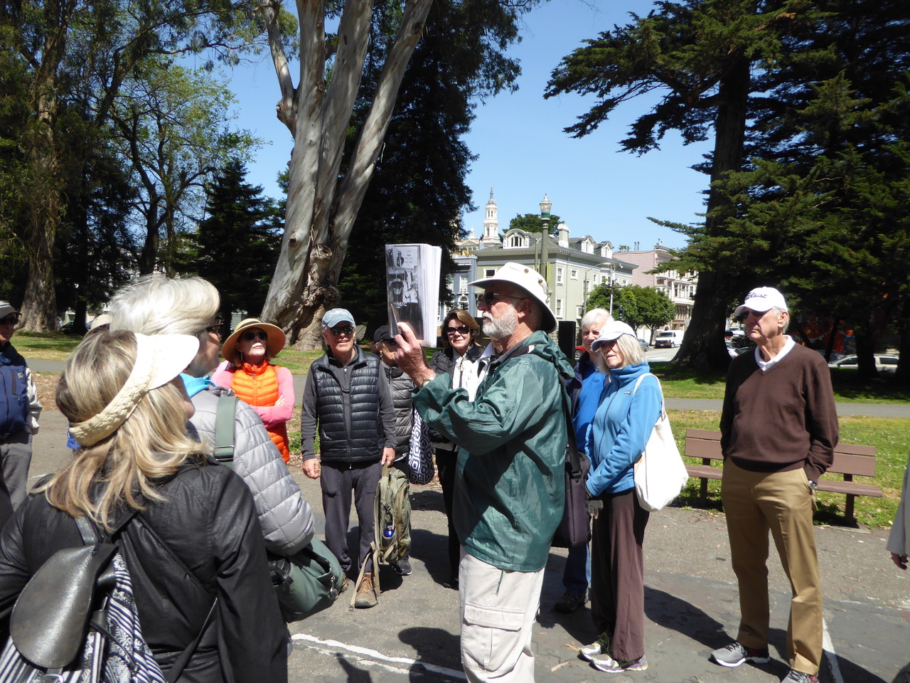
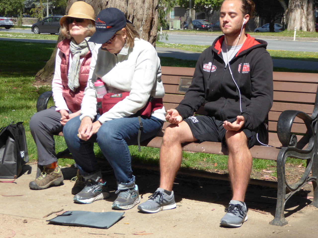
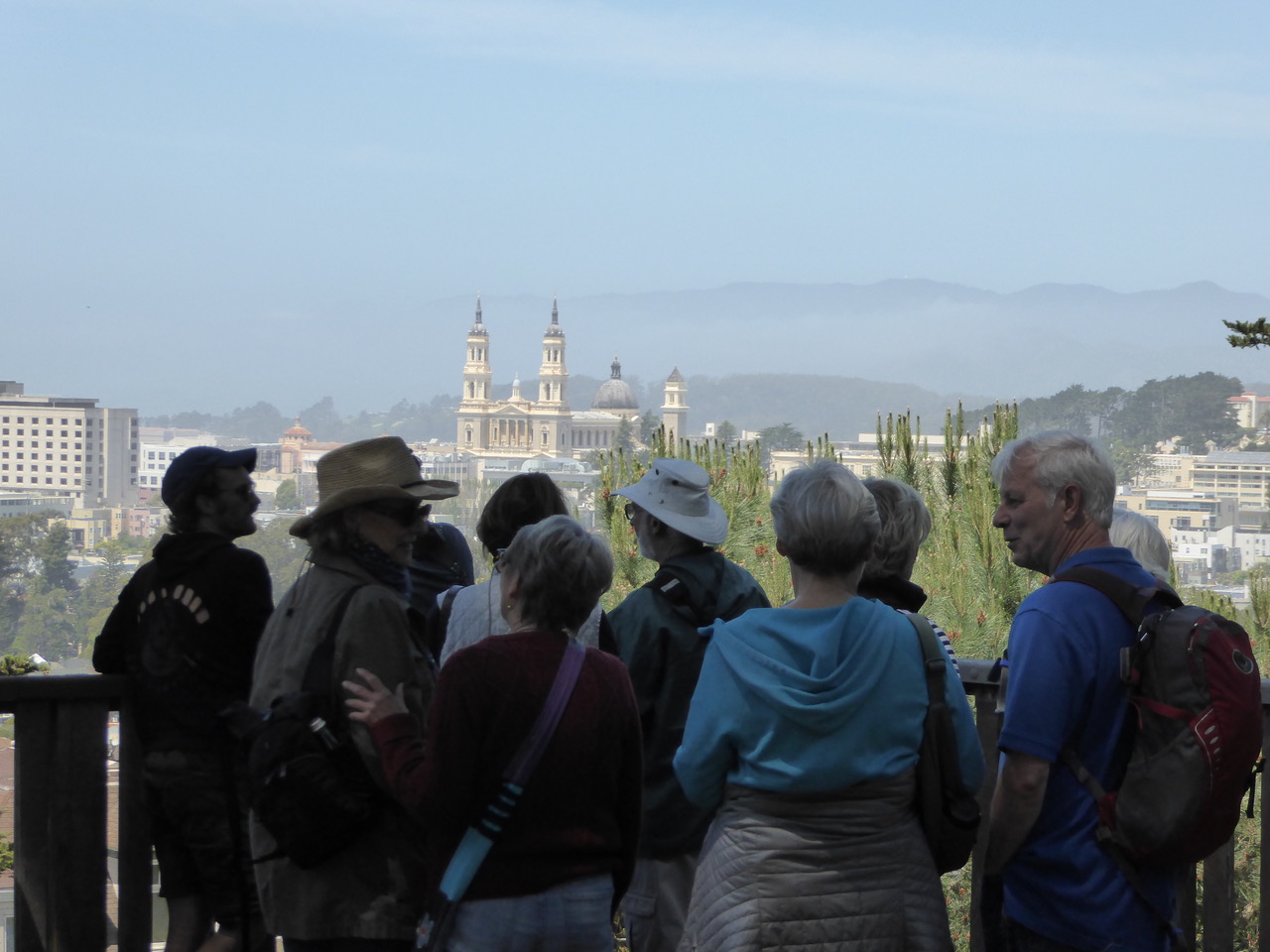
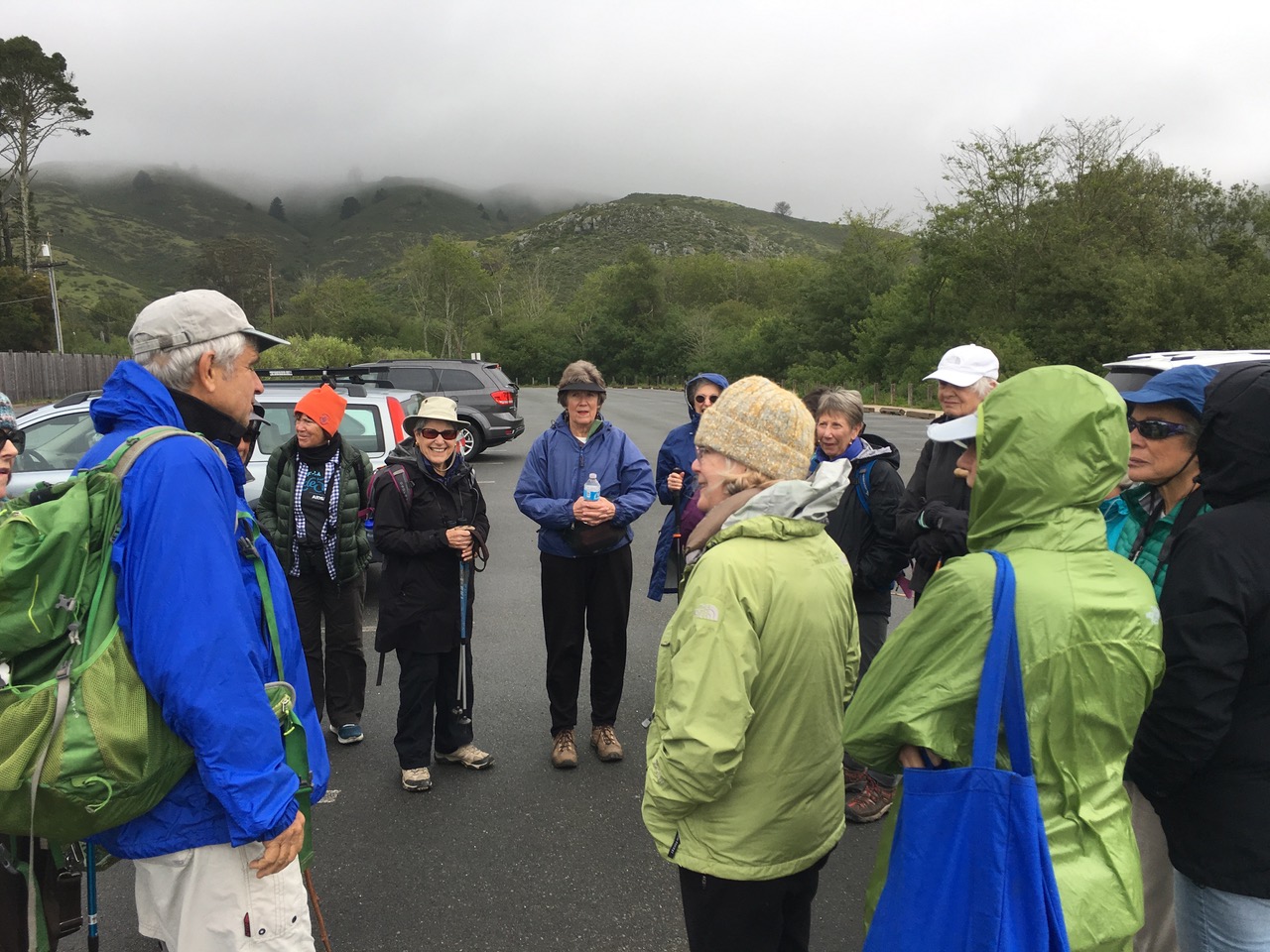
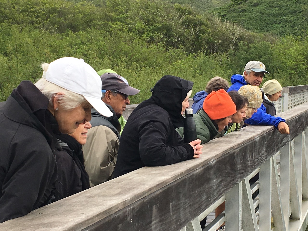
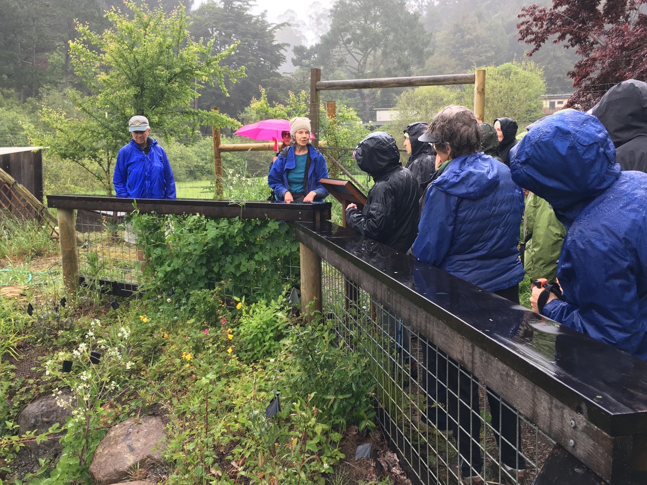
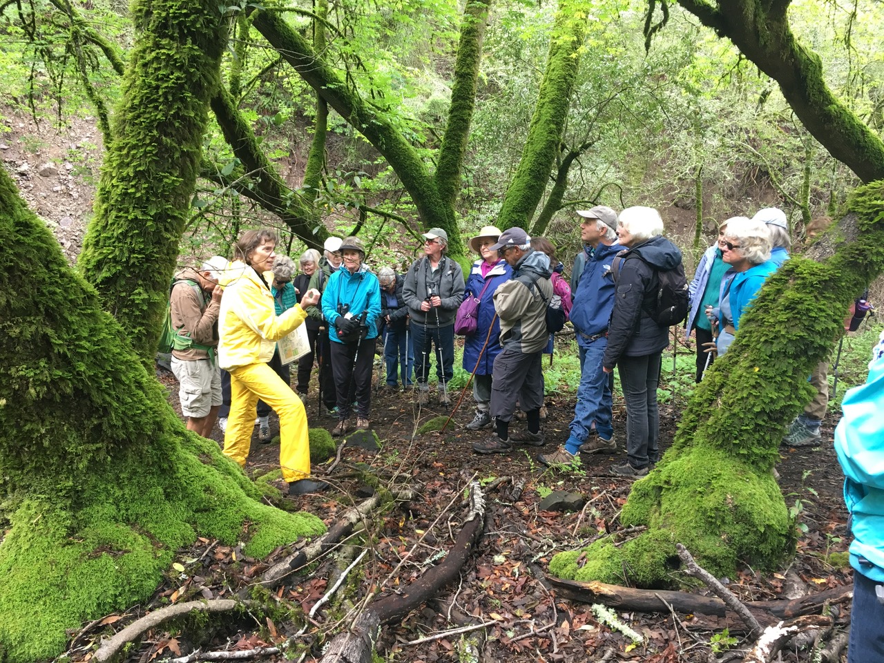
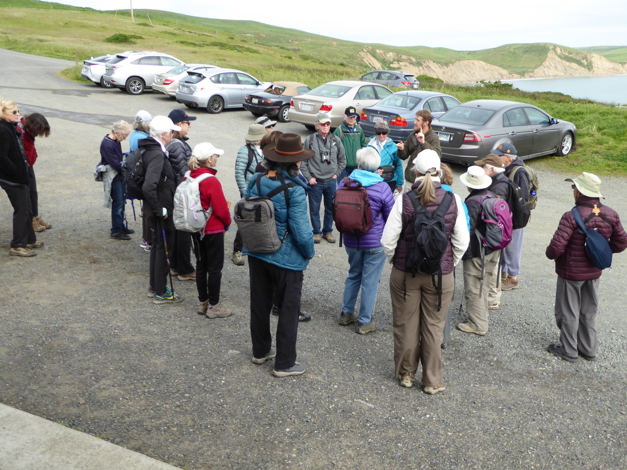
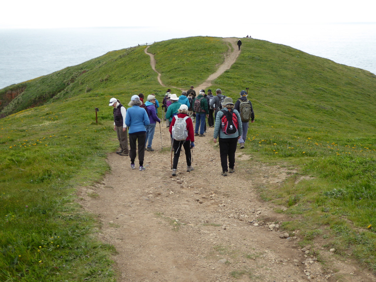
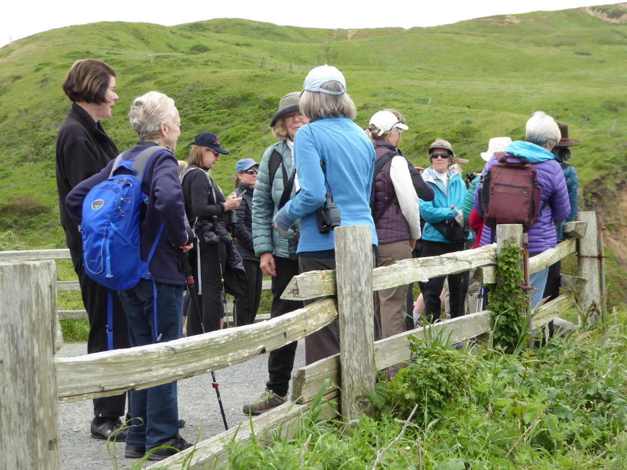
We circle up before the hike and share the moment. Yes, some dogs are aboard today and you can spot Matt’s poodle, Izzy, peaking out at us.

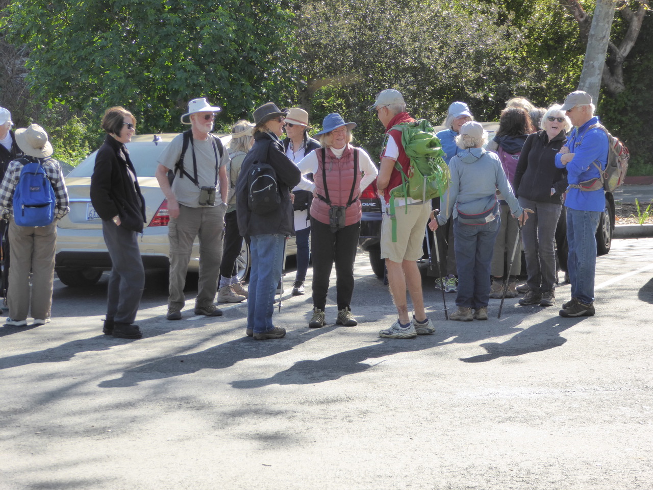
In the parking area where we gathered and spotted the FLAGship. The Marin County Library sponsors this bus which provides “Storytimes, kid’s songs and games, puppets, crafts another fun kindergarten-readiness activities . . . offers education and health workshops to adults and their children 0 to 5 years old.” All this is at various scheduled times across the county. http://www.marinlibrary.org/flagship/
Another aspect of the Flagship program is “Trips for Kids” – https://en.wikipedia.org/wiki/Trips_for_Kids

The final photo show us talking with the parking attendant who has her chalker in hand, always good to get to know your neighbors.

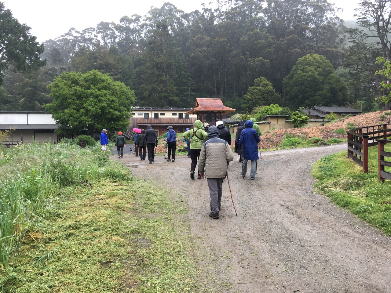
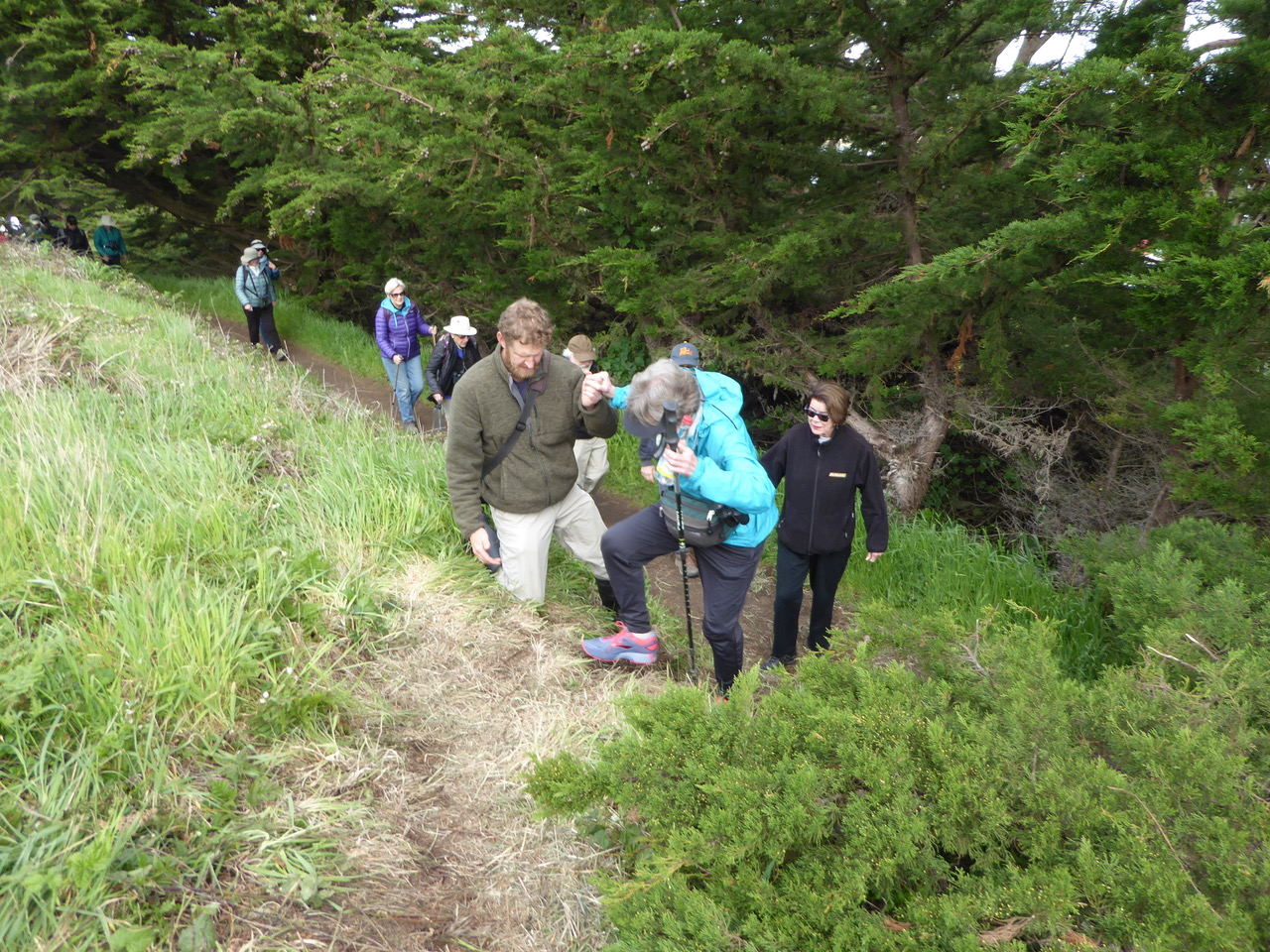
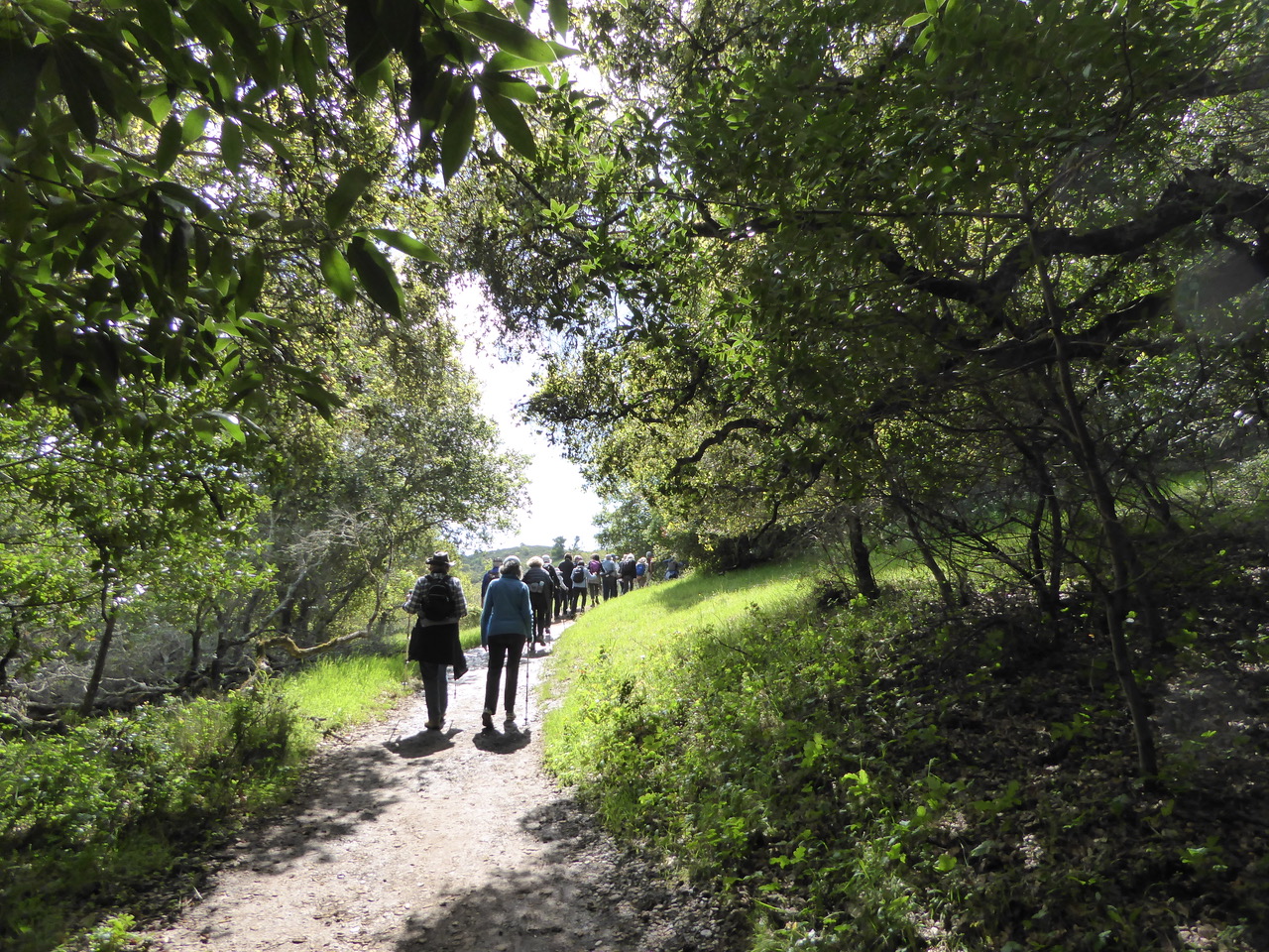
Getting out on the trail we begin to add the darker blue in the sign to that of the Bay to the not quite cerulean sky, ok not even close but I like the sound of cerulean.
What colors do you think? https://en.wikipedia.org/wiki/Category:Shades_of_blue

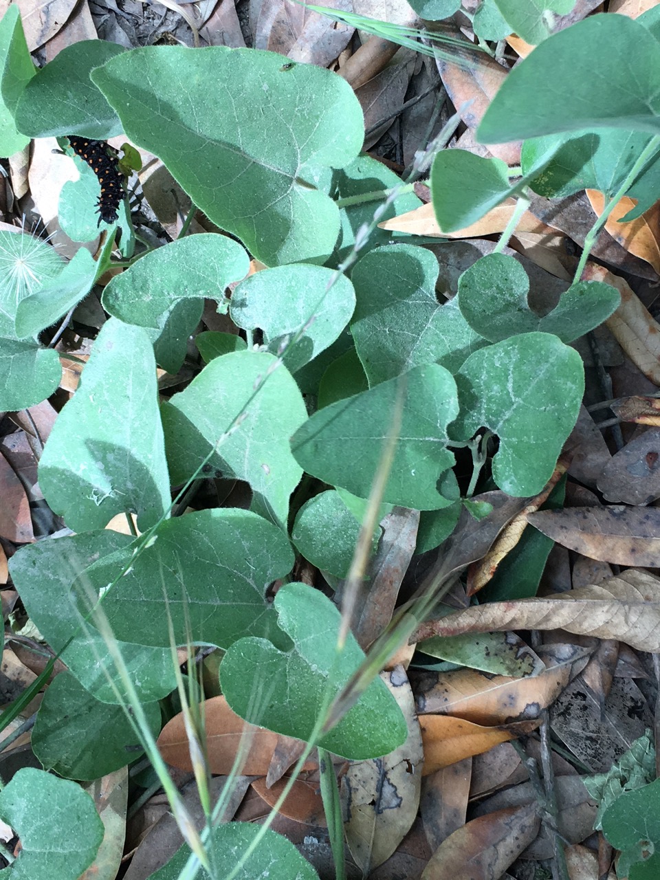
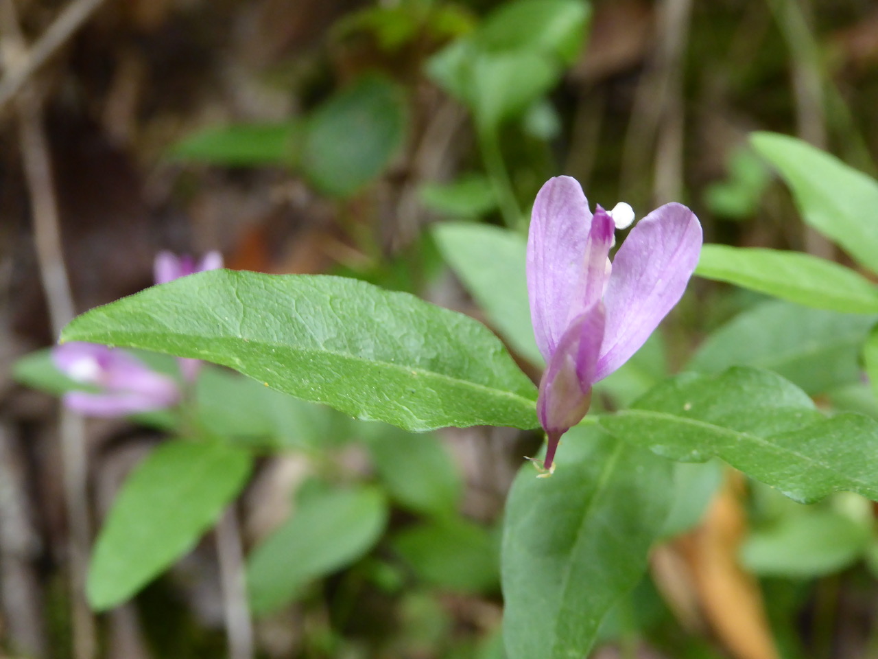
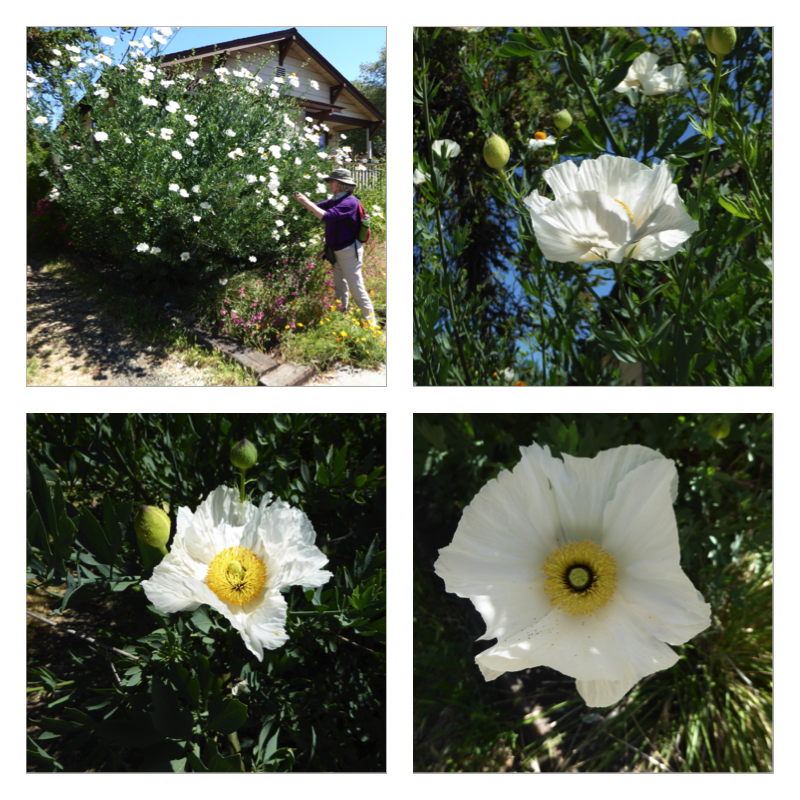
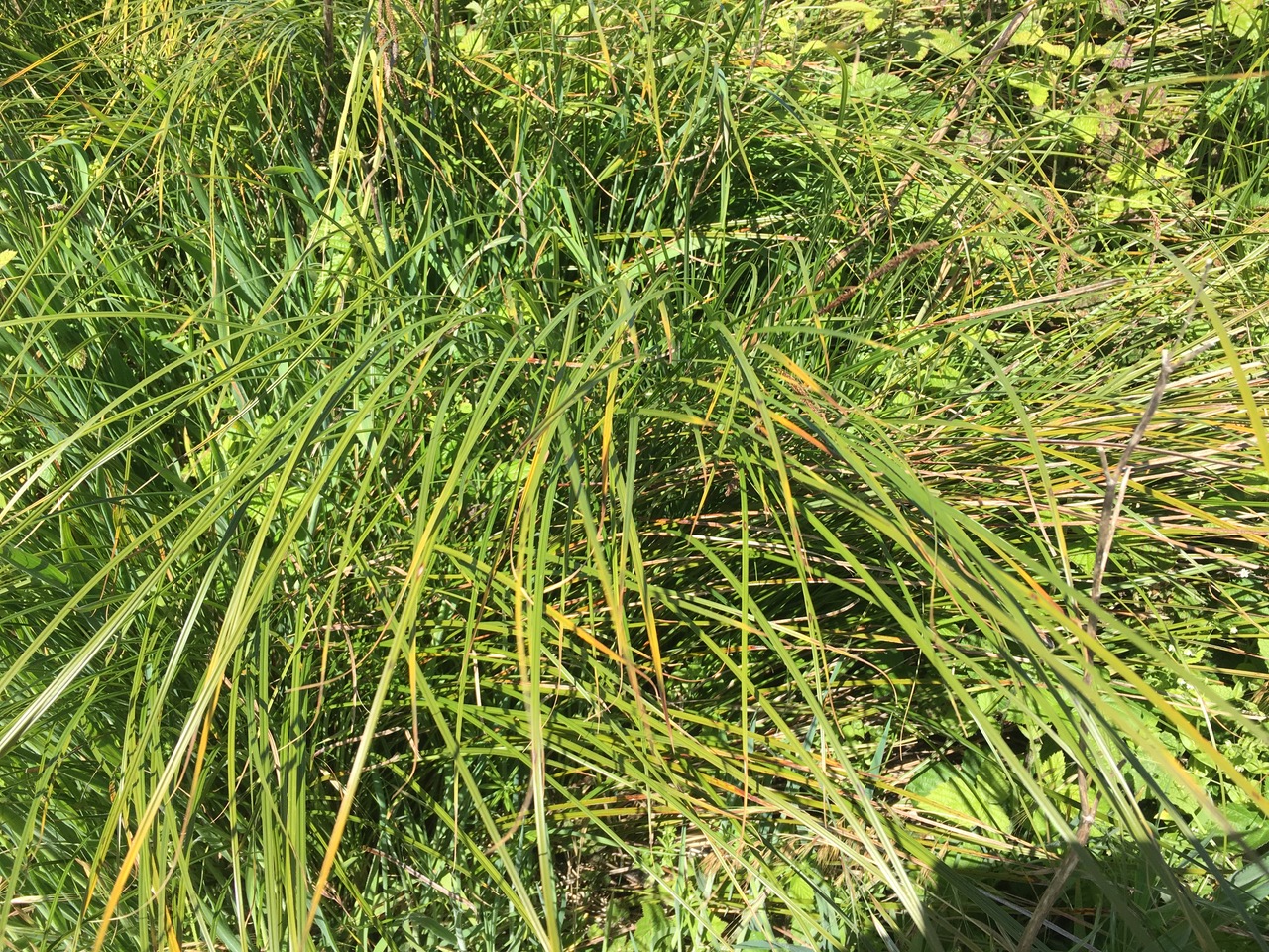
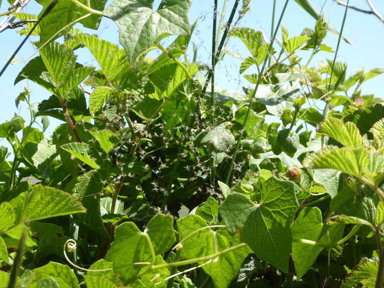
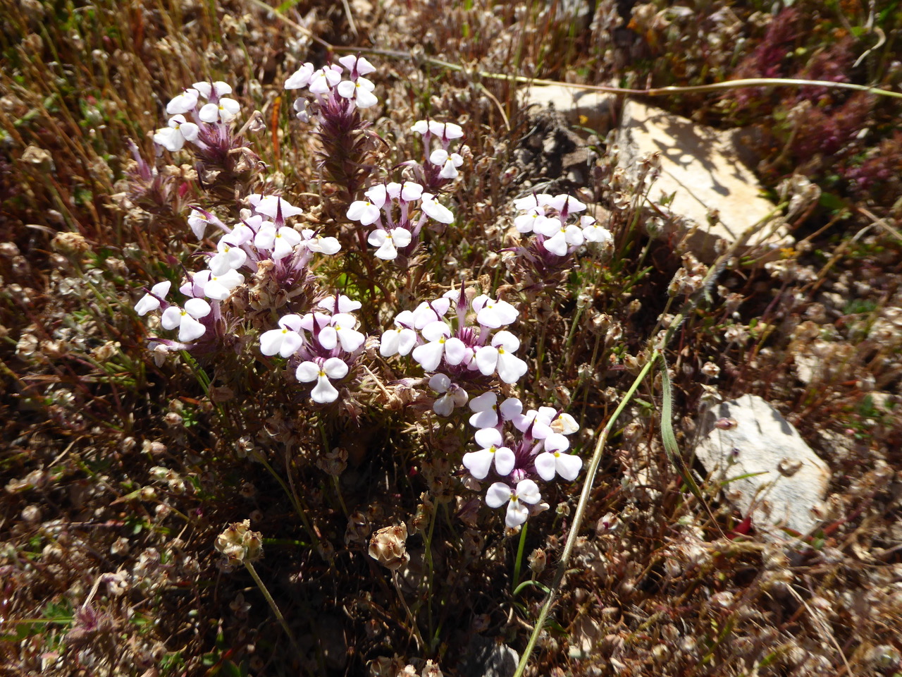
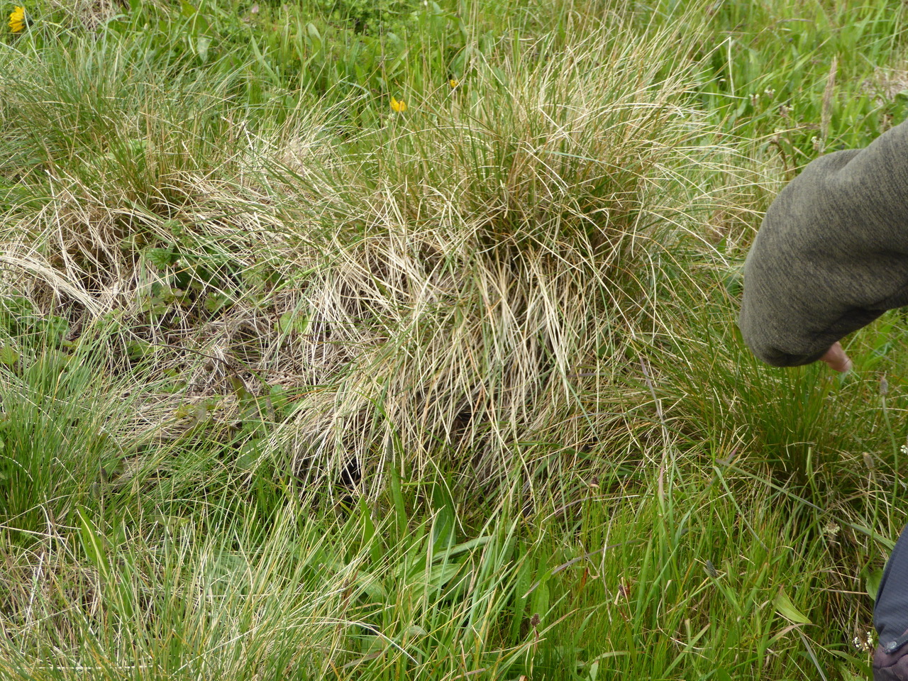
Michael identified this brilliant, glowing native plant array as Salt marsh dodder, Dodder Family (Cuscutaceae). Cuscuta salina Engelmann var. major
Peter R. Baye has written a remarkable guide to “Tidal Marsh Plant Species of the San Francisco Estuary” which describes the dodder among many others.
First, a brief introduction to him from our favorite magazine, BAY NATURE, giving you an idea of his remarkable grasp of the subject and his out-of-the-box thinking. https://baynature.org/biodiversity/sea-blite/
His guide is an amazing compilation, a large number of plants – all with fine photos, clear identifications and other markers. He notes whether the plants are Native, Rare or Invasive.
http://www.spartina.org/project_documents/field_guide_tide_plants_low-res_200703.pdf Our salt marsh dodder is found on page 33. Pickleweed is on 9,10 & 11. Spartina is commonly known as “cordgrass” frequently found in coastal marshes. The name comes from the Greek as spartine meaning rope or cord. It also refers to a restaurant in Los Angeles and in Spartina 449, an upscale women’s handbag and accessory company. I think that the first meaning was the intended.

We pass an unusual sign requesting consideration especially from 8 PM to 8 AM, quiet zone/zona de silencio.
Making one small change at Muir Woods brought an enormous difference. . . . https://www.nps.gov/subjects/sound/difference.htm
https://www.nps.gov/subjects/sound/enhance.htm Suggestions to enhance your soundscape – thoughtful and helpful.

http://www.naturesounds.org I recall on some walks we’ve had quiet zones (QZs) which has helped us a lot to get into the natural world we’re walking through.
https://wildstore.wildsanctuary.com/products/ocean-dreams There’s a 1:32 sample. Just came across this site, lots to listen to. I think it brings me back to my early days feasting on radio programs not all natural sounds, of course, but listening brought a special attention that I sometimes don’t hone when I’m watching something.

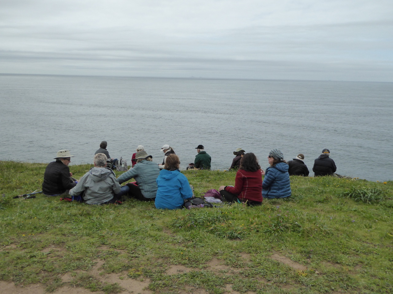
The dog contingent and their leash holders.

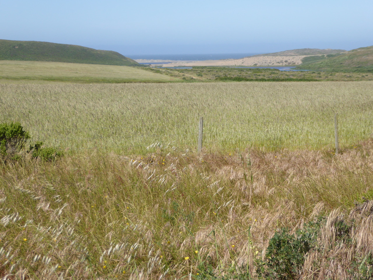
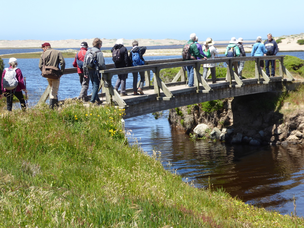
Looking out on San Rafael Bay we see the Marin Islands and spot a passing paddleboarder. https://en.wikipedia.org/wiki/Paddleboarding Long history, try 1781.
http://edition.cnn.com/2017/03/09/sport/chris-bertish-sup-atlantic-crossing/index.html Crossing the Atlantic on a paddleboard.

Back to these small islands which are conveniently named East Marin and West Marin. “The Marin name comes from a Coast Miwok man known as Chief Marin after whom Marin County was named. (and continuing in the wiki account) He is thought to have hidden out there in the 1820s after escaping from Mission San Rafael, before being recaptured and incarcerated at the Mexican San Francisco Presidio.”

In the 20th Century, Thomas Crowley, bought the islands at auction in 1926 for $25,461 in hopes that they would become the western terminus of the Richmond-San Rafael Bridge. Instead they became a family vacation spot for more than 60 years. The Crowley family of San Francisco attempted unsuccessfully to sell them in 1984 asking 4.25 million. They later donated them to the federal government.”
https://en.wikipedia.org/wiki/Marin_Islands https://en.wikipedia.org/wiki/Crowley_Maritime

http://www.nytimes.com/1984/05/08/us/island-deal-bay-views-4.25-million.html http://www.thomashenthorne.com/marin-islands/ – Well written recollection of a Marin realtor who grew up in the area and go out the islands frequently the 80s including a helicopter video fly over of the islands when they were for sale.

http://www.nytimes.com/1994/07/09/obituaries/thomas-b-crowley-79-shipping-executive.html Michael suggested there might be a mystery about this but I couldn’t find it as yet.

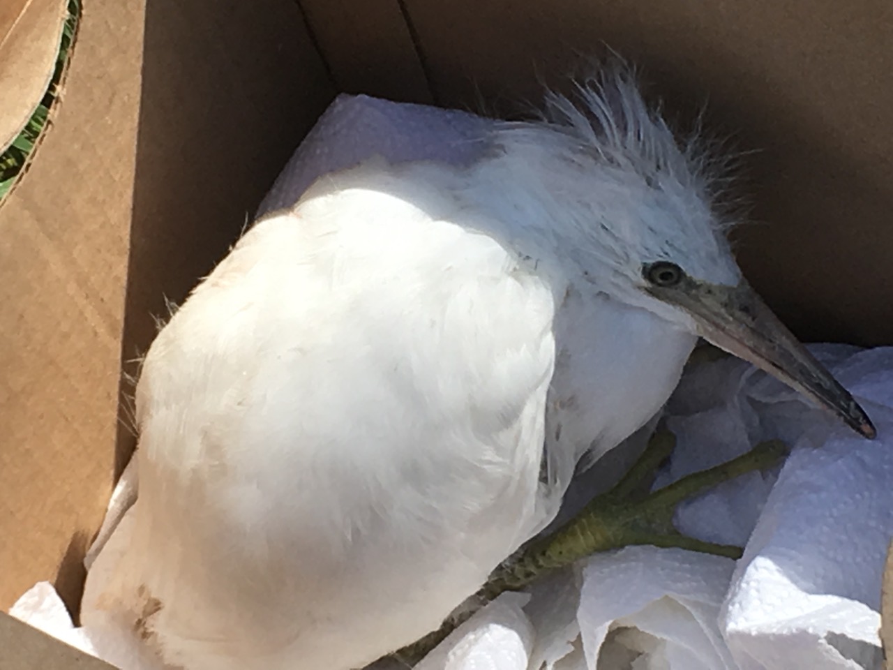
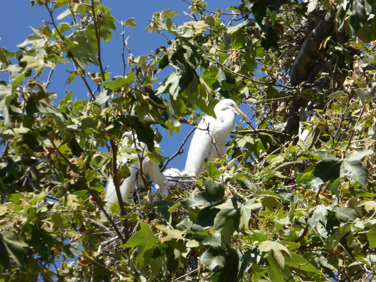
The West Marin Island became the largest egret and heron rookery in the San Francisco Bay administered by the U.S. Fish and Wildlife Service. Kit to got to go out
to the West Island area recently and the rookery has sadly disappeared. This is similar to the loss of the long-standing egret nest area in the Redwoods above Audubon Canyon Ranch in Bolinas that had been active since the 1940s. The arrival of bald eagles in the area is one explanation but John Kelly, director of conservation science at Audubon Canyon Ranch said, “That is one theory, but we do not have an exact answer yet.” This also could be an explanation for the loss
of the West Marin Island rookery. http://www.marinij.com/general-news/20140219/opening-delayed-at-famous-bolinas-egret-colony-that-collapsed-last-year

Statuesque Great Egret in the the lagoon next to our trail. It’s the symbol of the Audubon society. http://www.audubon.org/field-guide/bird/great-egret
http://video.nationalgeographic.com/video/egret_great?source=relatedvideo

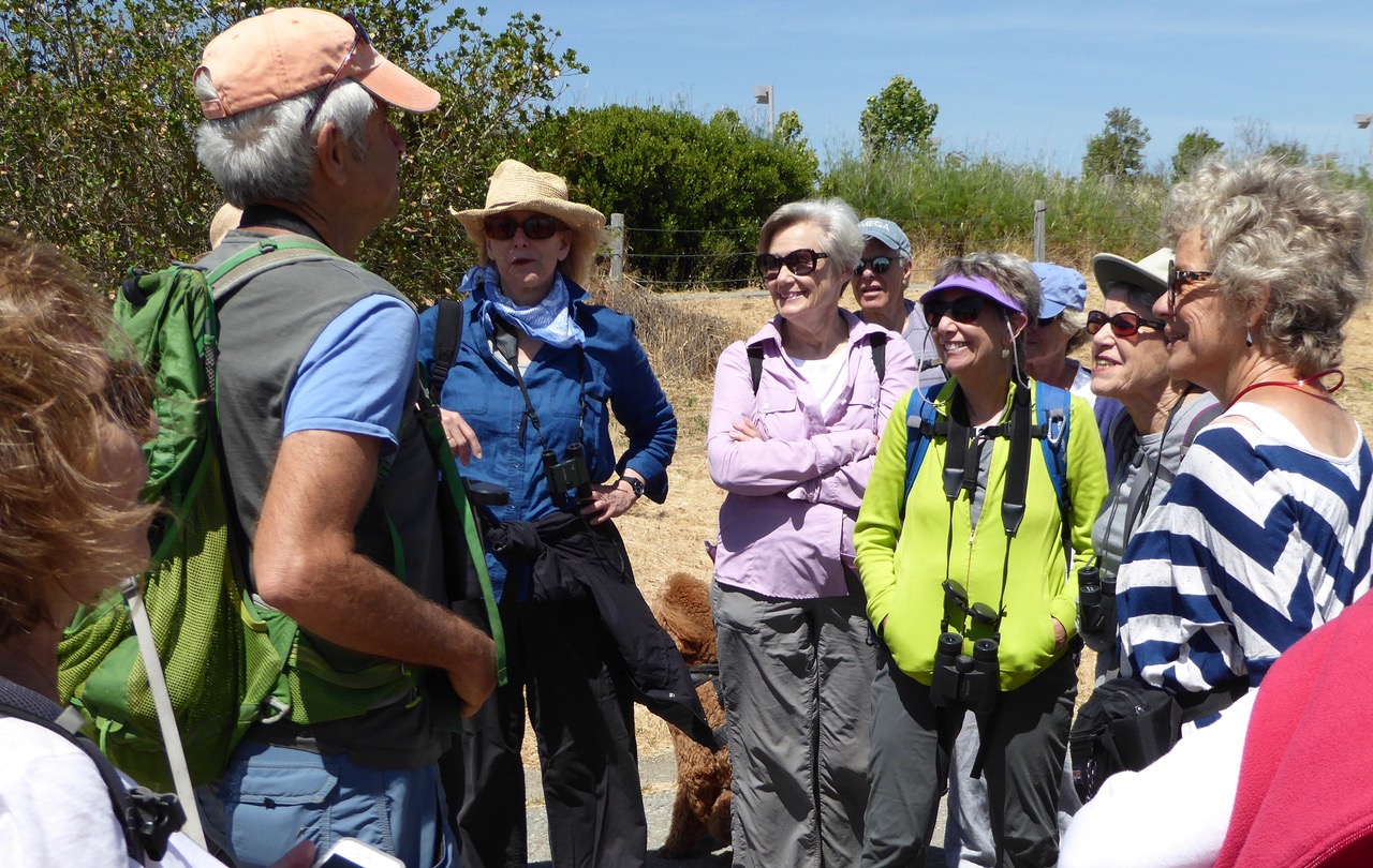
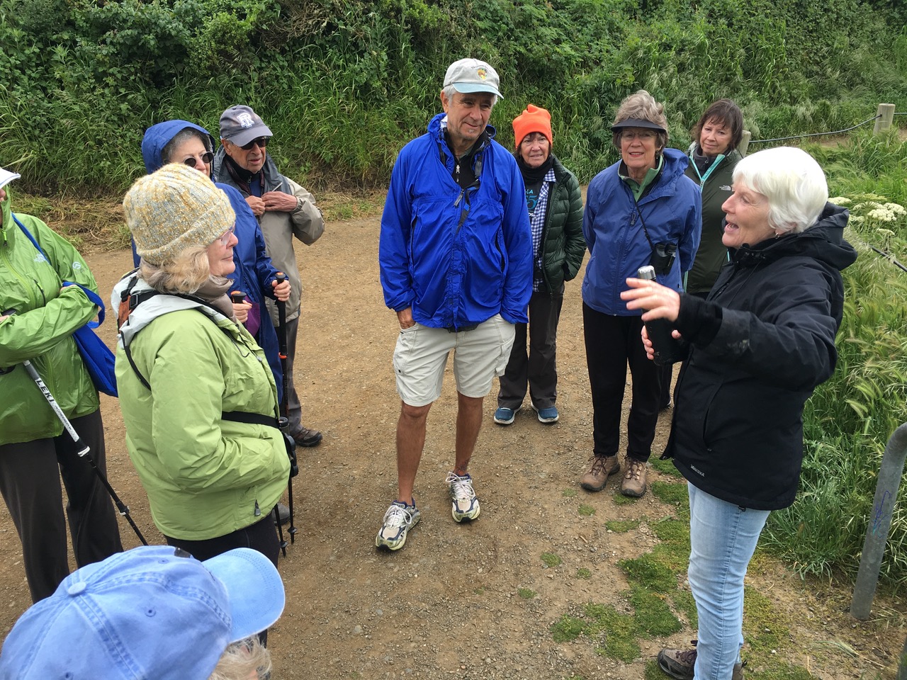
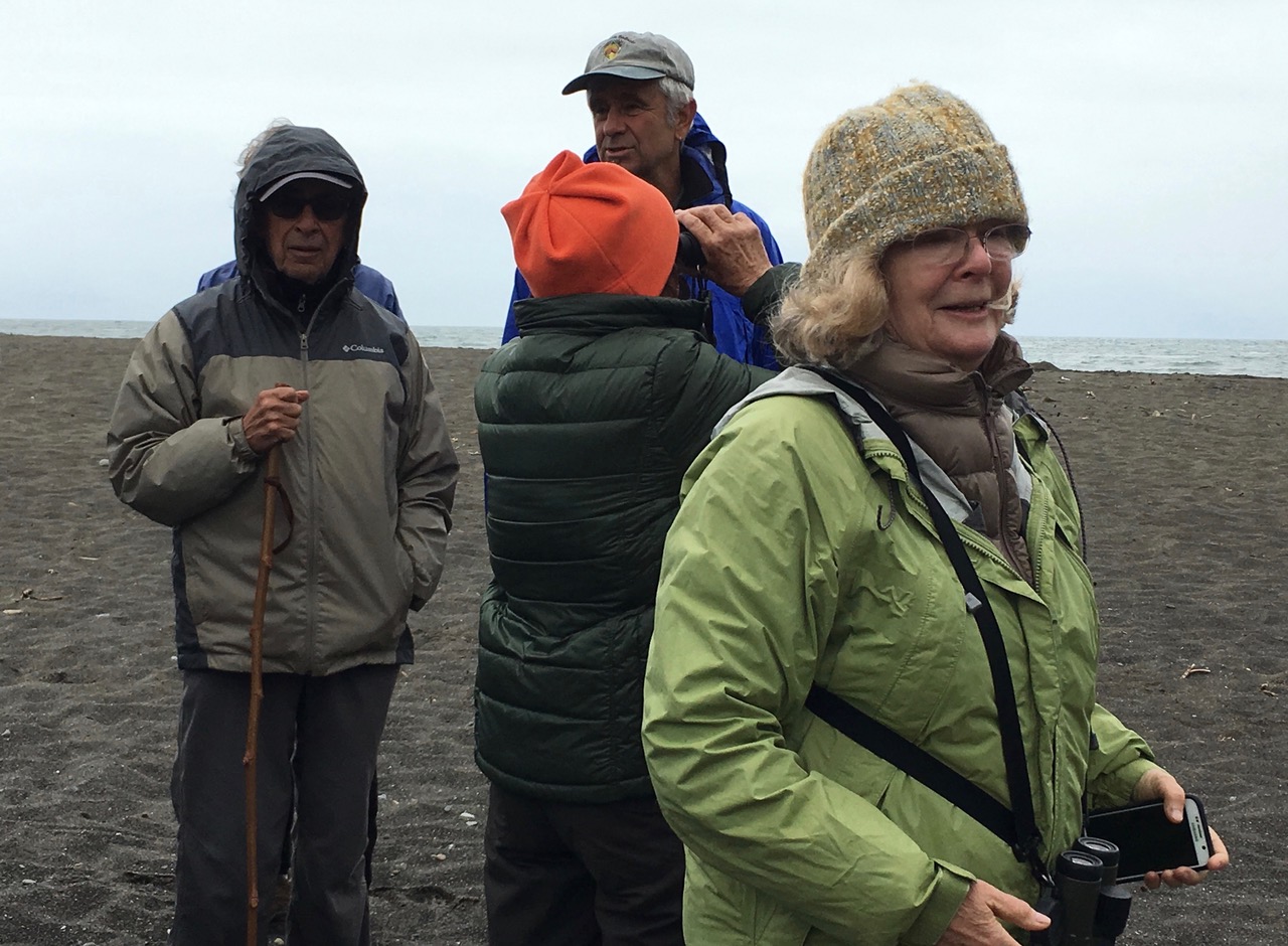
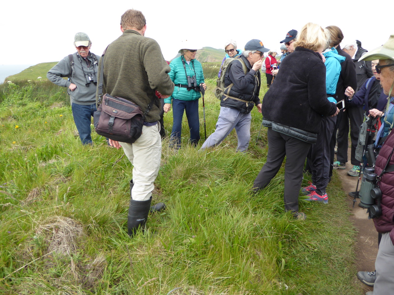
Clearly waiting for some kind of a gotcha, or perhaps just a bit of skepticism – ah, you’re a hard audience.

Last school days at Redwood High School for this school year, a bravo way to handle a restless class.

Michael asks us, “What is the northern most part of San Francisco?” Izzy has other interests.

The boundaries of three counties converge on Red Rock Island – San Francisco, Marin and Contra Costa. The San Francisco County portion is an incorporated part of the City-county of San Francisco. Leaving your heart in this part of San Francisco would be kind of lonely and probably not what Tony Bennett was envisioning. https://en.wikipedia.org/wiki/Red_Rock_Island https://www.youtube.com/watch?v=r6DUwMnDxEs

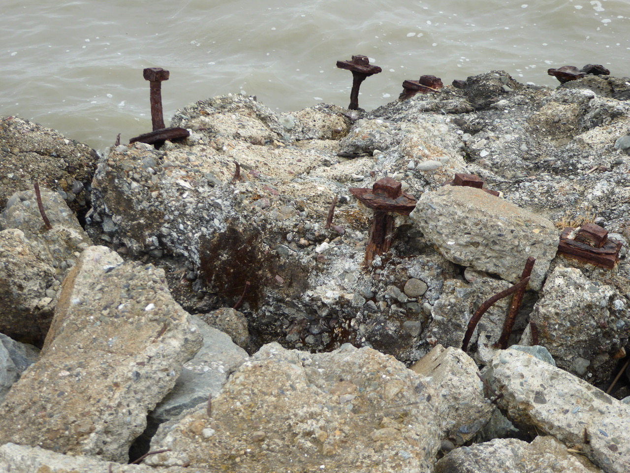
We walked along reinforced levees constructed of riprap on both sides of the trail. https://en.wikipedia.org/wiki/Levee https://en.wikipedia.org/wiki/Riprap
Maybe the sound of the waves hitting the levee is yet another kind of Rap music. This looks like it was some solid, Ozymandian installation now doing second duty as riprap. Recycling where once was a dump.

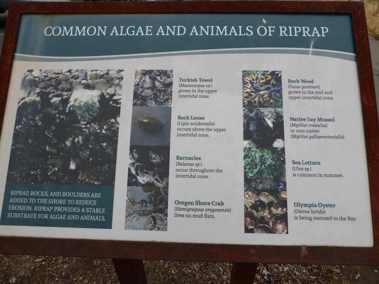
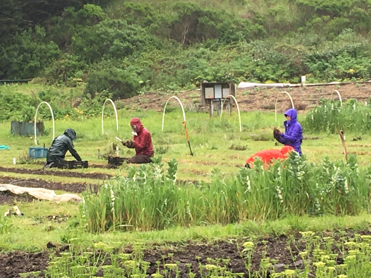
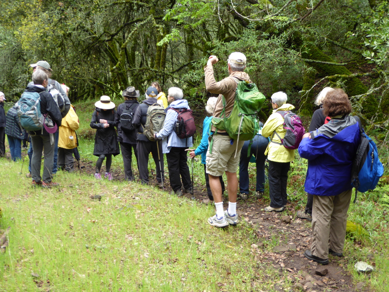
The path has some helpful signs with descriptions and explanations

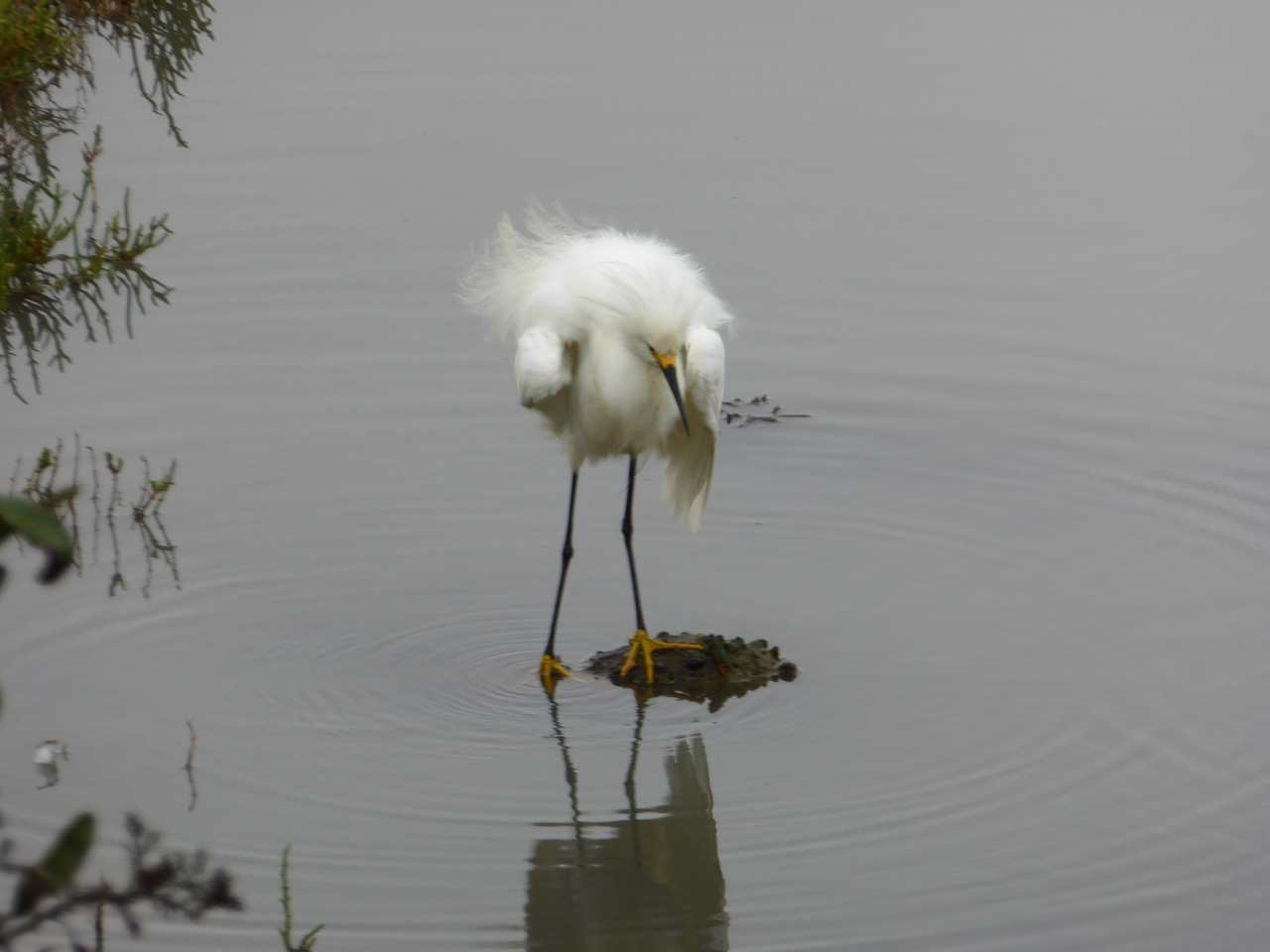
I waited quite awhile for a good angle to photograph some snowy egrets when this beauty swooped in and perched in the Toyon “hedge” directly in front of me. Pays to be patient and let nature come to you as Armando told us one time.

Here’s a Snowy having a fine feather fluff. From a BAY NAURE article by Rob Lee: (Egrets are also herons; their name derives from “aigrette,” the gorgeous nuptial plumes for which they were hunted almost to extinction in the early 20th century.) https://baynature.org/article/the-courtship-of-herons/ Actually, I think this may be more a cleaning moment rather than part of a courtship pattern but that will have to be determined. http://www.wildernesscollege.com/bird-behavior.html

Here’s a VIMEO VIDEO that I made of some snowy egrets in the lagoon set to a bit of J.S. Bach, Partita No. 6 in E Minor, played by Igor Levit.
https://vimeo.com/221129830

Toyon “berries” or are these buds about bloom? They’ll become red in the autumn – the signature plant of Hollywood. http://calscape.org/Heteromeles-arbutifolia-(Toyon A large number of Toyons had been planted on the lagoon side of our path. Returning in the fall to see them blazing with red berries will be memorable. http://www.theodorepayne.org/poppyprint/13-1.pdf https://nhm.org/nature/blog/california-holly-how-hollywood-didnt-get-its-name

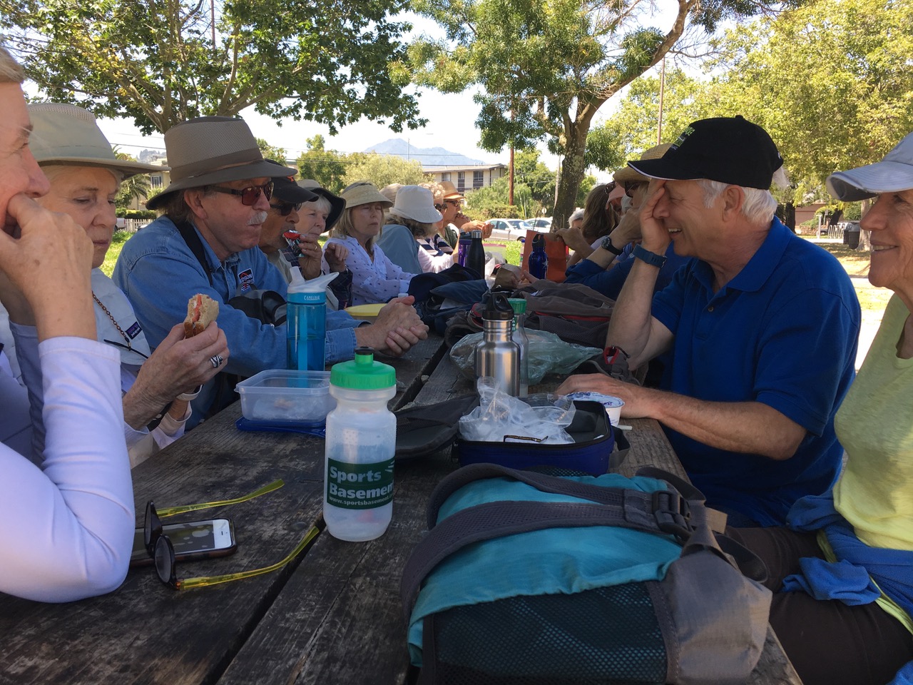
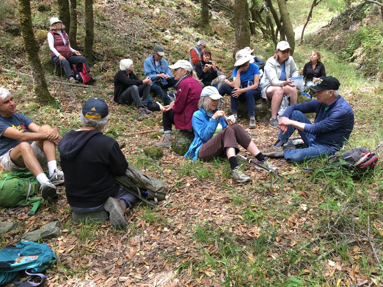
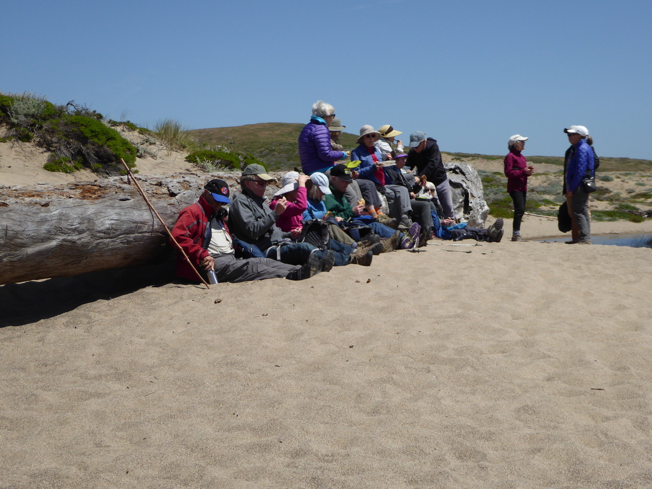
Returning to Pickleweed Park, we picnicked on two joined picnic tables that just fit the group. It felt like medieval moment feasting at a long refectory table at some castle or monastery with good friends pledged to the trail. Plenty of good spirits as well, all that was missing was the mead.
https://en.wikipedia.org/wiki/Mead

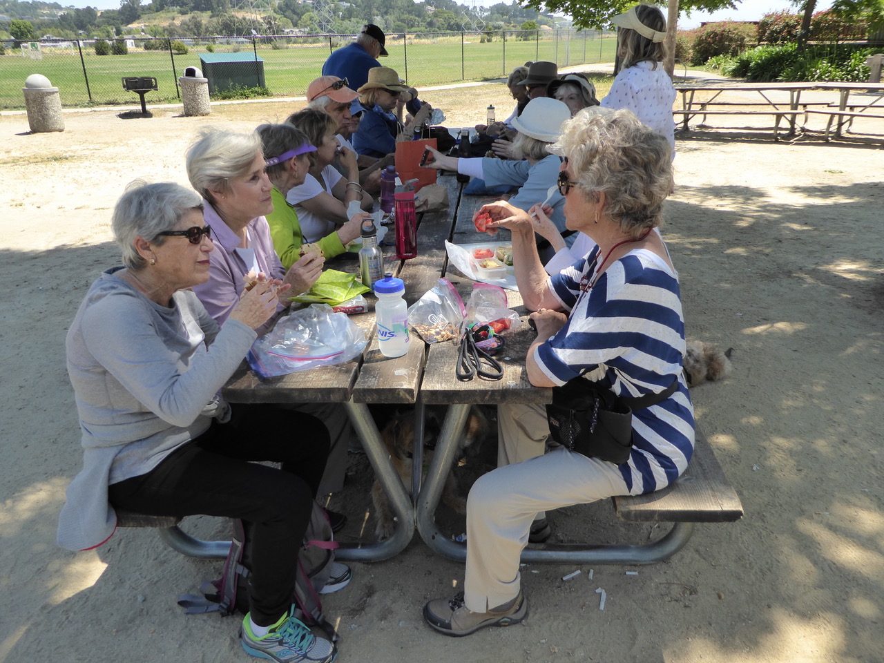
From the other end of the table we added yet another view of Mt. Tamalpais, the distinctive profile of Marin on the horizon.

P.S. Should want to remember our previous Pickleweed Park hike, here it is for your perusal. Best thoughts and hugs from here, Lew (alias Z)

https://zulupeacekeeper.wordpress.com/category/spring-2013/page/2/

Indian Valley Open Space with Michael – 29 May 2017

As we gathered at the Indian Valley parking area, we realized that we were one of three hikes heading out into the open space. It was Memorial Day and a number of groups had the same idea. This being Indian Valley how about extending the meaning of the day to native Americans as well? Normally, Monday is a quiet zone in the week and we Footloose Folk can have the trails to ourselves. At the same time wishing for our usual private pocket of nature, it was a happy discovery to see so many people enjoying nature – “out and about” as our Canadian friends like to say. Realizing this, Michael got us to the church, er, the restroom on time and then introduced the hike. This was followed by heading out on a road less traveled as we hung a right to the Ad & Gloria Schwindt Trail – a wise choice.

In fine form, Michael starts the day – http://www.huffingtonpost.com/2014/08/29/good-sense-of-humor_n_5731418.html

We heard the sounds of yelping just as we were starting the trail and thought that they were probably made by a group of teenagers pretending to be coyotes. But on more listening we realized that they were coyotes pretending to be teenagers. https://www.youtube.com/watch?v=HM1QW8vygL4
https://baynature.org/article/how-to-get-along-with-coyotes-as-pups-venture-out/ https://coyoteyipps.com/words-about-my-coyote-yipps-blog/
Scott spotted one of the parents walking across the field in the first photo below about to head into the coyote brush. https://granadanativegarden.org/2014/02/07/coyote-brush-an-under-appreciated-native/ Michael speaking to the group as a pair of equestrians ride by. Finally, Michael points to the cirrus clouds moving in the sky cover and asking what they mean? https://www.naturalnavigator.com/the-library/weather-lore

Inge spotted her favorite flower along the way, the Yellow Mariposa Lily, Calochortus luteus, with many blooms near the trail. “This species is found on the coastal prairie, grasslands and some open forest floors. It is native to California and is endemic (limited to California). https://en.wikipedia.org/wiki/Calochortus_luteus
http://www.calflora.org/cgi-bin/species_query.cgi?where-taxon=Calochortus+luteus “Like other Mariposa Lilies it grows from a bulb, with most of the growth occurring in winter, followed by spring flowering and summer dormancy.” http://calscape.org/Calochortus-luteus-(Yellow-Mariposa-Lily)?srchcr=sc562d653d89d63
Another very rare member of this family is the Tiburon Mariposa Lily, Calochortus tiburonensis, found only on Ring Mountain endemic to a single serpentine outcrop in California’s Marin County. http://calscape.org/Calochortus-tiburonensis-()

We met many dog walkers along the paths on the hike who had taken their owners out for some sunshine, shade and the delectable perfumes along the way.

Some medics arriving on the trail to take out a hiker who collapsed along the way. Michael brought one of our three nurses, Rowena, to the scene and she ascertained that the person was stable and that help was on the way. This particular medical help was in an easily accessed location but there are many rescues in Marin County that are much more challenging and complex. The Marin County Sheriff’s Office Search and Rescue performs many life saving missions each year. http://marinsar.org/ http://marinsar.org/unit-history/ https://www.facebook.com/pg/marinsar/photos/

Inge commented that we were walking in the shade of a California Bay forest. Many younger trees along with some of the older veterans some showing fire scars and some along the creek undermined and fallen with the raging water of the winter rains.

Pointing out a bracket fungi or “artist’s conk” on a California Bay tree with a soft white underside, he said was definitive for a dying tree.

Now we’ve joined the Indian Valley Fire Road and are stopping to smell not the roses but a blooming California Buckeye’s sweet perfume.
Flowers of Marin is back after a hiatus, a very useful site. https://flowersofmarin.wordpress.com/
http://www.pacifichorticulture.org/articles/california-buckeye-a-tree-for-all-seasons/
http://sonomamg.ucanr.edu/Plant_of_the_Month/Aesculus_californica_-_California_buckeye/

Elderberry bush in robust bloom. These flat-topped are Blue Elderberry flowers clusters whereas the more pyramidal or cone-shaped flower bloom is the Red Elderberry flower cluster – Michael’s nemonic device for this is red pyramids. Notice the distinctly serrated leaves.
http://homeguides.sfgate.com/elderberry-stems-poisonous-61948.html Ah, four types with the additional Black and “Sutherland Gold” which I’ll have to sort out.
https://plants.usda.gov/factsheet/pdf/fs_sara2.pdf Red http://www.calflora.org/cgi-bin/species_query.cgi?where-calrecnum=7321
https://plants.usda.gov/plantguide/pdf/cs_sanic5.pdf Blue http://www.calflora.org/cgi-bin/species_query.cgi?where-calrecnum=7320
https://www.cdc.gov/mmwr/preview/mmwrhtml/00000311.htm poisoning from elderberry juice.

Some late blooming wildflowers along the road, Michael points to a hillside of Linanthus androsaceus or Lepitosiphon androsaceus (False Baby Stars in Reny Parker’s book “Wildflowers of Northern California’s Wine Country” on p.117.) http://calscape.org/Leptosiphon-androsaceus-(False-Baby-Stars)?srchcr=sc577253b4b6cae
Curiously, it is a native plant in California and Pennsylvania. https://plants.usda.gov/core/profile?symbol=LEAN19

Lillian McHoul writes of Linanthus androsaceus (syn. https://en.wikipedia.org/wiki/Leptosiphon_androsaceus) that it is from the Greek linon for flax and anthos meaning flower. And Reny Parker writes, “In mid to late spring a profusion of perky pink flowers in open or shaded areas in woodlands and chaparral are most likely the pretty annual. . . .Each flower is a small upright trumpet of five colorful petals with the throat of the trumpet generally violet at the base and yellow above.” P. 117

Another flower on the same hillside was Red Ribbons (Clarkia concinna) in the Evening Primrose Family. Reny Parker writes, “Another common name is Lovely Clarkia but I was told that it’s not fair to use that name as all Clarkia are lovely.” P. 126 Mary Elizabeth Parsons writes in her “The Wild Flowers California” (1897), “in June these charming blossoms may be found in the company of maidenhair fern fringing the banks of shady roads or standing in glowing masses under the buckeye-trees.
In them Nature has ventured upon one of those rather daring color combinations of which we would have hardly dreamed, and the result is delightful. The petals are bright rose-pink, while the sepals are of a red pink.” P.242
https://www.calflora.org/cgi-bin/species_query.cgi?where-calrecnum=2175

Sonoma Sunshine, Blennosperma bakeri, in the Sunflower Family, Asteraceae. Reny Parker writes, “Closely related and very similar in appearance to Common Blennosperma, Sonoma sunshine is a much more pleasant descriptor than its generic cousin’s moniker. An endangered species, its bracts are yellow and the lower leaf lobes are entire or three lobed. The lobes are longer than those of the Common Blennosperma. You may find this annual herb in vernal pools and wet grasslands.
P. 89

Still another lovely was in this patch, Ithuriel’s Spear or Grass Nut (Triteleia laxa) in the Lily Family, Liliaceae. Parker writes, “Named after the spear of Ithuriel, an angel in Milton’s Paradise Lost, it is also known as Wally Basket. . . . Bees and butterflies love this blossom. . . . In the mid to late spring as the grasses begin to golden, this bright blue purple flower provides the only contrast color over vast stretches of gold. Spear head like flower buds open to reveal six petals forming each vivid flower. Clusters of flowers sit atop leafless stems.” P. 167 https://en.wikipedia.org/wiki/Triteleia_laxa

A former quarry, a long time healing. The exposed greenish rock at the base is serpentine, California’s state rock.
https://statesymbolsusa.org/symbol-official-item/california/state-rock-mineral/serpentine

The area along the fire road and the adjacent seasonal creek provided a welcoming environment for this California pipevine or California Dutchman’s-pipe. Michael pointed out that the pipe shape would be that of a Meerschaum pipe. https://en.wikipedia.org/wiki/Meerschaum_pipe https://en.wikipedia.org/wiki/Aristolochia_californica “The larva of the endemic California pipevine swallowtail butterfly (Battus philenor hirsuta) relies on the California pipevine as its only food source. The red-spotted black caterpillars consume the leaves of the plants, and then use the flowers as a secure, enclosed place to undergo metamorphosis. The plant contains a toxin which when ingested by the caterpillars makes them unpalatable to predators.” Note – one of these main characters is coming onto the stage at the top of the photo.

Michael shows us close-up a pipevine swallowtail caterpillar:

We turn off on the Waterfall Trail looking for a lunch spot, that waterfall was about two months earlier this year. We stop to admire some dandelion flowers
gone to beautiful white seed orbs about to be blown away by the wind. https://www.youtube.com/watch?v=UQ_QqtXoyQw

https://www.youtube.com/watch?v=l1XkcYWbq8s

Further on as we walk up the little stream, Michael spots some water striders in the pools and is able to bring up a talk he made on them on KQED, NPR pulling it up on his iPhone. 10 June 2010 https://ww2.kqed.org/perspectives/2010/06/10/water-striders/ They’re called the Jesus bug in Texas which hatched the discussion of which disciple walked on water.

Just over a small bridge that has a horse forbidden sign, Michael spotted and identified an unusual wildflower called Gay Wings, Polygala californica in the Milkwort Family. http://www.calflora.org/cgi-bin/species_query.cgi?where-taxon=Polygala+californica https://www.pnwflowers.com/flower/polygala-californica

And just over the trickling stream our picnic spot appeared. Looks very comfortable as long as there’s no poison oak.
Michael’s latest on his KQED Perspective series: https://ww2.kqed.org/perspectives/2017/06/01/leaves-of-three/

Easy conversation over lunch. We started remembering Drive-in movies for some reason and Sue Morris was recalling their family going to the San Rafael Drive In on one occasion with their four year old son. Disney’s “The Shaggy Dog” (1959) https://en.wikipedia.org/wiki/The_Shaggy_Dog_(1959_film) She remembers that her son found it very frightening and started screaming prompting a walk back to the refreshment stand for some distracting, quieting popcorn. Then Kit was remembering going to see Zeffirelli’s “Romeo and Juliet” with three girl friends and feeling positively gushy about the film. Michael mentioned that he heard about a woman who went to see a Shakespeare film but didn’t know about the author. When asked how she liked it she said, “It was ok but it was really full of cliches.”

P.S. http://indianvalleyorganicfarm.org/about-us/

https://www.marincounty.org/~/media/images/departments/pk/open-space/indian-valley/10_indianvalley-12016p.pdf

Stalking the Wild Egrets in Santa Rosa with Michael – 15 May 2017

What better way to treat a beautiful spring day than a visit with Michael on his home turf in Santa Rosa. Having just returned from leading two trips in Bhutan, he was still fresh from his Himalayan adventures. The prospect of spotting egrets on a median in the middle of a Santa Rosa street was curious, not our usual approach to bird watching. It would be easy to be just the least bit skeptical.

++++++++++++++++++++++++++++++++

Taking a stroll around Michael’s back yard I began to think that perhaps we’d already achieved our goal with this exotic creature. Had we found our answer already, was the treasure hunt over so soon?

Michael shared his customs return while we were gathering for the hike. He was the lucky one, two, three, four, FIVE to be taken aside for the full luggage search.
He opened up his suitcase and the inspectors laid out some curious objects: a number of large, wooden fertility symbols that are hung outside houses in Bhutan to keep away evil spirits and to “be fruitful and multiply” – all done in bright red. These were a gift of Michael’s long time friend and guide on these Bhutan forays.
Next came out the flaming hula hoop though not flaming at the moment but a part of Michael’s hula hoop diplomacy when he takes trips to many parts of the world.
And finally, there was the can of bird’s nest soup which he brought back for his son Hunter who has enjoyed previous exotic foods on Michael’s other trips. By this time the other customs inspectors were coming over to have a look at this exotic assemblage – nothing like something to break up the day. It was all passed except for the bird’s nest soup so that will have to be another time and an another place for Hunter. The bird’s nest soup was a bridge too far.

Wondering about egrets lurking in the shrubbery we pass our first traffic circle which should get a prize for cuteness, well-cared for gardens and for outsized directional signs..

We stopped beside a picket fence and Michael talked about some of the plantings. The one in the corner is a Virgin’s Bower vine, Clematis ligusticifolia, “called ‘pepper vine’ by early travelers and pioneers in the American Old West. They used it as a pepper substitute to spice up food since real black pepper (Piper nigrum) was a costly and rarely obtainable spice.” http://calscape.org/Clematis-ligusticifolia-(Virgin’s-Bower) I was reminded that I’ve avoided vines in my garden and that they add a context and transition to the plantings.
Further down, Michael talked about the white Foxglove blooms, Digitalis purpurea. The wiki entry mentions “it is not clear why the flower should be called foxglove, other etymologies have been offered. Henry Fox Talbot (1847) proposed folks’ glove where folk means fairy. Similarly, R.C. A. Prior (1863) suggested an etymology of foxes-glew, meaning ‘fairy music’. However, neither of these suggestions account for the Old english form foxes glofa.” Michael mentioned the medicines that are extracted from the foxglove plants called digitalis. Used for patients with heart conditions – it is prescribed for those who have atrial fibrillation.
https://en.wikipedia.org/wiki/Digitalis
Lastly, he talked about the name of the yellow blooms, Yarrow (Achillea milleforium) which is white or in this Moonshine variation a vibrant yellow. Michael who loves words and their origins asked what hero was remembered in the name? It’s Greek mythology’s Achilles. The wiki entry for Achillea mentions that his soldiers used yarrow to treat their wounds i.e. the names allheal and bloodwort. The Achillea millefolium wiki adds some other common names for it. “..called
plumajillo (Spanish for ‘little feather’) from its leaf shape and texture. In antiquity yarrow was known as herbal militaries, for its use in staunching the flow of blood from wounds. Other common names for this species include gordalado, nosebleed plant, old man’s pepper, devil’s nettle, sanguinary, milfoil, soldier’s woundwort, thousand-leaf, and thousand-seal.”

https://en.wikipedia.org/wiki/Achilles https://en.wikipedia.org/wiki/Achillea https://en.wikipedia.org/wiki/Achillea_millefolium
http://www.theodorepayne.org/mediawiki/index.php?title=Achillea_millefolium
http://www.ricola.com/en-ch/World-of-herbs/Ricola-herbology/The-magic-13-herbs/Yarrow

Santa Rosa has a tradition of marking and investing in many historical districts but no Egret Historical District as yet.

We continue in the West End neighborhood and immediately come across a remarkable building both historic and architecturally significant, the Issac De Turk Barn located in the park of the same name. The building is completely round as compared with other historic “round” barns which have corners with octagonal or other shapes. De Turk was born in 1834 in Berks County, Pennsylvania but his parents made their way west moving first to Indiana (1838-59). Both he and his father were horticulturalists. DeTurk moved out west to Santa Rosa, California planting a small vineyard in 1859. This was followed by a continuously expanding winery business with size of vineyards and scope of wine production increasing exponentially. He purchased a 1200 acre vineyard in what is now the Sonoma Valley and in the early 1880s produced 400 thousand gallons. He is described as “the Gallo of his time.”
http://www.rootsweb.ancestry.com/~cagha/biographies2/bios2/de-turk-isaac.htm
https://cdnc.ucr.edu/cgi-bin/cdnc?a=d&d=SDU18960317.2.64 Here in his obituary they note that he was a member of the Sonoma County Horsebreeder’s Association and the owner of the “celebrated stallion” Anteeo. It was for this very valuable horse that he build his barn.
http://www.tlcd.com/CI-deturk.html Be sure to click on the orange image of the camera for a wonderful video of the barn’s reconstruction, reclamation and fascinating history.
In the spirit of Achilles as we walked past, there was a fellow focused on his Yoga exercises. Some of us remember another man meditating on a bench in our Haight-Ashbury hike-log.

We walk past more history with project, classic automobiles along the way. Matt continues to look for passing or roosting egrets not forgetting our mission in life.
Larry mentioned to me that Rod used to own one of these and that they were designated “Fairlady” or Datsun Fairlady 1500. The racing version of this car is pictured as # 6 in the following series. http://www.roadandtrack.com/car-culture/g3903/photos-rising-datsun-the-american-history-of-a-japanese-brand/?slide=6
https://en.wikipedia.org/wiki/Datsun http://www.datsunhistory.com/home.html

Inge is taking some close-ups of Matilija Poppy bush, gorgeous delicate blooms on a native bush that needs lots of room.
http://calscape.org/Romneya-coulteri-(Coulter’s-Matilija-Poppy)
https://grownatives.cnps.org/2013/06/29/matilija-poppy-queen-of-california-flowers/ Mary Elizabeth Parsons in her book “The Wild Flowers of California” (1897) writes, “ The Matilija poppy must be conceded the queen of all our flowers. It is not a plant for small gardens, but the fitting adornment of a large park, where it can have space and light to rear its imperial stems and shake out its diaphanous flowers. It is justly far-famed, and by English gardeners, who now grow it successfully, it is regarded as a priceless treasure, an people go from many miles around to see it when it blooms. It is to be regretted that our flowers must go abroad to find their warmest admirers.” P. 66 Named for the famous Irish astronomer, Dr. Romney Robinson, the Matillija poppy (Romneya coulteri) was named because of its abundance in Matilija Canyon which is above Ventura in the mountains. https://en.wikipedia.org/wiki/Romneya On a more mundane note, some call it the Fried Egg Plant.

As we continue to walk through the neighborhood, we quickly pass a fellow who had a cautionary rock in his garden noting there was an “attack tortoise” but it was inside the house cooling down from the sunshine so no one came to undue harm. The owner said it was being cared for by his daughter. I wondered how such a slow motion confrontation might proceed. Cave Testudo
But as we moved down the street past Abraham Lincoln Elementary School, we began to see small white specs in the trees. Our hearts beat faster realizing that we were not just tilting at windmills after all . We spot some nesting birds in the Live Oak in the foreground, the Sycamore behind and in the distance a Great Egret landing in a Eucalyptus. The neighborhood has been very tolerant and protective of this unique phenomenon that began in the 1990s. http://www.pressdemocrat.com/news/5570971-181/abraham-lincoln-school-program-for?artslide=0 This article speaks of 216 nests in 2016. This year a volunteer in the neighborhood said that 350 had been logged.

This gentleman, Steven, is one of many volunteers who keep track of the rookery and save baby birds who have fallen out of their nests and are unable to return. The Madrone Audubon Society puts down rice straw at the base of many nesting trees to facilitate a safe landing. Steven said that there were four main types of nesting birds this year: Great Egrets, Snowy Egrets, Cattle Egrets and Black-crowned Night Herons. https://en.wikipedia.org/wiki/Rookery

https://vimeo.com/219027382

Steven had left with a previously fallen Snowy egret when this bird tried unsuccessfully to claw back to its nest. Fortunately, Steven had left his phone number and Kit called him about the newly fallen bird. He returned and was able to carefully corral it after some hide and seek around the eucalyptus. Here he checks up into the foliage for other possible customers and then carefully shows the bird to some of our group across the street. He took the birds to the International Bird Rescue facility in Fairfield, CA on 4369 Cordelia Road, Fairfield, CA. 94534 Phone 707-207-0380, or 707-207-0395 https://www.bird-rescue.org/about/overview.aspx
http://blog.bird-rescue.org/

Earlier in the day, Steve had saved another fallen egret which he’d put in a rescue box. He kindly brought it over to show us.

Looking up in a sycamore tree we see a nesting Great Egret. https://www.allaboutbirds.org/how-to-identify-white-herons-excerpt-from-better-birding-book/
The Great White Egrets get the top floor and the pent house suites.

Looking up at the main rookery area in a eucalyptus tree. It was binocular kind of day.

http://www.madroneaudubon.org/conservation-west-9th-street-heronry.php Background and history of the rookery
http://outtheresr.com/2016/07/an-egret-rookery-heron-santa-rosa/ Splendid action photos

https://www.youtube.com/watch?v=BtC6_e1c1SI A quiet ballet, the rookery is actually filled with calls, clicks and cries – quite a vibrant cacophony.
https://www.youtube.com/watch?v=cHSKk2YO2Ig Sound on this from the rookery, passing cars and a musical background.

P.S. An enjoyable bird watcher website that goes back to 2006 and is current, this particular entry is about when to CAPITALIZE the names of birds.
http://www.thebirdist.com/2013/07/a-word-on-capitalization-of-bird-names.html

Abbott’s Lagoon with Jim Coleman – 15 May 2017

Abbott’s Lagoon is a favorite flat hike through grasslands that lead to the Pt. Reyes Great Beach. Writing in BAY NATURE in August 2012 the estimable Jules Evans says, “A visit to Abbott’s Lagoon always proves rewarding and never fails to offer a fresh experience. I’ve strolled down to the main lagoon dozens of times over the years and each visit is unique and memorable.” In an interview by Paul Epstein in BN, January 2016, he asks David Lukas about his favorite trail at Pt. Reyes. DL: My favorite spot is Abbott’s Lagoon because there’s intact old growth coastal chaparral there, and a sense of openness to the sky, and openness to possibility – with the beach tantalizingly far off.”

https://baynature.org/article/abbotts-lagoon-photo-gallery/ https://baynature.org/article/find-new-words-nature/

This scene greeted us in the Abbott’s parking area beckoning bewitchingly on this Goldilocks Day last Monday.

Matt checks reception by the trailhead and points out that the sign has a “no drone clause”. “Launching, landing or operating unmanned or remote controlled aircraft in or onto Point Reyes National Seashore is prohibited.”

Jim is listening to Kit who is enthusiastically relating an exciting experience en route to Abbott’s this morning, She had a close and personal experience watching a coyote stalking some wild turkeys and then finally opting to “scout” a herd of cows before being scared off by the herd leader. Roz has found the perfect chapeau and some of us are having a group meeting.
https://www.youtube.com/watch?v=ITAtWN1xu58 not Kit’s coyote but in the family and just down the road
How about “herd leaders” to which I hadn’t given much thought. http://www.naturescornermagazine.com/bovine_brains.html

Jim introduces us to this amazing location and is telling us that the lagoon is divided unlike Gaul into two separate parts.
https://en.wikipedia.org/wiki/Abbotts_Lagoon He’s also talking about the exotic grasses brought in by agriculture for this area that have almost displaced the native grasses tended so carefully by the Miwok Natives for two thousand years. “Less than one percent of California’s grassland is still intact today. The northern coastal prairie, which extends into Oregon, is the most diverse type of grassland in North America. Pristine patches of this vegetation still grow at Point Reyes on either side of the San Andreas Fault.” https://www.nps.gov/pore/learn/nature/grasses.htm

Jim plucked up a few grass samples as we started the hike identifying some of the common agricultural grasses. From left to right we have “rye, oat, barley and brome” which sounds suspiciously like a rock group escaped from the Haight.
http://www.sonoma.edu/cei/prairie/history/recent_history.html Great history of the transition from native grasses to the exotic European grasses. http://www.sonoma.edu/cei/prairie/management/threats.shtml

http://www.hobbyfarms.com/all-hay-is-not-equal-choose-your-livestocks-carefully/ Looking at these grasses from the farmer’s point of view since we normally just rue the loss of the native grasses.

We’ve seen Owl’s Clover (Castilleja densiflora) (Castilleja exserta?) in a number of areas this spring. Lillian McHoul writes in her WILDFLOWERS OF MARIN about it with another name, Orthocarpus densiflorus, when it was included in the genus Orthocarpus. “From the Greek orthos, upright, and carpos, fruit.” The CNPS website notes that “the plant is an annual about a foot tall with a hairy stem covered in thready leaves. Although this species is variable in appearance and easily hybridizes with other Castilleja, it generally bears a brightly-colored flower cluster of shaggy pink-purple or lavender flowers that resemble clover (but they are not related). … this is a hemiparasite which derives some of its nutrients directly from the roots of other plants by injecting them with haustoria; this is the reason for its small reduced leaves.” http://calscape.org/Castilleja-exserta-(Purple-Owl’s-Clover)
And because you were curious: https://en.wikipedia.org/wiki/Haustorium – it wasn’t some kind of Roman building after all.

California’s only native thistle, the Cobweb (Cirsium occidentale), there were a number on the verge showing their cobwebby appearance. “spreading spines which are laced, often quite heavily, in fibers resembling cobwebs.” https://flowersofmarin.wordpress.com/tag/cobweb-thistle/
http://calscape.org/Cirsium-occidentale-()

a cobwebby discussion

We passed many areas with velvet grass which is a very invasive exotic and is very soft to the touch – there’s some kind of lesson in that.
https://en.wikipedia.org/wiki/Holcus_lanatus https://en.wikipedia.org/wiki/Invasive_grasses_of_North_America

Santa Barbara Sedge (Carex barbaras) was favored by the native Americans for basketry. https://en.wikipedia.org/wiki/Carex_barbarae
https://ringtailcats.wordpress.com/2013/10/15/santa-barbara-sedge-baskets/

Jim spied this Click Beetle along the trail practicing for its next olympic jumping event. It spun off his hand in a high arc and when snagged again continued to jump even higher with aplomb. The Wiki entry states that there are 9300 known species worldwide and 965 “valid”(?) species in North America.

A PRNS biologist passed us on the trail coming up from the beach. He’d dismantled some protective fencing that had been set up to protect a hatching Western Snowy Plover. With predation of the hatchlings the fence was no longer needed here and was being moved to South Limantour Beach where a viable hatching site needed protection. https://www.nps.gov/pore/learn/nature/birds_snowyplover.htm

There was a congregation of Cow Parsnips (Heracleum lanatum) in concentrations we hadn’t seen before. Like many coastal plants they were growing closer to the ground than their cousins in more protected places stretching to well over your head.
http://www.parksconservancy.org/conservation/plants-animals/native-plant-information/cow-parsnip.html?referrer=https://www.google.com

Scott spotted this spider web filled with midges and was wondering, “What if the spider doesn’t like midges?”

Jim is pointing out the great differences between disturbed land to the right (man-made changes here for agriculture) and areas that have non-native grass dominance. He made the point that the disturbed land gave opportunity for the growth of native plants that had lost the competition in undisturbed areas.
We found this on various hikes with Michael when cattle are run over grassy areas breaking up the hard soil and making a place for native plants to take root along with surrounding fertilizer.
A fine example of this is the work of Tiffany Knight and Eleanor Pardini on some the dune areas of Abbott’s Lagoon. Here a “rare lupine is being pillaged by a native mouse that steals most of the seed pods. . . . The mice are a ’subsidized’ species, given a competitive advantage by human activity.
European beachgrass (Ammophila arenaria), originally planted to stabilize the dunes, has had the unintentional side effect of giving the mice cover for their nocturnal forays among the lupines. Since the beachgrass near the richest patch of lupines has been removed in 2011, the rare lupine is rebounding and the dune ecosystem – perhaps -is recovering its previous equilibrium sans mice.”
Removal of the beachgrass was actually designed to help the endangered snowy plover by multiplying its natural breeding areas. It also inadvertently helped the recovery of the rare lupine. Cf. https://source.wustl.edu/2017/03/scientists-follow-seeds-solve-ecological-puzzle/
https://www.sciencedaily.com/releases/2015/04/150427145117.htm
https://www.ldeo.columbia.edu/edu/eesj/gradpubs/Newspaper/Charles_PRLight_Nonnativedunegrass_112107.pdf

Next along the trail we found some Mugwort (Artemisia douglasiana) https://en.wikipedia.org/wiki/Artemisia_douglasiana Sounds like a name that J.K. Rowling might have enjoyed – Hogworts for a start.

Jim spotted some Johnny Tuck’s blooming just up from the trail and was delighted to fine them, here he shares his enthusiasm.
https://en.wikipedia.org/wiki/Triphysaria_eriantha

Sometimes called “Butter and Eggs” in the yellow coloration, this discovery will remain Johnny Tuck dressed in white.

Just below the JTs was this lone outpost of Trifolium wormskioldii, cows clover or coast clover among its many handles.
https://en.wikipedia.org/wiki/Trifolium_wormskioldii

We looked back on the upper, eastern, freshwater portion of Abbott’s Lagoon – a study in blues and greens and tans.

Lunchtime beckons with another “room with a view”

The wind was blowing smartly even in this semi-protected area so we found shelter behind this large log. It must have made its way in from the ocean in one of the heavy winter storms of years gone by.

We’re looking out on the beginnings of the western part of Abbott’s Lagoon. It has some interesting history from WW 2. It was used as a practice bombing range with dummy bombs made wooden bodies with metal heads and tail fins. If the bombardiers were able to hit a 25’ triangular target it would blossom white material indicating a hit. This detritus they assured us was washed off in the rain. As I recall, Armando told us that he dove in here while a ranger at PRNS and observed some of the remnant debris. Entitled “Tomales Bay Bombing Target” this link also includes Abbott’s Lagoon:
http://www.militarymuseum.org/TomalesBay.html
Along with Tomales Bay, this part of Abbott’s Lagoon enjoys bioluminescence, this article was dated in June of 2012.
http://pointreyesoutdoors.blogspot.com/2012/06/bioluminescence-part-1.html

Who were the Abbotts of Abbott’s Lagoon? The Winter 2014 UNDER THE GABLES newsletter of the Jack Mason Museum of West Marin History includes a well written account of early butter making in the Pierce Point area of Pt. Reyes by Carola DeRooy called “Butter Days”.
http://www.jackmasonmuseum.org/Under%20the%20Gables%202-14%20final%20web.pdf As I recall, you were not encouraged to smile in these 19th Century posed photographs, serious, dignified and even solemn ruled the day. This might be your only photograph so you didn’t want to ham it up for posterity.

On our return trip, Jim was excited to spot some Pacific Reed Grass, Calamagrostis nutkaensis, on a far hill. https://en.wikipedia.org/wiki/Calamagrostis_nutkaensis https://www.calfloranursery.com/plants/calamagrostis-nutkaensis

Jim highlights a Yellow Bush Lupine which is part of the native dune scrub community in central and southern California but can be an invasive species on the northern California coastal dunes. https://www.fws.gov/refuge/Humboldt_Bay/wildlife_and_habitat/YellowBushLupine.html

Many thanks to Jim for another stellar hike.

P.S. https://www.youtube.com/watch?v=58fjmstO-bM – River Otters at Abbott’s Lagoon

Haight-Ashbury & Buena Vista Park with Don McLaurin – 8 May 2017

It’s the jubilee year for the Summer of Love in San Francisco, a time of remembering. Jubilees are usually 50 year events which cast a long shadow through history.
The importance of this 50 year anniversary is found both in Judaism and Christianity. “In Jewish tradition, the year of jubilee was a time of joy, the year of remission or universal pardon. . . . during which slaves and prisoners would be freed, debts would be forgiven. … The same concept forms the fundamental idea of the Christian Jubilee with the number 50 . . . the number of remission. Christian jubilees, particularly in the Latin Church , generally involved pilgrimage to a sacred site, normally the city of Rome.” Looking back 50 years for the Hippies of 1967 would be to 1917. They would have both “the poppies in Flanders fields” and “Where have all the flowers gone” to wrestle with – a huge challenge in a struggle for remission. Clean slates were hard to come by in the 20th Century and before. But the Hippies were not so much a looking-back-people preferring goals of a future world beyond war, a world of love and peace, longing and stretching for that Age of Aquarius. This is a rosy glow I know. There were downsides and slippery slopes as well or was it slickensides? https://en.wikipedia.org/wiki/Jubilee_(Christianity)

Ottorino Respighi in the second part his “Festa Romana”, Jubilee (Giubileo), portrays the joy of pilgrims as they arrive near their destination, a breathtaking view of shining domes of Rome from Mt. Mario. https://en.wikipedia.org/wiki/Roman_Festivals_(Respighi)
Perhaps the hippie pilgrimages to San Francisco had some of these moments too seeing the skyline of the city, the enormous Bay of San Francisco or profile of the Golden Gate Bridge softened and mystical in the incoming fog.

16 San Francisco (Be Sure To Wear Some Flowers In Your Hair).m4a

“San Francisco (Be Sure to Wear Flowers in Your Hair)” written by John Phillips of the Mamas and the Papas and sung by Scott McKenzie. This sweet and memorable song captures the idealism of the beginnings of the Hippie experience sharing that moment with other pilgrims of this history seeking an El Dorado of the heart and mind. https://en.wikipedia.org/wiki/San_Francisco_(Be_Sure_to_Wear_Flowers_in_Your_Hair) “McKensies’s version of the song has been called ’the unofficial anthem of the counterculture movement of the 1960s, including the Hippie, Anti-Vietnam War and Flower power movements.”

At the end of this hike-log there’s a Vimeo video of our walk-about-the-Haight.

+++++++++++++++++++++++++++++++++++++

Our starting point was the Park Branch Library, San Francisco Public Library, Branch No. 5, the oldest existing San Francisco Public Library building. It opened on October 29th, 1909 and its renovation was completed on February 26, 2011. https://sfpl.org/index.php?pg=2000083601

Katherine Powell Cohen writes in her book “San Francisco’s Haight-Ashbury” 2008, “At the turn of the 20th Century , the Haight-Ashbury gained prominence as the gateway to Golden Gate Park. Six decades later, it anchored the worldwide cultural revolution that bloomed in the 1960s. Though synonymous with peace, love, and living outside the mainstream, its history goes back long before the Summer of Love.”

Don is a San Francisco City Guide http://www.sfcityguides.org/ and so comes prepared not only with a wealth of fascinating information but with some visual aids as well. Here he’s talking about an earlier incarnation of the neighborhood when there was the Chutes, an amusement area with attractions and a thrilling ride.
http://www.foundsf.org/index.php?title=The_Chutes http://www.foundsf.org/index.php?title=The_Chutes_at_Fulton_and_10th_Ave.,_1902-1907
He also told us how this area of San Francisco was called “the Great Sand Waste” (also the name of a current band) prior to the development of Golden Gate Park and many other “reclamation” projects.
http://www.foundsf.org/index.php?title=The_San_Francisco_Sand_Dunes
http://www.foundsf.org/index.php?title=From_the_Great_Sand_Waste_to_the_Richmond

“In 1870 California Governor Henry H. Haight’s decision to develop Golden Gate Park under the guidance of the San Francisco Park Commission spurred investors, builders and prospective home owners to build along the blocks between Divisidero and Masonic. The original purpose of the park was to feature a broad green swath from City Hall and the Civic Center to the ocean. But land was precious in those early days of expansion. A compromise was forged allowing for three, instead of five miles of parkland with a narrower, one-block wide strip for three-quarters of a mile at the eastern end. . . . The narrow strip was dubbed Panhandle Park and was used as entry to the wider, more expansive Golden Gate Park. The Panhandle was no ordinary grassy open space. It became an outdoor arboretum with living exhibits from more than a dozen countries of every continent. . . . Today the eucalyptus trees in the Panhandle, originally from Australia, are among the oldest trees in all of Golden Gate Park.” http://www.michaelhelquist.com/san-francisco-history.html Mr. Helquist describes himself as an author, historian and activist. His fine website includes a “Politics and Passions Blog” and articles on San Francisco and Oregon history.

Don was telling us about the unique plantings in the Panhandle both at its inception and later when it became the botanical experimental garden for John McLaren who with William Hammond Hall developed Golden Gate Park. “The Panhandle is actually the oldest of the parks; at one time it was John McLaren’s arboretum. Every bush, every tree, even the Eucalyptus (now politically incorrect non-native species) were first planted in the Panhandle to see how they survived. Thus the Panhandle has the oldest trees in Golden Gate Park and 21 species of Eucalyptus.”
http://www.foundsf.org/index.php?title=The_Panhandle http://www.foundsf.org/index.php?title=Panhandle
https://fromthethicket.com/2010/09/16/trees-of-the-panhandle/ Following the trail of Elizabeth McClintock as she identified and described the Panhandle’s historic trees in 1973. McClintock was a herbarium botanist at UCLA from 1941 – 1947. She was the curator of the Department of Botany at the California Academy of Sciences from 1949 until her retirement in 1977. “She added many tree specimens from Golden Gate Park to the herbaria after noticing they were not well documented.” https://en.wikipedia.org/wiki/Elizabeth_McClintock

St. Ignatius Church looks over the proceedings in the Panhandle. After a series of moves in downtown San Francisco, this St. Ignatius Church building was dedicated in 1914 and continues to be the chapel for the University of San Francisco. It is a “mix of Italian Renaissance and Baroque elements and its floorpan follows that of ancient Roman basilicas.” https://en.wikipedia.org/wiki/Saint_Ignatius_Church_(San_Francisco)

We joined this person who remained in deep meditation as Don was describing a historic concert here on New Year’s Day 1967 by the Grateful Dead. They had given earlier concerts here on October 6 and 16, 1966. (In Marin they gave one at Rancho Olompali, Novato, CA on 5/22/66.) Their New Year’s Concert here was followed by their “Human Be-In Concert” on 1/14/67 at the Polo Fields of Golden Gate Park. https://www.youtube.com/watch?v=3lvH6gZH3j8 Here are the lyrics to their song “The Golden Road”:
As a fascinating aside, Oliver Sacks talks about “The Grateful Dead & The Power of Music” with a severely brain damaged patient.
https://www.youtube.com/watch?v=wvvVxtkglP4&app=desktop
Amazingly after we got up to leave 10 minutes later, our “host” remained in this quiet, quite wonderfully relaxed position. It was a moment that we might have had at our hike at the Zen Center in Green Gulch Farm two weeks ago.

This plaque dedicated to Susan J. Bierman on September 5, 2001 honors her as “a true champion, who brought the neighborhoods together in an eight-year struggle to preserve the Panhandle victory and what the nation called San Francisco’s ‘Freeway Revolt’ when, BY ONE VOTE, the Board of Supervisors rejected plans to pave a freeway through this wooded concourse to Golden Gate Park.” http://www.fogcityjournal.com/news_in_brief/sue_bierman_memorial_060905.shtml

Don pointed out the new Nate Thurmond Basketball courts further down in (Golden Gate) Panhandle Park, it’s not just the trees.
http://kron4.com/2016/09/10/nate-thurmond-basketball-courts-reopen-in-golden-gate-park/
https://www.courtsoftheworld.com/United-States/San-Francisco-CA/The-Panhandle/videos/315

Some Panhandle ambience and atmosphere:

Peace symbols are across Page street while Don gives us some neighborhood detail. http://www2.readingeagle.com/article.aspx?id=183468
Enjoying the houses of the Haight provides an intriguing and memorable experience – so many beautifully painted and with the gingerbread given wings to soar.

As we walk down the sidewalk, we see some students on their way back to school. Urban School is a private high school founded in 1966. http://www.urbanschool.org/page.cfm?p=2 http://www.urbanschool.org/page.cfm?p=32

Don asked his friend Chip, another City Guide, to share some details about his Victorian home kitty-corner across the street. Known as “The Hippie House” it was one of the locations for Harry Reasoner’s quite famous or better infamous film, “The Hippie Temptation” which has the look and feel of a “60 Minutes” episode. Clearly, the film was a collision of two cultures with the 50s in a “call the tow trucks tangle” with the 60s – in the Haight. https://vimeo.com/31005421

In addition to the beautiful detailing of his house and home, Chip had the most attractive side walk flower gardens that we saw on the walk and his house was a match.

Don has been tracing down where Janis Joplin lived or stayed in the Haight focusing on this area, one of these houses is “likely”. “At the height of her musical career, Janis Joplin was known as ’The Queen of Psychedelic Soul’. Her performances were described as electric.”

We passed St. Agnes Church with its banner in front “Immigrants and Refugees, Welcome” – a sanctuary church in a sanctuary city.

http://www.americamagazine.org/politics-society/2017/03/07/how-st-agnes-church-became-first-jesuit-parish-america-declare-itself
https://ignatiansolidarity.net/blog/2017/01/20/respect-and-dignity-jesuit-sanctuary/

As we passed this house, Don asked us, “Who lived here?”

Built in 1900, the Magnin house this was (is?) their family home along with some adjoining houses for family and workers. After the 1906 San Francisco Earthquake, Don mentioned that the Magnins sold some things at this address during the rebuilding of their store near Union Square which wasn’t reopened until 1912. “In the early 1870s, Dutch-born Mary Ann Magnin and her husband Issac Magnin left England and settled in San Francisco. Mary Ann opened a shop in 1876 selling lotions and high-end clothing for infants. Later, she expanded into bridal wear. As her business grew, her exclusive clientele relied on her for the newest fashions from Paris.”
https://en.wikipedia.org/wiki/I._Magnin http://www.sfgate.com/living/article/I-Magnin-resurrected-in-glossy-book-118-year-2482261.php This is full of rich detail about I. Magnin history, lots of sweet memories.

http://www.foundsf.org/index.php?title=Masonic_from_Page_to_Hayes
http://hoodline.com/2013/08/archival-the-magnin-house

Don mentioned that one contractor built this entire procession of Victorians. Ok, I forgot the builder but you have won instead: http://www.friendsof1800.org/VIEWPOINT/haight.html – This is a superb albeit longer link about the architecture and social structure of the Haight with lovely detail and historical photos. There’s even a part 2!

Inge & Don and Barb & Scott live next to each other in the Haight so that they can take care of each other’s cat when they go on vacation. The cats know and give this arrangement their imprimatur. How convenient for us too, we could come by here for a rest stop and have a go at the ‘loo’.

The last part of our hike was at Buena Vista Park just up the street. From Wikipedia, “The park is on a steep hill that peaks at 575 feet (175 m), and covers 37 acres.” https://en.wikipedia.org/wiki/Buena_Vista_Park https://rootsrated.com/san-francisco-ca/hiking/buena-vista-park-hiking

Neat panorama of some our hike area looking over our ports of call – have we sailed in a new direction? Is this Umbria?

And, of course, it’s time to appreciate a magical four-footed addition our walk.

And at no extra cost, Don adds a shining geologic phenomenon for the end of our hike. The name is Slickenside and I remember it by recalling our children enjoying a Wham-o product when they were growing up called Slip ’N Slide. https://www.thoughtco.com/gallery-of-slickensides-4122857 Our Slickenside is
# 11 on this list, Slickenslide in Chert (sounds like a song yet to be written). Here’s a clear explanation along with some kid context by the remarkable San Francisco Chronicle columnist, Carl Note. http://www.sfgate.com/bayarea/nativeson/article/Peixotto-Playground-hidden-in-plain-sight-5801306.php#photo-6954098
http://www.sfchronicle.com/author/carl-nolte/ Pat and I arrived in California in 1962 and Carl Nolte has been with the SF Chronicle since 1961!

Thanks to Jeannie for these photos.

Our final “number” is from the “Rock Band Slickenside”.

Thanks to Inge for this parting shot.

And many thanks to Don whose hikes around the City continue to intrigue and delight. Can’t wait for the next one.

As one of our venerable hikers said, “Don is fascinating, I could listen to him all day long!”

The VIMEO VIDEO of our walk-about has “The Age of Aquarius” backgrounding or maybe it’s the other way round.
This classic by James Rado and Gerome Ragni was written for the 1967 musical HAIR. This performance is by The Fifth Dimension which had its start in the 1960s.

San Francisco – Haight-Ashbury & Upper Market
https://vimeo.com/217319057

P.S. – This Monday (tomorrow!) we’re with Jim Coleman meeting at Abbot’s Lagoon, turn right at the ‘Y’ onto the Pierce Point Road.

Mt. Tam West Peak with Armando – 1 May 2017

This week’s hike high on Mt. Tamalpais couldn’t have been more different from last week’s at Green Gulch Farm. Bright sunshine and fair winds greeted us at Rock Spring parking area. Instead of rain parkas and umbrellas, it was time for sunscreen and wide-brimmed hats. It was almost shorts weather. The undulating hills of Marin County spread out before us as we looked south – just the distant profile of San Francisco etched in the morning fog. The pathway to the top of this view point was lined with cheering Bicolored Lupine and California Poppies bobbing and blowing in the breezes. Their enthusiasm was hard to miss and happily contagious.

Adding to the excitement, we were able to see our friend and one of our esteemed hike leaders, Armando Quintero, after a hiatus of . . . was the last time 13 May 2013? Mando was in fine feather as he shared some of the moments of his life since we last walked and talked together.
Maybe we recall that chilly moment at the Pt. Reyes Lighthouse with the Gray whale skull that Mando had reclaimed from a beach at Vandenberg Air Base while he was a naturalist at Pt. Reyes National Seashore.
Perhaps it was the hike at Port Costa when he pointed out the tiny mouse bones in some owl scat.
You’ll recall his story of sleeping in John Muir’s bed a bit restlessly when he was working at the John Muir National Historic Site in Martinez.
Or maybe it’s the hike along the shore of Briones Reservoir when he brought along his then teenagers, Lily and Bella. Now Lily is an obstetric nurse in Seattle and Bella is about to graduate from the University of California, Santa Cruz.
Many other happy memories crowd in as we gather for our hike today.

Our hike into history was focused on the West Peak of Mt. Tam which was the highest point on the mountain until it was bulldozed for a national defense installation at the start of the cold war. Now it barely holds that altitude record. Gary Yost whose creative work we’ve appreciated in previous hike-logs has a superb film on the West Peak called THE INVISIBLE PEAK. https://vimeo.com/garyyost/invisiblepeak?ref=em-v-share

Armando emphasized that the mission to restore the West Peak is a remarkable collaborative effort joining a variety of government entities each sharing in the process and contributing to this goal. ONE TAM through the Tamalpais Land Cooperative (TLC) not only seeks to fulfill this goal but to evaluate and meet the challenges of maintaining the health and vigor of the entire Mt. Tamalpais ecosystem. The mission is not only to have government commitment but also to welcome NGOs coordinating wide community support and volunteers. “ . . . Mt. Tam has been protected for 100 years. And it’s through ONE TAM that we can protect it for 100 more.” http://www.onetam.org/

Originally the West Peak was over 2.600 feet (792 m) before being “flattened for radar dome construction”. Today after these alterations it is 2,576 feet (785 m). https://en.wikipedia.org/wiki/Mount_Tamalpais

The East Peak is the mountain’s second highest peak at 2,572 feet (784 m) though it appears the taller of the two from many directions. It was from this peak that another of Gary Yost’s splendid films was shot – “A Day in the Life of a Fire Lookout”.
https://vimeo.com/48169212)

Rock Spring parking area is a favorite destination with a number of trail directions all around the compass. We come in for a landing on a Monday morning.

Mando keeps bees as well as chickens. He is describing how he got stung by some angry female worker bees during an unplanned moment.

Ed and Armando (wearing the hat) – Mando wears a number of hats. He’s the Executive Director of the Sierra Nevada Research Institute at UC Merced and a California Water Commissioner. http://ucwater.org/person/armandoquintero Should you google Armando Quintero, he’s the water one.

Another way of going up the mountain and – – – – coming down. Roadie biking – http://bestrides.org/mt-tamalpais/ and then there’s Mountain Biking.

https://en.wikipedia.org/wiki/Mountain_biking_on_Mount_Tamalpais

https://mmbhof.org/mtn-bike-hall-of-fame/history/ http://www.sfchronicle.com/sports/article/How-mountain-biking-s-mega-success-started-on-6483464.php

Exchange on the trail, Armando is talking about a mosquito swarm he encountered that wasn’t attacking. It responded moving up and down to his low vocal sounds as if he was conducting their flight. http://www.biodiversitylibrary.org/content/part/JAMCA/JAMCA_V02_N4_P507-510.pdf

Then he went on to talk about what the baby in the womb hears and why babies seem to initially resemble their fathers. This could be a protective adaptation in the animal kingdom but with humankind it is under discussion. https://biology.stackexchange.com/questions/34691/do-babies-resemble-their-father

Clip29
https://vimeo.com/215943487

Some of the 50s archaeology on the West Peak. Here is an excellent aerial photo of the newly constructed Mill Valley Air Force Station, there were various iterations so I’m not sure if this was at the activation of the 666th Aircraft Control and Warning Squadron on January 1, 1951. The map at the end of this link shows the expanded site in 1979 with various buildings identified. http://www.militarymuseum.org/MillValleyAFS.html
https://en.wikipedia.org/wiki/Ground_Equipment_Facility_J-33 This link describes some of the changes with the various electronic improvements and it freely uses a variety of CAPITAL/NUMBER combinations – “acronyms” of military design. Knowing “militarese” would help in understanding.
http://www.dtic.mil/whs/directives/corres/writing/Writing_Style_Guide.pdf

The West Peak area was marked with a cairn and plaque dedicated to its members “who gave their services to our country during the Great War A.D. 1919” by the California Alpine Club http://readtheplaque.com/plaque/alpine-club-wwi-memorial Sadly, the cairn was bulldozed in 1950 to build the Mt. Tamalpais Air Force Station. Read about the California Alpine Club’s history on their fascinating website entry by Verna Steele West. http://www.californiaalpineclub.org/cac-history/

By the way, Armand (not Armando) seems to be carrying a large metal object but that piping is attached to the site, not Armand.

Looking down on some housing pads for married officers and perhaps, airmen. Here is a lovely and fascinating recollection by Lisa and Madelyn Byrne who lived at the Air Force Station from 1957 – 1959. This is a rare time capsule. The furthest pad next to the red rock hill was the site of their home – of Lt. Col and Mrs. John Byrne and their six daughters. https://www.mvhistory.org/growing-up-on-the-west-peak-of-mt-tamalpais-interview-with-lisa-and-madelyn-byrne/

https://vimeo.com/126699268 (A little over half an hour but well worth the time)
The film was done by the venerable Gary Yost in 2015. Note to Michael in Bhutan, this film contains HULA HOOPING!

On a previous West Peak hike with Mando on 13 May 2013, he showed us some the USAF facility buildings from the time.

Serpentine underpinnings for part of the Mill Valley Air Force Station. “…the California Legislature specified that serpentine was ’the official State Rock and lithologic emblem’.” https://en.wikipedia.org/wiki/Serpentinite

We always love to find a picnic spot with a view and today we weren’t disappointed.

The classic Rambler’s Guide to the Trails of Mt. Tamalpais and Marin Headlands and some new ink, a Redwood Tree that Mando shared after lunch. He has long had a special bond with Sequoia and King’s Canyon National Parks starting with working there on one of his park ranger assignments. You’ll recall his story of meeting Janet Yellen on the trail in that area. Soon all of our hike leaders will need ink, Don next? Jim?
http://www.ucmerced.edu/news/2015/sierra-nevada-research-institute-names-new-executive-director

Jeannie who does such a fabulous job organizing and updating the hike information each series for us, iPhone in hand keeping in touch with us and the world.

Heading back down the Mountain with one “Radar Dome” (FAA-owned radar antenna protected by a “golf ball” radome) still at work on the horizon.

Barb and Scott as we return back to Rock Spring parking area. Barb is a retired nurse practitioner and Scott is a retired engineer. He is a board member and webmaster for San Francisco Amateur Astronomers. http://www.sfaa-astronomy.org/ http://www.sfaa-astronomy.org/wp-content/uploads/2017/05/2017-05.pdf If you scroll down you’ll see a West Peak Hike with the SFAA on Saturday, 13 May from 10 AM-1:30 PM with film maker Gary Yost and Marin Municipal Water District ranger Matt Cerkel. They will lead a hike from the Mountain Theater overflow parking lot.

A shady catching our breath and it’s a wrap. Next time we meet with Don McLaurin, a San Francisco City Guide, on a Haight-Ashbury/Buena Vista Park tour.

P.S. There is a remarkable amount of additional material but it can be enjoyed at your leisure, I know, what’s that?

1. Doug McConnell and Armando discuss the Mt. Tam West Peak Restoration Project: https://vimeo.com/165756904

2. “Song of the Last Place” by Gary Yost – https://vimeo.com/164439459 Music based on J.S. Bach’s 5th Cello Suite

3. The hike-log for 13 May 2013 https://zulupeacekeeper.wordpress.com/2013/05/13/top-of-mt-tamalpais-with-armando-13-may-2013/

Muir Beach and Green Gulch Farm & Zen Center with Michael – 24 April 2017

Heading south on 101 the usual profile of Mt. Tam was among the missing lost in a blanket of fog. The rain was a mixed bag with sometimes wipers, sometimes not. We inadvertently got into the start of a classic car procession (1959 or earlier) that was going over the mountain to Stinson Beach and destinations north. Memories of my first car returned, a black 1958 VW Bug and that unique feeling of the freedom – – the open road. There we were in my 2002 Camry, a part of this procession of collector cars from the 50s. A few people were on the sides of the road in the fog waiving and taking pictures of our parade. Then our turn came up and the classic cars went on up the mountain and we took the left down toward Muir Woods. We’d become, if only for a few brief, shiny and wistful moments a part of the venerable California Mille – Amici americani della Mille Miglia (American Friends of the Mille Miglia – the original in Brescia, Italy). It’s a 1000 mile classic car tour of northern California that has been held every spring since 1991- now in its 27th year. http://californiamille.com/

Originally our hike was a trip to both Muir Woods and Muir Beach. But Michael had checked out the trails to Muir Woods and it was badly overgrown – another time. As we arrived at the new and much improved parking lot at Muir Beach, he gave us some choices. We made the pivot to “plan Bravo” enjoying the beach and its new, improved profile as well as a walk over to nearby Green Gulch Farm.

Here’s a Vimeo video of our hike with Igor Levit playing Bach’s Partita No 5 in G major. Diana has been an enthusiastic volunteer here during the Muir Beach renewal. She and her group planted the native plants and shrubs we were looking at from the bridge. This year we saw the amazing difference from a spotty, stressed environment there to a lush and natural beach backdrop. This was a rainy day hike with a meditative quality heightened by our visit to Green Gulch Farm and the Zen Center.

https://vimeo.com/215090115 (With a whoops post script.)
================================

Here’s the gathering of the tribe at Muir Beach parking lot while we get a break from the rain, the new restrooms continue to be a boon to woman and mankind getting us off on the right foot.

Michael talks about our hike options while the weather holds off. He also reminds us that this Redwood Creek is one of multitude of Redwood Creeks in California.

Diana shares some of the process of her volunteer work here, renewing and planting in this back beach area.
http://www.parksconservancy.org/park-improvements/past-accomplishments/redwood-creek.html?referrer=https://www.google.com/
https://www.nps.gov/muwo/planyourvisit/upload/MUBE-sb.pdf

Joy in this renewal of native plants in this area – a bravo job. https://www.nps.gov/goga/learn/nature/muir-beach.htm
https://www.nps.gov/muwo/learn/nature/restoration-mb.htm

Looking down at the restoration, Michael points out some Beach Evening Primrose (Camissonia cheiranthifolia). Reny Parker writes in her “Wildflowers of Northern California’s Wine Country …” “Beach Evening Primrose is found along sand dunes and beaches. It favors full sun and sand. The solitary flowers are yellow, turning to reddish. They are formed from four bright yellow petals, sometimes with one or two red spots toward the base. Short lived, each flower opens at dawn and blooms for only one day.” P.68

A park worker putting some rock riprap (fun to say fast) together for hillside support at the southside of Muir Beach, anyone with a tendency toward hernias is advised to skip the next picture. The mini caterpillar utility mover makes smaller site-specific projects possible. https://en.wikipedia.org/wiki/Riprap And just for fun: http://www.canycomsales.com/products/

You often are thankful that you packed some cold weather gear for coastal adventures. Even in the summertime perhaps especially then it comes in handy with the wind and fogs.

Redwood Creek as it passes out to the Pacific across the northern edge of Muir Beach. Great efforts have been expended to save the Coho Salmon and steelhead that are unique to this creek, fish that are able to hone in on, to smell this particular water of “home”. Odysseus citing Ithaca after his long journey at sea might leap to memory. Michael likes to remind us that this would be the last trip for the salmon who make this return only once but that
the steelhead return to sea for repeat performances. As he says, if I were to be reincarnated, it’s better to be a Steelhead – choose that one every time.
The flow of water in winter and spring augmented by the rains is strong. It forms a passage across the beach which can close later on in the year as the flow subsides. For the salmon and steelhead timing is everything.
http://www.marinij.com/environment-and-nature/20160110/marin-coho-returned-to-muir-woods-creek-after-protective-hiatus-at-hatchery

Jeannie spots a passing Caspian Tern which conveniently circles back over our heads. After calling it a Caspian, Michael corrects himself saying, “No it’s a U-tern”. Many other terns followed, as we know one good turn deserving another. http://www.audubon.org/field-guide/bird/caspian-tern
P.S. You can see the riprap work in the distance at the base of the hill.

While beachcombing we not only discover a bit of drift wood but some drift paper as well, interesting to think how it got here. We wish them well on the DMV test.

“By the beautiful sea, how happy we’ll be”. To go along with the California Mille, we have the musical BY THE BEAUTIFUL SEA from 1954.
http://www.mtishows.com/by-the-beautiful-sea
And some music from a local Muir Beach composer and performers that gives a great feeling for the community and its spirit. References to the “Pelican” are to the venerable Pelican Inn. http://www.pelicaninn.com/

Here is the youtube rendition of MUIR BEACH by the local composer and performer, Willow Wray (1950-2014). She is described in the muirbeachcomer of August 2014 “… our songbird and friend taught us all so much about living, and about dying with such incredible grace and courage!”
https://www.youtube.com/watch?v=LFpAnKYQxfs

https://en.wikipedia.org/wiki/Redwood_Creek_Native_Plant_Nursery

Pink flowering Currant in the Gooseberry Family with the name, Ribes sanguineum var. glutinosum.
http://www.pacifichorticulture.org/articles/a-currant-affair/ Fascinating article in the January 2012 PACIFIC HORTICULTURE giving a neat Ribes tour. As you scroll down you’ll find this currant. The author writes, this is “One of over 430 California native pants introduced to the public by horticultural pioneer
Theodore Payne, pink flowering currant is widely available and versatile. … used as an understory shrub, it is harmonious with toyon, oaks and coffee berry.
… leaves are sticky and pungent. Dark blue berries are popular with birds in the fall. Found from Humboldt to Santa Barbara counties in the Coast Ranges”

Michael finds a wild cucumber, we often see the galloping vine but the fruit of the vine not as often. Also called a Manroot, the Wild Cucumber can have an enormous tuber. The Wikipedia article describes it, “The anthropomorphic common names “man root’ and “old man” derive from the swollen lobes and arm-like extensions of the unearthed tuber. On old plants, the tuber can be several meters long and weigh in excess of 100 kg (220 lb).
https://en.wikipedia.org/wiki/Marah_(plant) – This claim has a “citation needed” added. Michael mentioned that the Latin name Marah fabaceus comes from Exodus 15:22-25 and refers to bitter water. Native Americans used it for a variety of purposes treating aches, sores, kidney trouble, venereal disease and women cut slices from the fruit when they wanted to stop breast feeding putting the bitter slices (sans stickers) on their nipples.

Continuing our promenade Michael points out the Western Thimbleberry (Rubus parviflorus) blooming in all of its delicate glory with a leafy surround next to the trail. It’s a member of the Rose Family http://calscape.org/Rubus-parviflorus-(Western-Thimbleberry)

Just a bit further on he spots a Twinberry (Lonicera involucrata) in the Honeysuckle Family (Caprifoliaceae). Reny Parker writes, “A treat to behold in many moist coastal habitats, …. The glossy deep purple double berries ripen near summer’s end and are presented in a cup of now bright maroon bracts appearing as a reddish ruff of Tudor women’s dress. A delight to the eye but brutally bitter to the taste.” P. 207

Green Gulch Farm Stand in a quiet space before it gets busy later in the year.
George W. Wheelwright III and his wife soon to be, Hope Richardson, decided to move west from Corpus Christi, Texas buying an 800 acre cattle ranch in Green Gulch, California in 1945. Mr. Wheelwright’s storied career had a restless quality wearing many hats including being a co-founder of the Polaroid Corporation. In writing a history of Green Gulch Farm, Mick Spoke relates that Mr. Wheelwright virtually gave Green Gulch to the Zen Center in the summer of 1972. “The two main requirements we have to honor in perpetuity are to maintain a working farm – this is part of Mr. Wheelwright and Hope’s request – and in the spirit of the surrounding Golden Gate National Recreation Authority property, be open to the public for trails. The Zen Center had at this time already proved itself with Tassajara as an able steward of an inholding surrounded by wilderness”. http://www.cuke.com/zc-stories/gg-history.htm Rich and extensive history.
http://www.nytimes.com/2001/03/03/business/g-w-wheelwright-iii-97-dies-co-founder-of-polaroid.html

Cultivated field as we walk further into the Green Gulch property. http://www.sfzc.org/green-gulch

Planting in the rain, sounds like a good subject for a haiku.

Crimson clover (Trifolium incarnatie) in the Pea Family. “Crimson clover is commonly used as a winter or summer annual cover crop in rotation with vegetables or field crops.” https://plants.usda.gov/plantguide/pdf/pg_trin3.pdf

https://www.upaya.org/2017/01/making-way-no-way-wendy-johnson/ Meditation and action

The yew hedges mark the entrance to this garden Alan Chadwick designed with four entries or exits.
“One of the original architects of the gardens at Green Gulch was the renowned late horticulturist Alan Chadwick — who had introduced the biodynamic farming techniques influenced by Rudolf Steiner on the farm. Chadwick’s grave is marked by a stupa on site. Author Fenton Johnson writes that Green Gulch Farm, ’serves as a model for living on the land in the context of Zen Buddhist practice.”
https://en.m.wikipedia.org/wiki/Green_Gulch_Farm_Zen_Center
https://en.m.wikipedia.org/wiki/Alan_Chadwick

Holly is our ambassador, she seems to know someone at all our ports of call.

What a garden shed can be with imagination.

http://www.sacbee.com/entertainment/living/travel/article33750666.html From a visitor’s point of view with insights from a beginner – bear with the ads.

What a great way to begin your gardening day.

One of the workers describes their work in renewing and rehabilitating the creek that flows through Green Gulch.

Native plants and boulders at this point to maintain the creek sides.

Heading to the top of the Zen Center

Large temple bell in its superb belfry http://theunboundedspirit.com/zen-haiku-poems/
https://www.savetheredwoods.org/blog/national-poetry-month-inspires-student-haikus/

Fairfield Osborn Preserve with Claudia and Michael

The ever narrowing road gave us an early taste of this “mountain eyrie” situated between 1350 and 2300 feet (411-701 meters) on Sonoma Mountain. Fairfield Osborn Preserve is located on 450 acres of dramatic countryside that could easily qualify as “the land that time forgot.” In fact, as we walked along next to a burbling brook with a lovely overlay of birdsongs it seemed to be setting the scene for a kind of Jurassic or better, Late Cretaceous experience. (Jurassic does seems to have more zing.) It was an idyllic moment along the trail in a verdant riparian woodland that seemed to be waiting for the crash of trees as a T. Rex approaches or even more disarming the soft movement of leaves ahead that might presage the presence of stalking velociraptors. Imagine seeing the avian image below, there’s an obscuring fog as night sets in. Maybe you can just spot this foot in the gathering darkness, it’s slippery on the path and hard to get a purchase in all this mud.

Claudia Luke met us as we arrived and described the mission of Fairfield Osborn Preserve. Dr. Luke is the director of Sonoma State University’s Center for Environmental Inquiry and oversees activities at SSU’s three nature preserves: Fairfield Osborn, Los Guillicos and Galbreath Wildlands. She emphasized that we are facing enormous and intense environmental challenges. To approach these we need to develop ongoing conversations mingling various areas: education, the arts, economic, business, medical, governmental and others. In setting up the new program at Sonoma State they found that students were spending 65 hours a week with digital media at the expense of actual time in nature. The goal is to have students involved in real world projects and to have lots of outdoor, hands-on experience to combat this “Nature Deficit Disorder”. It is not only brain storming with various parts of society but also the most basic – communication with the natural world for ourselves.
https://vimeo.com/214215060 Here’s a Vimeo video of Dr. Luke’s talk to us last Monday.

https://vimeo.com/135259828 This video briefly describes the program and its possibilities for prospective students.
http://www.sonoma.edu/cei/programs/grasslands.html http://www.pressdemocrat.com/lifestyle/2510697-181/land-for-learning?artslide=0
https://www.sonoma.edu/cei/osborn/projects/ https://www.sonoma.edu/cei/documents/osborndata/osborn-active-research.pdf
http://www.sonoma.edu/newscenter/2015/05/ssu-expands-nature-preserves-with-launch-of-center-for-environmental-inquiry.html

Later on we came across this plaque along the trail, it was so much better placed out here along our pathway than adjacent to some buildings or as part of a parking lot. The Nature Conservancy is a great facilitator for preservation of natural areas, we found them to be pivotal on another hike we took – Ring Mountain in Tiburon. The Roths, Joan and William H. bought this property on Sonoma Mountain “around 1950” and gave it to the Nature Conservancy in 1969. The Nature Conservancy in turn donated it to Sonoma State University “maintaining a conservation easement over the property for educational , research and conservation.” An additional 190 acre donation by the Roths is managed under an easement with the Sonoma County Agricultural Preservation and Open Space district. “TNC recognized several natural resources of conservation value on Preserve lands, including the protection of Copeland Creek, one of the few fishless perennial creeks in California.” http://www.sonoma.edu/cei/osborn/about.html

https://www.nytimes.com/2014/06/16/business/william-m-roth-shipping-heir-who-became-lifelong-public-servant-dies-at-97.html?_r=0 Remarkable biography
https://www.sonoma.edu/cei/documents/osborndata/fop_transcript_roth_joan.pdf An interview with Joan Roth on April 5, 2013 – very fresh and forthright. In one response she describes going to the then one restaurant in Glen Ellen for an early dinner (in the 50s?) riding on horseback over Sonoma Mountain to get there and then riding back. “She briefly mentioned how appalled she was at the information about him (her father Fairfield Osborn) in Wikipedia, especially the claim that he was interested in eugenics. Joan mentioned his time as Captain in an all black group during World War 1 and his desire to separate himself from his father, Henry Fairfield Osborn. According to Joan, her father dropped the name ‘Henry’ and went by Fairfield Osborn.
https://sites.google.com/site/newyorkcityapril1946/in-progress/newspapers/the-sunday-papers-on-april-14/the-sunday-times/the-main-news-section/city-events/society-news/weddings-and-engagements Lovely account of the Roth’s marriage in 1946.

http://www.anb.org/articles/13/13-01245.html Brief biography of Fairfield Osborn – In her Oral history interview Joan Roth said, “Fairfield Osborn was really influential in going around Africa and setting up preserves, conservatories and establishing the importance of the animal wildlife there.” https://en.wikipedia.org/wiki/Henry_Fairfield_Osborn_Jr.
In reading about Henry Fairfield Osborn Sr. (b. 1857) and Henry Fairfield Osborn Jr. (b. 1887) it seemed all too easy to superimpose the one biography on the other. I can see why Fairfield Osborn wanted to separate himself from his father’s history and use Fairfield Osborn as his name. John Muir was introduced to Osborn Sr. in an East Coast visit in 1893 at Osborn’s Castle Rock home along the Hudson. Muir continued his contacts in 1896, 1898 and took the Osborn family to Yosemite in 1910. In 1911 he spent time at Osborn’s editing the final proofs of “the Yosemite”. It would be intriguing to learn what Fairfield Osborn’s experience was in meeting him during some of these visits starting when he was 6 years old . http://vault.sierraclub.org/john_muir_exhibit/people/osborn.aspx

http://www.newyorker.com/news/news-desk/environmentalisms-racist-history In this arresting article now more appropriate than at the time of its August 2015 publication, Jedediah Purdy describes a mixed bag in environmentalist history. It might be easy to dismiss this early extremism in the conservation movement with cliche rationalizations, “that was then, this is now” or “don’t throw out the baby with the bath” but with our current great political leap backward, it is sadly and powerfully timely.

Claudia pointed out early signatures of people who had lived on this land. Above the familiar rock wall boundary markers now softened by mosses & lichens and below the remains of a cabin underneath an old Monterey Cypress.

Michael wanting to interject a comment makes himself just a little taller on tip toes.

Some False Solomon’s Seal along the trail http://identifythatplant.com/false-and-true-solomons-seal/ I always think that the “false” designation
some how communicates that we shouldn’t take the plant seriously, how about Solomon’s Other Seal!
Some turkey egg shells looking more destroyed than pecked out – All About Birds has some surprising history https://www.allaboutbirds.org/guide/wild_turkey/lifehistorys
Soap Root plants were prolific along our way. Here’s an excellent article in Bay Nature: https://baynature.org/article/versatile-bulb-many-uses-soaproot/
And calling on Bay Nature once again as we pass some grayish white lichens on a rock: https://baynature.org/article/lichens/

Here Rowena who has been a hospice nurse is making a short video for one of her patients who is unable to get out into nature.

Copeland Creek starts “slightly above Fairfield Osborn Preserve on the lower slopes of Sonoma Mountain. Upon reaching the valley floor Copeland Creek bisects the campus of Sonoma State University on its journey into the Laguna de Santa Rosa.” It becomes part of the Russian River basin and in turn part of the Pacific Ocean. https://en.wikipedia.org/wiki/Copeland_Creek

We looped an area called “Turtle Pond” covered with duckweed https://commons.wikimedia.org/wiki/File:Turtlepondfob.jpg and continued down the muddiest trail that we’ve had the pleasure to hike. Trousers are tucked into socks to disadvantage any ticks along the way.

Michael spies an American Bullfrog and captures him bare handed with a low, stealthy approach. https://aqua.org/explore/animals/american-bullfrog They are a ferocious predator and Claudia mentioned that they eat small turtles among other things. Michael seems to be in the midst an interspecies conversation.

Since this was our first fauna closeup on the hike there was a lot of interest and excitement.

Adding to the magic of the day, the fog descended on us for a time transforming the landscape with a gauzy blur.

We learned about “slumps” – the geological kind. While ours is less dramatic perhaps than some, it is a slump nonetheless.
http://www.geologyin.com/2015/02/types-of-wasting-slump-rockslide-debris.html
Passing a pond on the right, Claudia talked about the kind of decisions that needed to be made as the pond silts in . . . do you let this happen? do you bull doze it out to maintain the life for rails and other water birds? How much “management” is needed to maintain the “preserve”?
Here’s a project to minimize erosion around the creek near the parking lot. And the array of solar panels powers Fairfield Osborn Preserve. This is only a small part of solarization at Sonoma State University. “The Solar Power Monitoring System project for SSU’s Fairfield Osborn Preserve . . was collaborative between SSU field Stations & Nature Preserves and senior thesis students in the Department of Engineering.” http://www.sonoma.edu/pubs/solar/
The fourth photo also shows the weather station above the solar array. http://faridfarahmandresearch.blogspot.com/2011/06/solar-powered-wireless-weather-station.html

Time for an indoor picnic this time as we return to the facility buildings

Harriet shows us what the stylishly dressed muddy person might wear for lunch.

Michael has just returned from an epochal family trip to Oakridge, TN. to be with his mother at the time of her death. He generously shared some of this experience including discovery of family members previously unknown and many family mysteries beginning to be revealed. There was rapt attention and I think it was Rowena who said, “This is better than HILLBILLY ELEGY!

Chimney Rock with Jim – 10 April 2017

Chimney Rock at the end of the Pt. Reyes Peninsula was a timely destination for us last Monday with the spring wildflowers and the beach of Elephant Seals providing equal opportunity viewing. It’s been a destination for our hikes for many years each year providing new adventures like spotting the badger on the hill above Elephant Seal overlook with Michael in 2015. On an earlier hike with Armando we saw a lonely sea otter swimming by himself around Chimney Rock. After reconnoitering a small beach, he finally swam in and flopped down with some sleeping Elephant Seals on the beach for a little warm company. The views are always spectacular with the crashing waves on the rocky shore, the view practically to Japan well at least to the Farralone Islands. For those attentive to the waves there may be a female Gray whale with her baby swimming north. Sharp eyes and patience can win the day. Often we’ve been in the midst of a gale of fog and ocean winds thankful that we can layer up to keep warm. This past Monday by contrast was sunshine mild with only light winds to freshen the views.

Who would have known that geologists could wax eloquent but in the introduction to Pt. Reyes National Seashore in the helpful “Roadside Geology of Northern California” (Mountain Press Publishing Company, Missoula, Montana, 2016) the authors write: “Pt. Reyes Peninsula is an afterthought of tectonics, a scrap of granite dabbed at the last moment onto the coast of northern California. According to most geologists, it lurched at least 270 miles north along the San Andreas and San Gregorio faults. It is still moving. . . . the granite lies beneath sedimentary rocks. The oldest are sandstone and conglomerates of the Point Reyes Formation that cover the granite tip of the peninsula. They were laid down during the Paleocene time, about 60 million years ago, probably in deep water. Most of the others were deposited in shallow water between 5 and 20 million years ago, during the Miocene and the Pliocene time. They make up the long line of pale sea cliffs that face south across the sheltered waters of Drakes Bay.” P.155

In Geologic Trips San Francisco and the Bay Area, Ted Konigsmark adds this with a nice flourish as well: “The Pt. Reyes Peninsula is a piece of southern California that has been carried north by the San Andreas fault several hundred miles during the last 25 million years. As it moved north, the peninsula accumulated rocks from several different places in south and central California and carried these rocks with it, like a tramp steamer adding cargo to its deck.” P. 145
“The Point Reyes Headlands jut out southward into the Pacific from the Point Reyes Peninsula and intercept the full fury of the large Pacific waves. The headlands have survived this onslaught because they are made up of very hard granite and conglomerate. The granite is from the backbone of the headlands and the conglomerate caps the east and west tips of the headlands.” P. 152 http://www.geologictrips.com/sf/sfttprp.pdf

What’s in a name or what is the name? The Coast Miwok Indians lived on Pt. Reyes for thousands of years. An annual celebration near Pt. Reyes Headquarters is held each year to remember these centuries of habitation at the site called “Kule Loklo – Valley of the Bear”. In 1542 Juan Rodrigues Cabrillo sailed in the area and named it “Cabo de Pinos”. Later in 1579 Sir Francis Drake sailed into what became Drake’s Bay with his ship Golden Hinde and called it “Portus Novae Albionis” or Nova Albion, or Port of the New White Land or some say New England. In 1595, Sebastian Rodriguez Cermeno entered the horseshoe shaped bay and called it “Bahia Grande” and later “Bahia de San Francisco” (with the real San Francisco Bay fogged in and still to be discovered almost two centuries later by Gaspar de Portola in 1769). On January 6th 1603 Sebastian Vizcaino anchored his ship Capitan in what would become Drakes Bay on the Day of the Three Kings, Epiphany at the end of the 12 Days of Christmas and named it “Punta de los Reyes”. In 1836 the eastern and southern part of Pt. Reyes Seashore was a land grant for Mexican Army Colonel, Rafael Garcia, named “Rancho Tomales y Baulines”. Later in 1843, after the secularization of the Spanish Mission lands, the area came to be regarded as mostly unsuitable for cattle ranching and was known as “Punta del los Reyes Sobrante” with sobrante meaning left over. Its agricultural identity waxed at the hands of some enterprising lawyers from Vermont, the Shafter brothers, who established a “butter empire” there with 33 ranches on the peninsula in 1866. After that, the history of the area can be seen with the establishment of post offices in Olema 1859-1860, Bolinas 1863, Pt. Reyes (later becoming Pt. Reyes Station) in 1882 and Inverness in 1897. With another leap we arrive at September 13, 1962 when President John F. Kennedy signed the bill to authorize the acquisition of Point Reyes National Seashore.

https://en.wikipedia.org/wiki/Point_Reyes

http://www.sfchronicle.com/bayarea/nativeson/article/Point-Reyes-island-at-edge-of-the-world-4528678.php#photo-4643952

Here’s a short Vimeo VIDEO of our hike with some fun music provided by Apple and a small post script ending at the old RCA Marine Receiving Station
with its parade of handsome, overarching Monterey Cypresses. New places and faces, I know, but got a dog in at last.

https://vimeo.com/213186712

+++++++++++++++++++++++++++++++++

Jim talks to us about the virtues of cows walking over the land breaking up the hard surfaces and fertilizing, allowing plants to root and grow with a pat on the back or the bottom. Compost on rangelands by running cattle and in more organized scattering of finished compost materials on rangelands “could lock up gigatons of atmospheric carbon, preventing it from heating up the planet and contributing to such unpleasantness as prolonged drought, polar ice cap loss, seal level ride and ocean acidification.” The site for these studies was the Nicasio Native Grass Ranch.

https://alumni.berkeley.edu/california-magazine/just-in/2016-06-01/new-global-warming-remedy-turning-rangelands-carbon-sucking
http://pacificsun.com/feature-climate-solution/
http://www.marinconservationleague.org/resources/calendar/events/nicasio-native-grass-ranch-tour-afternoon.html

A large Monterey Cypress branch fell over the trail requiring a work around walk around.

Tufted Hair Grass (Deschampsia cespitosa) – from the remarkable study that Jim was involved with at Sonoma State University: “. . . a densely clumped native bunchgrass with narrow leaf blades that can reach 3 feet in height. Can be dominant or co-dominant in coastal bluff and terrace prairies and a single plant can live 30 years or more and produce over 500,000 seeds in one season . . . Tufted Hairgrass is one of two coastal grasses that are host
for the umber skipper (Poanes melane)” caterpillar and butterfly. (http://www.butterfliesandmoths.org/species/Poanes-melane) It “is one of the most important range forage species in the western United States.”
http://www.sonoma.edu/cei/prairie/prairie_desc/grasses_rushes_sedges.shtml#dece
http://www.sonoma.edu/cei/prairie/prairie_desc/index.shtml This is remarkable site with clear organization, rich detail without being overly burdened with high-end scientific language – a very approachable and fascinating array of information, great photo illustrations and even “Fun Facts” sections.

Cow Parsnip’s (Heracleum maximum) is a reference to their tall size “reaching to heights of over 2 meters (7ft). The genus name Heracleum (from “Hercules”) refers to the very large size of all parts of these plants. Cow Parsnip has the characteristic flower umbels of the carrot family. . .”
https://en.wikipedia.org/wiki/Heracleum_maximum
http://www.parksconservancy.org/conservation/plants-animals/native-plant-information/cow-parsnip.html?referrer=https://www.google.com/
https://www.youtube.com/watch?v=sysmrqw4sEo
The Pt. Reyes “Cliffs of Dover” in the distance are quite different in origin. The Drakes Beach exposures are composed of siltstones and mudstones whereas those of England are composed of chalk with streaks of black flint. https://en.wikipedia.org/wiki/White_Cliffs_of_Dover

Jim talking about grass communities and their vital importance in sequestration. – carbon storage in deep rooted grasses.
https://teeic.indianaffairs.gov/er/carbon/apptech/terrapp/index.htm

Tasting some Peppergrass

Blooms along the way: INDIAN PAINTBRUSH (Castilleja Wightii or perhaps Castilleja franciscana?) in the Figwort Family. LilianMcHoul in her book “Wildflowers of Marin” writes: “Named in honor of Juan Castilleja, a Spanish Botanist. The specific name refers to an American Botanist.” I wonder how often two botanists get to ride together? “The plant is shrubby, sticky and hairy, one to two feet high.” Except out in the weather of Chimney Rock plants tend to more hunker down. “Like all Castillejas, the most colorful parts of the plant are the bracts, which are three-lobed and tipped with yellow.” P. 23 HAIRY PUSSY-EARS (Calochortus Tolmiei) in the Lily Family. “From the Greek words halos, beautiful and charts, grass . . . The specific name is in honor of W.T. Tolmie, surgeon of Fort Vancouver. The plant is four to sixteen inches high. The white or cream-colored flowers are very hairy on the inner surface, the lower petals with purple hairs and the upper with white. . . . It has on basal leaf that is longer than the stem.” P. 36 Reny Parker adds that the “flowers do indeed look like the ears of sleeping kittens.” P. 138 GOLD FIELDS (Lasthenia californica) in the Sunflower Family (Asteraceae). Parker writes in her “Wildflowers of Northern California’s Wine Country . .” .. extensive blankets of gold covering many coastal bluffs and open fields from March to May. Upon closer inspection the covering is constructed of thousands of tiny yellow rayed flowers.” P. 87 and COW PARSNIP (Heracleum maximum) in the Parsley Family. “The white flowers are in flattish compound umbels.” P. 56 McHoul

Making our way to “land’s end” Chimney Rock style

Arriving at the cliff edge we are looking down on a seamount (or maybe better rocky outcrop unless seamounts come in many sizes) (or is it bird poop rock?) just off the coast that some identify as Chimney Rock but perhaps there are other candidates – for sure we’re on the Chimney Rock Peninsula! There was more nesting activity last visit but maybe we’re just earlier on the scene.
https://www.yelp.com/biz_photos/chimney-rock-point-reyes-national-seashore-point-reyes-sta

Some adjacent rocks along the shore provide a brief VIDEO meditation complete with the sound of wind and waves:

https://vimeo.com/213390459

Not quite “Picnic at Hanging Rock” but picnic none-the-less feasting on the food and the view.

We join a young family at their picnic with their hikers of the future “in training”.

Jim spies a Peregrine Falcon perching on the cliffside and in no hurry to swoop away. David Allen Sibley writes “This sleek, powerful falcon has long been considered the embodiment of speed and power. Found in open areas, it hunts mainly medium sized birds from high above in spectacular swoops.” P.133

David Lukas (with whom we’ve hiked) writes in his BAY AREA BIRDS: “Thanks in large part to stringent legal protection and herculean efforts to breed these birds in captivity and release them back in the wild, Peregrine Falcones have made a stunning comeback from the perilous lows they reached in the 1960s due to DDT contamination. . . . These beautiful and powerful birds are among the world’s most impressive avian predators. Much has been made of their ability to dive at more than 200 mph, but just as impressive and far more easily observed is their ability to take off after fast-flying birds in an all-out pursuit that is thrilling to watch. These falcons are master aerialists, and they seem to hunt and play for the sheer pleasure of the chase . . .”
P. 80

https://www.youtube.com/watch?v=ovocT91G1ww + +

Looking out for whales passing by we come up with a passing container ship and wish for the times of tall ships on the bounding main.
http://www.ocean-institute.org/tall-ships-festival and if you are an aficionado https://en.wikipedia.org/wiki/Tall_ship

Returning we come by the the Point Reyes Lifeboat Station with a storied history. A few smaller Elephant seals have found a quiet haven on the small beach.
https://www.nps.gov/pore/learn/historyculture/people_maritime_lifeboatstation.htm

And sometimes the “surfmen” themselves drowned on their mission to save “those in peril on the sea”. The Historic Live-Saving Service Cemetery writes large that we are a nation of immigrants. https://www.nps.gov/pore/planyourvisit/events_memorialday.htm

Jim saved the Elephant Seal Overlook until last at a more approachable time with so many other hikers on the trail with us on Monday.
We looked up on the hill to see if the badgers which we saw with Michael in 2015 might be about but the lush grasses covered their turf and no one spotted them this year. But the Elephant seals were there in abundance, they had recolonized Point Reyes in 1981 after an absence of 150 years.

What is their sleep number?

http://www.marinemammalcenter.org/education/marine-mammal-information/pinnipeds/northern-elephant-seal/?gclid=CJ7T55vaqdMCFQx-fgodya0DkQ?referrer=https://www.google.com/

Here’s a VIDEO of a young male Elephant Seal that I took a couple of years ago, it was included in a previous hike-log.
https://vimeo.com/126559495

Elephant seals and wildflowers

Edgewood Park and Nature Preserve with Michael – 27 March 2017

It all began with a walk in the woods. The hike led by Mable Crittendon in April 1975 of the then recently formed Santa Clara Valley California Native Plant Society “foreshadowed involvement in a conservation effort that has continued to this day . . .” Fremontia, October 1990. The area had been acquired by the State of California in 1967 as a potential state college site. Later in 1975, the San Francisco PUC proposed the land for recreational use including a golf course. Then in 1979 San Mateo County purchased the land for about two million dollars. County supervisors approved a master plan for an 18-hole golf course and certified an Environmental Impact Report (EIR) in 1982. The California Native Plant Society filed a lawsuit challenging the EIR in 1983 which was settled out-of-court affirming that “sensitive habitats would be given protection”. In 1992, two-thirds of Edgewood Park were set aside for a natural preserve with one-third to be considered for the golf course.” Finally, in the summer of 1993 the county supervisors concluded that “the parts of the park flat enough to support a golf course were also the same parts that contained the protected species. The Natural Preserve declaration in 1993 protected the entire park from future development.”
https://en.wikipedia.org/wiki/Edgewood_County_Park

http://www.cnps.org/cnps/publications/fremontia/fremontia_36-1.pdf This 2008 issue of Fremontia, the magazine of the California Native Plant Society details the remarkable serpentine habitats with a focus on Edgewood and its history in articles by Carolyn Curtis and Donald Mayall. It’s a treasure trove of information about this area: the fight to save it, the “special status” plants at Edgewood, the efforts to reintroduce the Bay Checkerspot butterfly to Edgewood after its loss in that area, the Save Edgewood Park Coalition of friends, Committee for the Green Foothill and local chapters of the Sierra Club and Audubon Society working together saved this area. Superb writing by Carolyn Curtis in the Edgewood article. She outlines an approach to find another area for development which ultimately was viewed as an unacceptable compromise in the fight for Edgewood. Always good to have a “Plan B”
http://www.friendsofedgewood.org/edgewood-county-park – Brief overview of the park’s unique ecology and history
https://baynature.org/article/serpentine-splendor/ – Bay Nature article from April 2004 by Carolyn J. Strange that is written with a fine, accessible style – is fun to read and thorough in content.
http://www.greenfoothills.org/projects/history-edgewood-park/ 2003 PG & E threat with a new transmission line successfully protested and after a year the California State PUC required the under grounding of the lines. “Eternal vigilance is the price of liberty”.

===================================

Gathering in the morning at our 10 AM rendezvous time on a day that originally had some rain in the forecast but happily showed us a sunnier side.

Inge and her husband, Don, come down to Edgewood more frequently than the rest of us so Michael asked her to point out some highlights along our way.

Mission Bells or Checker Lily along the trail (Fritillaria affinis) – Remy Parker comments that it is well camouflaged with the brown of this plant blending into its background, that you need to look carefully to find it. The bell shape tends to be challenging to photograph and here Kit helps me to get a view that works. Parker writes, “Color varies greatly and can be yellowish or greenish brown with yellow mottling to purplish black with little mottling, or yellow green mottled with purple. A plant that makes life interesting for botanists.” She captions her photo poetically, “Mission Bells, the sound in the forest no one’s around to hear.”

There are 10 basic trails on the 467 acre park footprint that are clear and well maintained with regular trail markers. Initially, we were walking on the Edgewood Trail through a shaded oak woodland. http://parks.smcgov.org/edgewood-park-trails

We went by a couple of dusky-footed woodrat “fortress style stick houses”. “In 2014, one Friends of Edgewood docent counted 345 woodrat houses visible from the Exercise Loop. (Sylvan Trail, Franciscan Trail, Baywood Glen Trail)!” http://www.friendsofedgewood.org/dusky-footed-woodrat

How eek, a dusky-footed wood rat, came into the life of the author of this blog. http://eekosphere.net/?q=node/14
http://eekosphere.net/?q=2013/07/31/the-marvelous-dusky-footed-woodrat

http://animaldiversity.org/accounts/Neotoma_fuscipes/

Out of the woods in open grassland we stop to appreciate some Narrow-leaved Mule Ears in bloom (Wyethia angustifolia) in the Sunflower family and Michael talks about the plant’s anatomy. Other Mule Ear variations are Coast Mule Ears (Wyethis glabra) and Gray Mule Ears (Wyethia helenioides). The Santa Cruz Mountains are on the horizon and below is a slice Interstate 280. Nathaniel Jarvis Wyeth’s name is a part of this genus and he is best known in botany for his discovery of the Mule Ears plants. Living in America in 1833 would have given him ample opportunity to compare the flora with some passing fauna. Wyeth came to the West coast with the idea of setting up a fur trapping business but at the same time collected plant specimens. He sent them to Thomas Nuttall who was an Englishman lecturing in natural history at Harvard. Nuttall must have been impressed because he resigned his post in 1834 and joined Wyeth’s party in the West. “It was Nuttall who wrote up the botanical description of Wyethia, naming the plant in honor of its first collector.” Edgewood Explorer, June 2001, P.2
http://friendsofedgewood.org/wp-content/uploads/2001-06.pdf

We remember him for the Mule Ears but he was many other life accomplishments as well being the great-great-great-great-grandfather of the famous painter Andrew Wyeth (1917-2009). https://en.wikipedia.org/wiki/Nathaniel_Jarvis_Wyeth

Following the pattern of the sunflower, “Ray florets are flowers with long, traplike petals along the outside of the sunflower. Each petal on the outside of a sunflower is a flower. Disc florets are the flowers tightly clustered together inside the ray florets. The ray florets are unable to reproduce by themselves because they are missing one or more sex organs. The disc florets possess both male and female reproductive organs.”
http://homeguides.sfgate.com/male-female-parts-sunflower-plant-81222.html

We discover another rare bloom in this area just off the trail, the Balding Tennis Ball Plant (Et capillus calvescere). Actually, I think it must be a serious marker for a plant easily lost track of in the surrounding grasses. Any other ideas?

The pineapple weed was the plant of the day in the “Flowers of Marin” blog (May 3, 2014) that, sadly, is currently on hiatus. “Pineapple weed (Matricaria discoidea) is an unobtrusive plant; it grows up through cracks in the sidewalk, or along hard-packed roadsides. … The composite flower heads look like small yellow-green pincushions, earning the name. This is a native to both northwestern North America and northeastern Asia.”
https://flowersofmarin.wordpress.com/2014/05/03/plant-of-the-day-pineapple-weed/
The blog’s author, Jacoba Charles, describes her inspiration to “Write about one new plant every day for a year. Common name, scientific name, plus whatever fun facts I stumbled across.” https://flowersofmarin.wordpress.com/about/
I’ve found the site most accessible and quite addictive. She has a wealth of information well organized and a great backpack full of helpful links.
She co-authored THE LIGHT ON THE COAST with David Mitchell published in 2013.

Purple Owl’s Clover (Castilleja exserta) thrives in the serpentine soil of Edgewood and is a “crucial host plant for the Bay checkerspot butterfly (Euphydryas editha bayensis), endemic to the San Francisco Bay region in California, and a threatened species in the state.”
https://en.wikipedia.org/wiki/Castilleja_exserta
http://www.friendsofedgewood.org/bay-checkerspot-butterfly
https://www.fws.gov/sacramento/es_species/Accounts/Invertebrates/es_bay-checkerspot-butterfly.htm

Michael pointed out a vole trail in the grass. There are pages of references on the net about controlling and “getting rid” of voles but few about appreciating them. Here’s an interesting one that at least talks about natural predation and the tell tale trail voles lead that shows up in ultra violet light – Michael has mentioned this a number of times.
http://www.nytimes.com/1995/04/25/science/raptors-found-to-track-prey-s-ultraviolet-trail.html
http://infinitespider.com/an-intro-to-moles-voles-and-shrews/

Royal Larkspur (Delphinium variegatum ssp. variegatum) Buttercup family. Reny Parker writes, “Commonly found on grassy hillsides or open woods, this beautiful Royal Larkspur has very large flowers. The flowers consist of five sepals, the upper one with a prominent spur resembling a dolphin or the spur of a bird. The flower is usually a deep royal purple, but there are rare variations of white or lavender.” p.170 “Wildflowers of Northern California…”
The Marin County town of Larkspur was founded in 1908. “The English-born wife of an early developer mistook lupine for larkspur and named the town accordingly”.
But I haven’t heard of any efforts to rename it Lupine. How about catching the Golden Gate Ferry to San Francisco from Lupine Landing?

An Anna’s Hummingbird (Calypte anna) next greeted us atop the shubbery and gave us time to appreciate his emerald green against cerulean blue. We fastened our eyes hoping to see his red head flash in the sunshine. When he finally burst into flight, there was a chorus of ahhs from the group.
https://www.youtube.com/watch?v=zdmTBjhZmyc https://www.youtube.com/watch?v=TlyBPa95_Mg

Here’s that picnic with a view that we missed on 3/20/17 with that incoming storm at Crockett. We’re looking down on Redwood City and south San Francisco Bay.

We were occasionally aware of the flight path leading to San Francisco International Airport (SFO).
https://www.youtube.com/watch?v=I0Y6GTI9pg4 View from the cockpit of a KLM 747 from August 17, 2008 approaching and landing at SFO.
http://www.mercurynews.com/2016/08/08/flight-path-noise-residents-fight-changes-in-sfo-approach/ Another view.

Heading back to the barn we started descending on the Sylvan Trail and found some Kellogg’s Yampah (Perideridia kelloggii) along the way. I think this plant was just about to flower into its white color. Carolyn Curtis in her NPS 2008 article describes it as “a showy, long-lived perennial that favors seasonally moist habitat.” These areas are frequently overrun with invasive exotic plants and in this place Ox Tongue (Picris echioides), a non-native plant with those warty leaves (not Ox Tongue Lily [Haemanthus coccineus] an exotic from South Africa). Kellogg’s Yampah is a favorite of the Bay checkerspot.
http://www.calflora.org/cgi-bin/species_query.cgi?where-calrecnum=6499 https://en.wikipedia.org/wiki/Perideridia

Walking down the trail Harriet and the rest of us spotted a phenomenal rock, a sandstone monolith on a hilltop in the midst of suburbia – the Emerald Hills subdivision in Redwood City. She loves to read maps and gave a name to what we’d been wondering about. It’s called Handley Rock Park and is a privately owned park that is open to the public and seeming on the edge of Edgewood Park. Harriet found this link about rock climbing there.
https://www.mountainproject.com/v/handley-rock-park/107301619
https://patch.com/california/redwoodcity-woodside/handley-rock-emerald-hills-hidden-peak

We spotted some poison oak plants that were ready to bloom or are these the already forming poison oak berries? Their vigor was daunting. I’d never seen this flowering part in the poison oak’s life but apparently it is the female plant after 3 years producing blooms that become berries. The whitish-green berries can be seen late in the summer. I’d always put poison oak in an isolated mental (and physical) category – the exotic invader, so I was amazed to realize at last that it’s a native plant!
http://ipm.ucanr.edu/PMG/PESTNOTES/pn7431.html http://www.poison-ivy.org/pacific-poison-oak – great photos of poison oak’s variety with helpful commentary

A refreshing stream along our way came just at the right time cooling us down toward the end of the hike.

This is the only park we’ve hiked in that provided a mud-cleaner for your shoes. In looking it up I found it’s called a Scrusher boot and shoe brush. Here Lisa enjoys this unique opportunity.

The Edgewood Sign notes the Bill and Jean Lane Education Center where staff and volunteers provide directions, information and flower identification from there website. https://www.youtube.com/watch?v=ODYRV8EgGrA Bill and Jean Lane were noted for their quiet philanthropy throughout this area and beyond.
http://www.pv.beaucamera.com/bill-and-jean-lane/ http://news.stanford.edu/news/2010/august/bill-lane-obituary-080210.html
The Edgewood interpretive signs are numerous and provide an introduction to the area highlighting special features.
https://en.wikipedia.org/wiki/Cordilleras_Creek In the third photo Inge talks with the docent about a flower identification. And last, it seems the next generation has arrived for the afternoon shift.

P.S. 6 March 2017 – Roy’s Redwoods – 4.6 miles, 10,842 steps and 32 floors
13 March 2017 – Closed Highway 1 – 5.6 miles, 12,182 steps and 8 floors
20 March 2017 – Crocket Hills Regional Park – 4.6 miles, 10,387 steps and 41 floors
27 March 2017 – Edgewood Park and Preserve – 6.3 miles, 13,730 steps and 28 floors