Lynch Canyon with Michael – 6 November 2017

Driving the water level route on Highway 37 often means a traffic jam but at 9 AM on a Monday morning it was “anything but”. There was a surrounding sense of the greater San Francisco Bay heightened by old farming levees coming down in the process of reclaiming the bay.
Returning the tidal baylands to their original buffer role between water and land is preparation for rising sea levels in the not so far future.
Added to this there is the remarkable beauty of this scene as you drive by with shorebirds and migrants just outside your window. This view was
only heightened by a hovering white-tailed kite, the slow circling of a flock of white pelicans riding a thermal high into the sky and a beautiful array
of surrounding clouds highlighted by the sunshine. http://www.audubon.org/field-guide/bird/white-tailed-kite

I recalled Cunard Line’s 1952 advertising slogan, “Getting there is half the fun”. This was a bold but late attempt to appeal to traveler’s by promoting relaxed travel of ship. The airlines were about to take market share but these last years of going to sea to get somewhere was still a shining moment in travel history filled with many comforts, luxuries and maybe even a ship board romance. First out of the gate British Overseas Airways (BOAC) began its DeHavilland Comet 1 jet service between London and Johannesburg in May of 1952. Determined to maintain their lead in spite of accidents grounding the Comet 1, BOAC “inaugurated its .. weekly transatlantic service on 4 October 1958 with the new Comet 4. Pan Am Clippers were soon to begin their new era of jet travel with the Boeing 707. On 26 October1958, Pan Am inaugurated its first 707 daily transatlantic service from New York to Paris shrinking travel time and offering “Only seven hours to brush up on your French.”

http://quirkyberkeley.com/getting-there-is-half-the-fun/ This unique and rich website is a trove for all things Berkeley. The particular link has assembled a splendid series of Cunard travel posters about “getting there is half the fun.”
http://www.boeing.com/news/frontiers/archive/2008/july/i_history.pdf
https://matadornetwork.com/bnt/50-most-inspiring-travel-quotes-of-all-time/

You may recall our last visit to Solano County Parks on our hike at Rush Ranch in December of 2016 or at least recall our star Dalmatian actor, a
Stonewall Sport Horse. http://stonewallsporthorse.org

We talked at the time of other Solano County Parks and got our chance to explore a new one on this hike at Lynch Canyon. Solano County was named after a famous Native American Chief of the Patwin, a word meaning people. He was a friend of Mariano Vallejo and an ally of his in conflicts with other tribal groups in the area. His native name was Set-Yeto meaning “brave or fierce hand” and his baptized Christian name was, Francisco Solano. In addition to being a charismatic leader “one of his most striking and imposing characteristics was his height, topping off at 6 feet and 7 inches.”
http://www.sonomasun.com/2009/09/18/patwin-chief-solano/ http://bellavistaranch.net/suisun_history/chief_solano-bowen.html
http://www.co.solano.ca.us/depts/rm/countypark/lynchcyn.asp

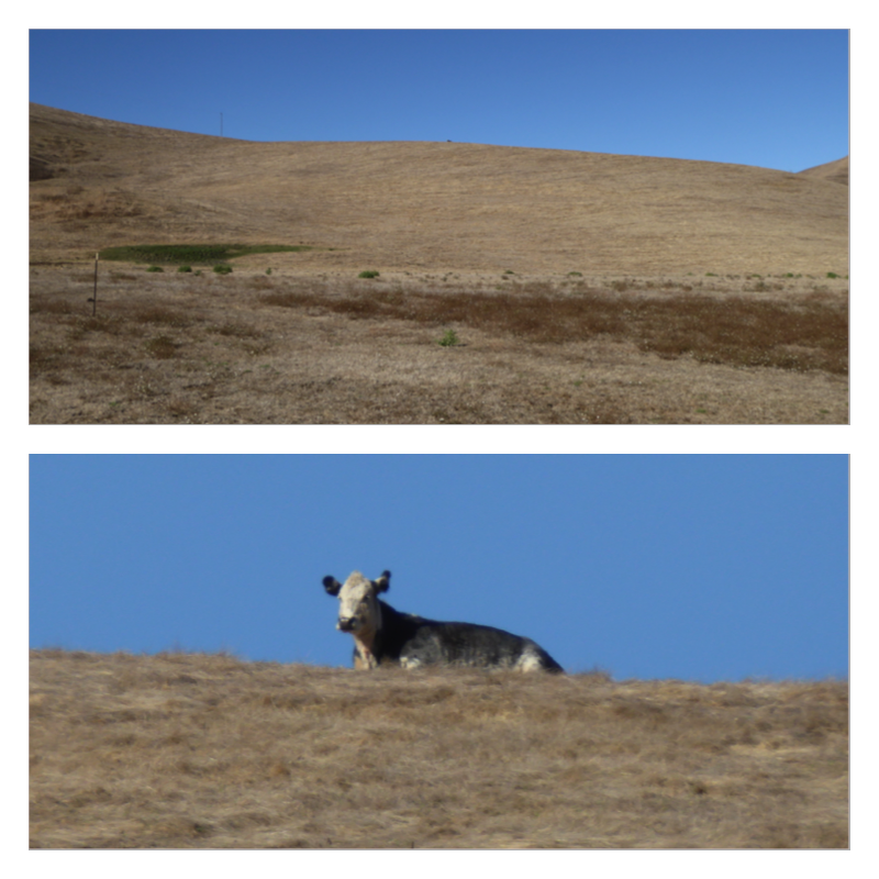
Gathering at the parking area a dramatic hill sets the scene as does the welcome rest room after out travels. You can spot a few black dots on the hill – Black Angus cattle keeping down the grass. They seem content with more solitary work.

Gathering at an information sign we read that Lynch is home to golden eagles and hawks as well as being a magnet for migrating and over-wintering birds of prey providing “over 1,000 undeveloped acres where they can hunt and rest.” http://www.solanolandtrust.org/raptors.aspx

Michael noticed some Northern California black walnut trees. In agriculture they are used as root stock for the tastier English walnuts which are grafted on top of the black walnut root ball. https://en.wikipedia.org/wiki/Juglans_hindsii http://calscape.org/Juglans-californica-() this description of the Southern California Black Walnut relates that the Chumash Indians of the Channel Islands eat the nuts.
http://napavalleyregister.com/lifestyles/home-and-garden/columnists/bill-pramuk/in-search-of-big-black-walnut-trees/article_7e66165f-73c2-51d9-a335-2b08aee5cc4b.html – If you can stand the advertising, this is an interesting article about some special black walnut trees in the Napa Valley area from an article in the Napa Valley Register by Bill Pramuk in 2009. They were found just across the Napa County Line in Lake County on a UC research station at the Donald and Sylvia McLaughlin Preserve in Pope Valley.

Michael points out a bluebird house or better “nesting boxes” which have been constructed by local cub scout troops and the Napa-Solano Audubon Society. The location and design of the box are as crucial as its location. The hole needs to accommodate the particular bird size. If it is too large it would allow starlings to take it over destroying the fledge of the desired birds: western bluebirds, tree swallows, house wrens and a few others.
In placing a box, crews face it to the east or south away from prevailing winds, the round entry holes measure 1 & 9/16ths of an inch, six inches from the bottom of the hole to the box floor. “If the box is too shallow, predators can reach the chicks. If it’s too deep, the chicks can’t crawl out. To make the box just right, the box builders carve little grooves on the inside for the chicks to stepladder their way out.”
https://baynature.org/article/a-helping-hand-for-bluebirds/

Spotting a ……?

The sign urges us to resist the urge to pet a cow, hadn’t seen this one before. Getting between a cow and her calf could be problematic and dangerous.

Solitary and substantial black cottonwood tree, Populus trichocarpa. https://en.wikipedia.org/wiki/Populus_trichocarpa Or it might also be a Fremont’s cottonwood, Populus fremontii, https://en.wikipedia.org/wiki/Populus_fremontii
https://sites.google.com/site/ezillmer/home/cottonwood_fluff

High wires keeping up the clouds

Michael spots two Golden Eagles, one mature and one immature, on the horizon with a white cloud helping as background.
https://www.allaboutbirds.org/guide/Golden_Eagle/id http://www.water.ca.gov/suisun/dataReports/docs/SEW/geagle.cfm
https://abcbirds.org/bird/golden-eagle/ http://ca.audubon.org/birds-0/golden-eagle

Topping another rise we looked way up a hill to an object of interest, that dark spot on the crest. The cattle perform a valuable service keeping down the grass as well as enjoying the forage. She’s enjoying a view from close to 900 feet with “panoramic views extending from the Coast Range to San Francisco Bay and across the Delta to the Sierra Nevada”. https://baynature.org/event/mid-week-hike-at-lynch-canyon/

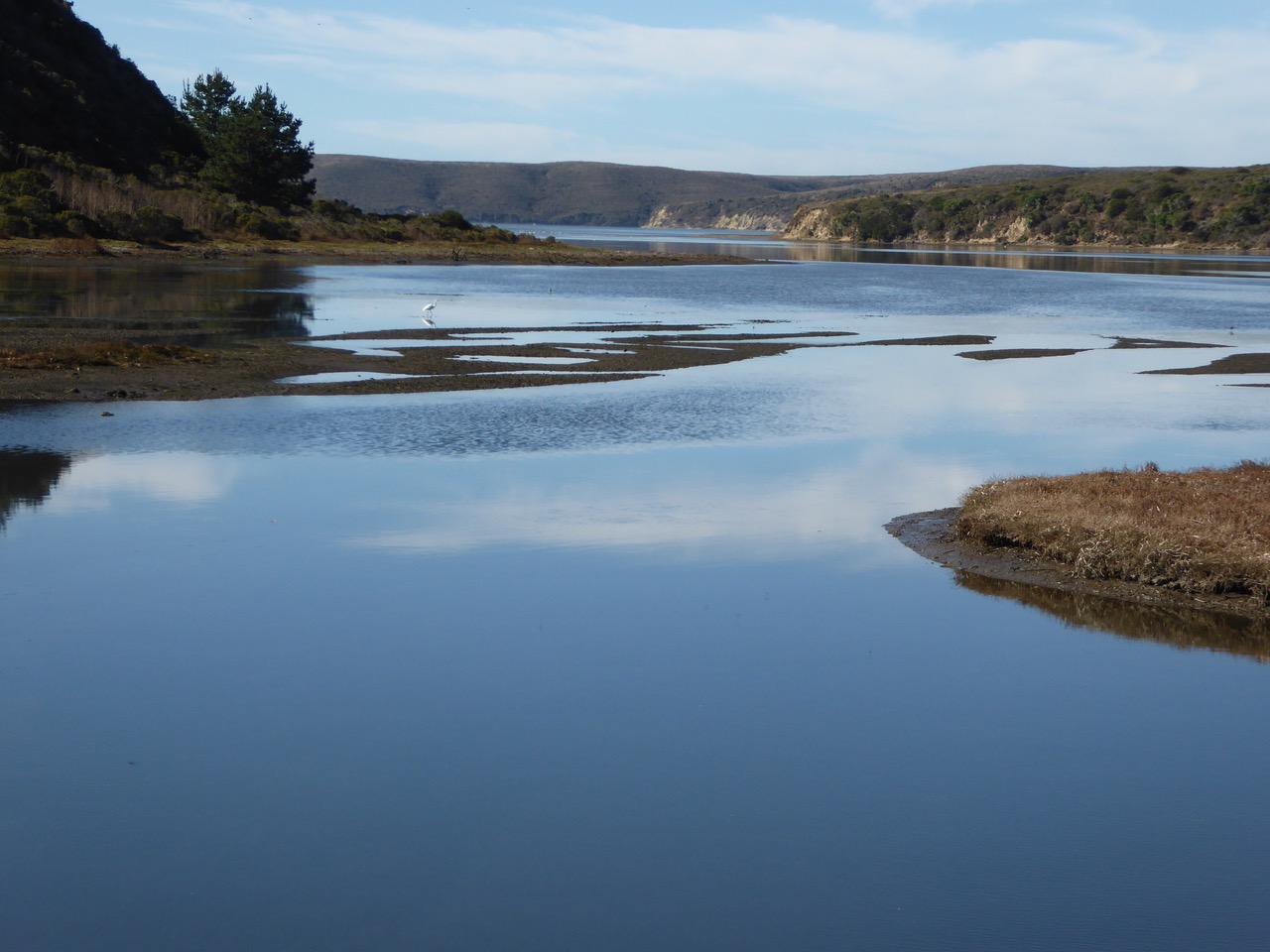
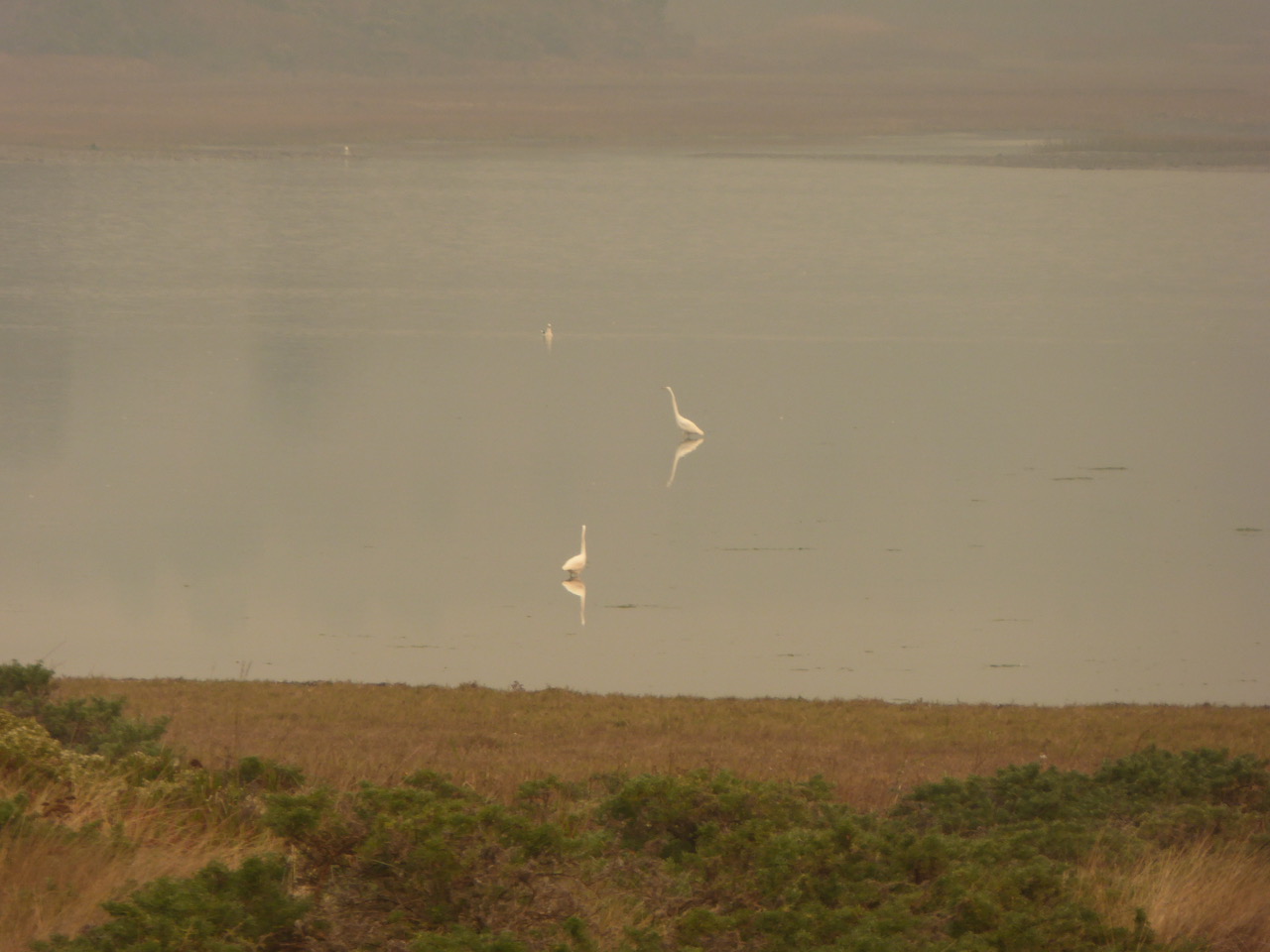
Lynch Canyon Reservoir provides habitat for many waterbirds both locals and those migrating through, a great white egret can be spotted in the center. In the foreground is a border of tule grass which was used by the California Indians to make “shelters, boats and sleeping & sitting mats”.
http://www.cabrillo.edu/~crsmith/tule.html http://wpn.org/wpn/tuleboat.htm
https://www.livescience.com/46121-california-tule-fog.html from 2014 Tule fog can transform the Central Valley of California and make the roadways a gamble with markers at the side of the road your only guide.

Michael makes an explanation with hands added for emphasis, what does his body language tell us?

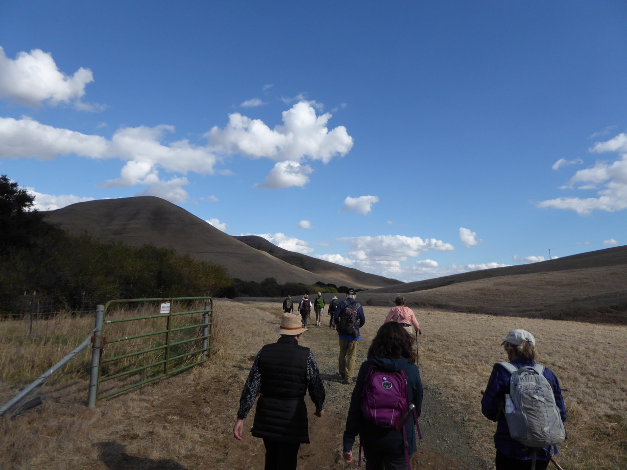
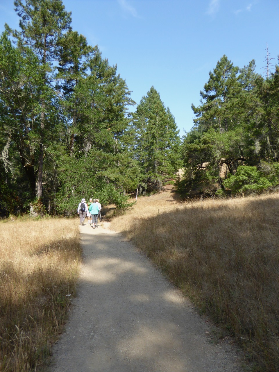
Heading uphill to take the high path so we can “get to Scotland afore ye” or at least to our lunch spot with everyone else. Harriet leads the way.

Michael mentioned that some animals like to leave their scat atop cow paddies, all sorts of signatures out there.
http://www.chippewanaturecenter.org/wp-content/uploads/2016/11/November-2016-Animal-scat.pdf

And a purple star thistle in bloom as well as we continue up the hill, there is also one with a yellow flower called a golden star thistle.  The lancing thorns and the delicate bloom provide a vivid contrast.
http://wric.ucdavis.edu/information/natural%20areas/wr_C/Centaurea_calcitrapa-iberica.pdf

Lunch atop the rise: Michael loves Halloween and he shared some of this year’s celebration on McDonald Avenue in Santa Rosa at lunch.
The owners of the McDonald Mansion, the John Webleys, decided that a celebration this year after the recent devastating fires would be a nice respite, a healing time and a welcome back to normalcy for everyone and especially the kids. This year there was a crashed spaceship in their front yard, a cafe in Roswell, N.M and live music. Michael went as the Disco King and rode his bike over hanging a disco ball from the handlebars with a boom box accompaniment.
He’d met a lady from Israel, Ellen, giving her a ride on the way back from Burning Man. They hit it off, she’s a spinner – you’ll recall Michael’s love of hula hooping. Ellen and her friend Issac came by on this scene and Michael gave them a grand tour of an American Halloween. They joined him trick or treating and got a royal welcome at all the houses since Michael is a well known participant in this celebration. The next day they were off home to Israel.

http://www.pressdemocrat.com/gallery/4588613-181/story.html?artslide=0 Some shots of the McDonald Mansion through the years with a few photos of Halloween through the years toward the end of the series.

We find a fascinating and beautiful thistle as we head down the hill after lunch. https://en.wikipedia.org/wiki/Cardoon
http://www.incrediblevegetables.co.uk/how-to-grow-cardoons/ http://www.bestofsicily.com/mag/art332.htm

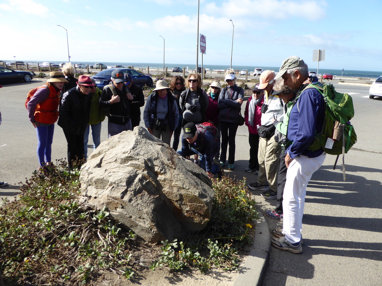
There were remarkably few rocky outcroppings on these hills. Here Michael finds some weathered sandstone. In “Roadside Geology of Northern and Central California”, the authors describe this area’s geology: “The highway (I 80) passes through a spectacular road cut in Franciscan rocks at the top of Sulphur Springs Mountain, just east of Vallejo. Basically similar Franciscan rocks form the hills north of the highway between San Francisco and Vacaville, where the highway passes the southern ends of several long ridges and wide valleys that extend to the northern horizon. These are slices of the Coast Range that moved horizontally along faults parallel to the San Andreas Fault.” P.271

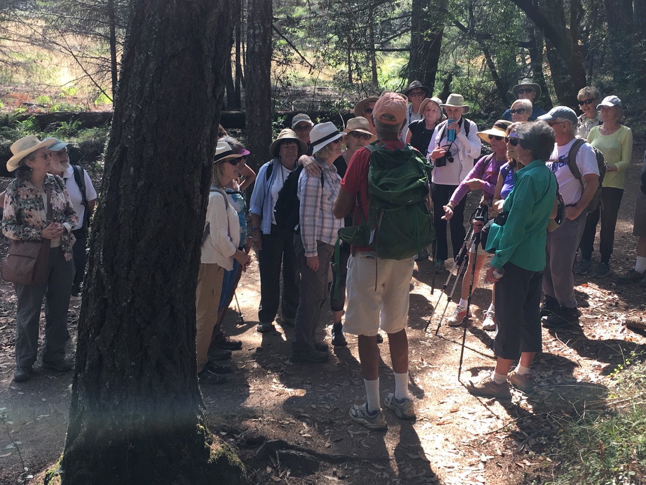
Armand talks to a Solano Land Trust Volunteer at Lynch Canyon, Jeff Bonneville, who has the Disneyesque title of “Bluebird Monitor”. Michael greeted him warmly and Jeff shared an array of interesting information about the nesting box program.


Clip42
https://vimeo.com/242121099
Anyone

Heading back, following the clouds home.

P.S. Last week I misidentified a Bald Cypress for a Dawn Redwood on our Golden Gate Park hike. Here’s are three youtube videos which give some helpful, basic information about both: https://m.youtube.com/watch?v=gIlu0I3Pulw https://www.youtube.com/watch?v=19Jyp6CxA7A
https://www.youtube.com/watch?v=uHnge34PytI

P.P.S. I discovered this helpful link on the WordPress site which organizes some of my more recent hike-logs (as well as many other blogs) with select photos and introductory sentences as well – a nice diving board. https://wordpress.com/read/feeds/18737942

Tilting at Windmills in San Francisco – 30 October 2017

Golden Gate Park is a mecca for people and nature in the heart of San Francisco. Wrested from the sand dunes starting in 1870, this precious green space provides a haven for city dwellers, tourists and is a special destination for Bay Area residents. From the Wikipedia entry: “It is over three miles (4.8km) long east to west, and about half a mile (0.8) north to south. With 13 million visitors annually, Golden Gate is the fifth most-visited city park in the United States . .”. We’ve enjoyed hiking here with Don McLaurin, our friend who is a City Guide, in the Panhandle and the eastern section of the park in recent past hikes. Michael surmised this western part of the park was last visited by our Footloose group “ . . about 15 years ago.” https://en.wikipedia.org/wiki/Golden_Gate_Park

We gather for the hike circling up for instructions – we might have looked like this 60 years ago plus or minus! Many classes and school groups are always out and about in the park enjoying the mysterious pathways filled with fascinating discoveries. Our hikes all have special highlights but this one especially seemed like a “Pictures at an Exhibition” experience with focus moments followed by a promenade to the next frame.

https://www.youtube.com/watch?v=Mdkp7YBB-zU&app=desktop This is a remarkable series with at least 7 parts on a variety of local subjects. These “lymarchvideos” by Glenn Robert Lym who is an A.I.A. Architect open up a fascinating window to San Francisco history, carefully researched and presented with sensitivity and style.This one is HERE2 – A History of Golden Gate Park.

Harriet, stylin’ for the day, sets the tone for our ramble with some autumn colors in a bow to the east coast and her cherished Baltimore.

Michael talks to us by the Buffalo Paddock about the history of the North American Bison species.

https://vimeo.com/241415036 https://vimeo.com/241415726

https://ww2.kqed.org/news/2017/06/08/whats-with-the-bison-in-golden-gate-park/ https://goldengatepark.com/buffalo-paddock.html
https://www.nps.gov/yell/learn/nature/bison.htm excellent narrated video set in Yellowstone Park
https://www.smithsonianmag.com/history/where-the-buffalo-no-longer-roamed-3067904/

Barb suggested that we explore the casting pools which were just across the way from the buffalo paddock – a new island in our voyage of discovery. Along with three casting pools there is “a rustic mountain-style lodge, home of the Golden Gate Angling and Casting Club where generations of San Franciscans have learned to fly fish. The lodge was organized in 1933, as an offshoot of the San Francisco Fly Casting Club, which dates back to 1894.” https://goldengatepark.com/anglers-lodge.html Dropping the fly in the target circle was amazing to watch.

A member of the club, Victor Lee, spoke to us enthusiastically about their history and the opportunities offered here. At the end of his comments he was talking about the Spey Casting technique used in fly fishing and fly fishing competitions, a name that comes from the River Spey in Scotland. https://vimeo.com/241416619    https://video.search.yahoo.com/yhs/search?fr=yhs-adk-adk_sbnt&hsimp=yhs-adk_sbnt&hspart=adk&p=shortspey+casting+video+clips#id=9&vid=8481fe

http://www.ggacc.org/Spey-O-Rama-2017

New Zealand Tea Tree or Manuka (Leptospermum scoparium) contorts beautifully along our path. Manuka is a Maori word for Leptospermum scoparium and the name of a coveted honey. On Captain Cook’s arrival in New Zealand in 1769 his crew boiled the leaves of the Manuka to make tea.

https://meaningoftrees.com/2013/07/24/manuka-leptospermum-scoparium/ This artful, well written and illustrated link details 18 other New Zealand trees as well.

http://www.boethingtreeland.com/leptospermum-scoparium-helene-strybing.html https://en.wikipedia.org/wiki/Leptospermum_scoparium

A shady grove with a stream on our right as we promenade two legs and four. The Rotterdam Philharmonic Orchestra is conducted by Valery Gerfiev playing the Promenade (part 1) by Modest Mussorgsky: https://www.youtube.com/watch?v=_5r8sa863Ts

Mallards to the right of us: https://www.allaboutbirds.org/guide/Mallard/id http://www.audubon.org/field-guide/bird/mallard

Michael pointed out a Dawn Redwood which unlike other Redwoods is a deciduous tree. It was discovered in China relatively recently – in 1943 during WW2.
http://www.quarryhillbg.org/home/quarryhill/The%20Dawn%20Redwood.pdf
http://peabody.yale.edu/exhibits/dawn-redwood http://dawnredwood.org/HISTORY.htm

Nearby Michael spotted an American Chestnut tree. Here’s an American Chestnut Leaf, burr and nut. You can see the leaf is toothed as its Castanea dentata Latin name indicates. From the Wiki entry it was “a large, monoecious deciduous tree of the beech family native to eastern North America. It was one of the most important forest trees throughout its range, and was considered the finest chestnut tree in the world. It is estimated that between 3 and 4 billion American chestnut trees were destroyed in the first half of the 20th century by blight after its initial discovery in 1904.” https://en.wikipedia.org/wiki/American_chestnut

From The American Chestnut Foundation site: https://www.acf.org/the-american-chestnut/
https://www.acf.org/the-american-chestnut/history-american-chestnut/ – Don’t miss the video which is a remarkable piece of Americana nor be put off by its 27:37 minute length. There are interviews with many people of the Appalachians who have lived with and love the American Chestnut tree. The language immerses you beautifully into their culture.

As advertised, a windmill looms at last. This is the first windmill constructed to pump water to the growing Golden Gate Park in 1902, called the Dutch Windmill. https://noehill.com/sf/landmarks/sf147.asp
http://hoodline.com/2017/03/getting-to-know-golden-gate-park-s-elusive-windmills
https://goldengatepark.com/windmills.html and this one to satisfy your engineering instincts http://www.sfmuseum.org/hist/wmill.html

https://www.youtube.com/watch?v=EFcnF1yS4o4&app=desktop This brief video gives you a good idea of how the windmill works, this one from Derbyshire, UK was built in 1797 and restored in 2002. http://www.heagewindmill.org.uk/ Sorry, it feels un-Dutch to feature an English windmill but they had the best brief video.

http://www.indepthinfo.com/windmills/history.htm Here’s a brief windmill history from which we learn that our Dutch windmill is a smock mill allowing just the top part of the windmill to be turned to face the wind. “This was a vast improvement as it was lighter and easier to turn. More permanent structures could be built to house the mill beneath. Brick and stone towers developed from this innovation.”

https://en.wikipedia.org/wiki/History_of_wind_power More detailed going back to the beginnings of wind power though not quite as far back as the discovery of fire. Whether grinding grain or pumping water, the windmill was a technological marvel of its time and continues its remarkable history today. This extensive link takes us up from ancient history to wind turbines of the present day.

The displays of tulips at the Dutch Windmill are an exciting destination in San Francisco from mid-March to mid-April. In fact, they are part and parcel of the Dutch Windmill’s identity today. http://www.hiddensf.com/420a-dutch-windmill-tulip-garden-sf.html

Crossing JF Kennedy Drive at Ocean Beach

Scott reads a memorial plaque about Roald Amundsen (1872-1928) to the group. He was a remarkable Norwegian explorer of the early 20th century who arrived to a hero’s welcome in an earthquake ravaged San Francisco on October 19, 1906. He and his crew had just successfully completed a three year Northwest Passage voyage traveling from the Atlantic to the Pacific Ocean over the North Pole. They sailed into San Francisco Bay on their ship the Gjoa. The name means “god” and “beautiful” in Norse and is pronounced simply as “Joe”. The Norwegian American community sought to buy the ship from him. He didn’t want to sail back home around the Horn and so pleased them when he donated it to the city of San Francisco. The ship was “dragged up on the beach to the Northwest corner of Golden Gate Park where it became a display. It deteriorated through the years and repairs were postponed by WW 2. Finally in 1972, it was returned to Norway where it was lovingly rebuilt and restored. It remains honored in a separate building of the Fran Museum in Oslo.
https://en.wikipedia.org/wiki/Gjøa http://www.outsidelands.org/gjoa.php http://www.artandarchitecture-sf.com/tag/roald-amundsen

Amundsen went on to the hero’s life after completing the Northwest passage, becoming the first to cross the Arctic by air and also the first to reach the South Pole. This was a memorable competition with Great Britain’s Robert Falcon Scott in which Scott and his companions perished. Amundsen “was one of the greatest figures in the field of polar exploration.” https://www.britannica.com/biography/Roald-Amundsen

We break for lunch in the garden behind the Beach Chalet .http://sfrecpark.org/destination/golden-gate-park/beach-chalet/

And Louise’s dogs take the opportunity to relax being dog tired.

The murals, mosaics and wood carvings on the ground floor of the Beach Chalet building were a 1936-37 project funded by the Works Progress Administration (WPA). The frescoes were done by the French-born painter Lucien Labaudt. “The images depict residents at play in Golden Gate Park and Land’s End during that time. Labaudt recruited friends and family as models, but several well known figures are included, among them legendary Golden Gate Park Superintendent John McLaren.” Here are some links to this “time capsule” of history.
http://www.foundsf.org/index.php?title=Murals_at_the_Beach_Chalet
https://www.atlasobscura.com/places/beach-chalet-wpa-murals
https://noehill.com/sf/landmarks/nat1981000172.asp

We joust with the other windmill in the park that is also near the beach. It’s a bit more than quarter mile further south and is called “The Murphy Windmill”. It was a $20,000 gift to the city from a banker, Samuel G. Murphy. It was considered the largest in the world when it was completed in 1908. We’re beginning to have some sympathy now for Don Quixote riding against his nemeses astride faithful “Rosinante” along with his loyal companion Sancho Panza on his donkey “Dapple”. http://outsidelands.org/murphy_windmill.php https://noehill.com/sf/landmarks/sf210.asp https://www.atlasobscura.com/places/murphy-windmill https://inspiredimperfection.com/adventures/murphy-windmill-golden-gate-park/

Perhaps this was our “Great Gate Of Kiev” but we still needed to find our way back to Go . . . and home.

You have many choices on this Yahoo page, I chose the performance in the middle of the top row. From Radio-Television of Slovenia in Ljubljana Maestro En Shao leads the RTV SLO Orchestra.
https://video.search.yahoo.com/yhs/search?fr=yhs-adk-adk_sbnt&hsimp=yhs-adk_sbnt&hspart=adk&p=great+gate+of+kiev#id=3&vid=bd64cdf4b7bc14

How to complete our circle? Scott, our urban pathfinder, studied a map of the crisscrossing pathways and mapped out our route back for which he received a hug from Michael and a smile from us all. He got us to the church on time.

Estero Hike with Michael – 23 October 2017

The Estero Trail at Pt. Reyes National Seashore is one of Michael’s favorite hikes and we could see why. Rolling golden hills meet the blue waters of Drake’s Estero in the quietness of nature all under a sunny blue sky and for extra measure, a Christmas Tree farm gone feral.

Having a quick gather as we get it and us together

We’ll be walking the Sunset Beach Trail today full of bird calls and scenic overlooks of Home Bay, named after this area of Home Ranch. The greater Drakes Estero (Estuary) opens into Drakes Bay and thence into the Pacific.

Stepping out smartly we find the hills are alive both with the sound of music and blooming coyote bushes.

Here’s a look at the considerable expanse of the Christmas Tree farm from an overlook of Home Bay from an earlier hike I took on 7/10/10. Jules Evans mentions in an excellent hike write-up from December of 2012 that according to our local historian Dewey Livingston the Christmas trees were planted to enhance the value of the ranch land in the area. Were they ever a destination for families seeking their trees for the holidays? This needs some more research. Here’s the fine, solitary hike that Jules Evans took on the Estero Trail on December 12, 2012 courtesy of BAY NATURE.
https://baynature.org/2012/12/13/point-reyes-drakes-head-via-estero-trail/

We stopped in the quiet Christmas tree forest where Michael talked of many things, no cabbages or kings but the origin of the Audubon bird count, ravens, crows and the whole passerine scene. https://en.wikipedia.org/wiki/Passerine

Three VIMEO videos of Michael sharing: https://vimeo.com/240236961 https://vimeo.com/240239487 https://vimeo.com/240240338

The bridge over Home Bay and a convenient stop to observe what’s coming in on the tide.

With views of Home Bay quite resplendent

A great Egret works on his reflection and checks the menu for lunch. http://www.audubon.org/field-guide/bird/great-egret

We’ve seen White Pelicans in the Estero area on previous hikes but currently the ones I’ve watched are by the Village Shopping Center in Corte Madera and in this photo at Vintage Oaks Shopping Center in Novato behind Costco. Why would they choose what seem kind of marginal tidal areas and not be out in the beauty of Home Bay and Drakes Estero at Pt. Reyes? The very idea! http://www.audubon.org/field-guide/bird/american-white-pelican

Climbing the hill out of Home Bay we again find plants growing in the seep provided by the hillside. One of Michael’s favorites is Sneezeweed:
http://portlandnursery.com/plants/perennials/helenium.shtml We just missed the bloom on this one but it still provides great food for birds.

Michael pointed out a debris spider’s web along side the trail. The spider resides in the debris “house”. https://en.wikipedia.org/wiki/Cyclosa

Heading down the trail past some trail maintenance to a couple of stock ponds

On a previous hike, June 25. 2010, I spotted some river otters in the near pond. http://www.riverotterecology.org/research.html
https://video.search.yahoo.com/yhs/search?fr=yhs-adk-adk_sbnt&hsimp=yhs-adk_sbnt&hspart=adk&p=River+Otters+at+Pt.+Reyes+National+Seashore#id=1&vid=d1d7b4353bbed3b308eb46c150942edf&action=click

Moving well to high ground overlooking Drakes Lagoon

Looking down on Drakes Estero from our picnic aerie. Was it here in 1579 that he had the Golden Hinde’s bottom scraped, parlayed with the Miwok only to continue in his circumnavigation of the globe? The link below describes him like an astronaut returning from space when he came back to England. What to do for an encore? Why not defeat the Spanish Armada in 1588? http://www.marinmagazine.com/October-2011/Did-Drake-Really-Do-It/

Some ponies from Iceland spruce up our return trail. http://www.inspiredbyiceland.com/things-to-do/activities/horses
https://en.wikipedia.org/wiki/Icelandic_horse

Almost all downhill from here

I’d like to tell you that everyone celebrated on our return by hula hooping in the parking area and that seems the right ending to a beautiful hike.
Michael brought his hoops because he was planning an event at his house and he wanted some photos to include in the invitation. He’s used hooping on his international trips as neat way to get to know and bond with the people of many other cultures.

Limantour Beach with Michael – 9 October 2017

The day began early with the smell of smoke in the air and the sleepy rational that someone next store had been barbecuing the night before. But the smoke and the smell were pervasive and we began to wonder if it would just “blow over”. It was early on, hard to make the call for the hike. Some emails set the scene:

“Safe and sound in west Sonoma county at my daughter in laws parents home. Fires raging in Santa Rosa. I could hear many explosions at 3 am and our neighbors dog continually barking coming through my dreamscape. My son Hunter contacted us from India to wake us up to flee. I suspect our houses are ok at this point. But who knows??
Warmly, Michael Ellis, Footloose Forays

Because of the fires in Sonoma and Napa Counties, Michael has evacuated west from his Santa Rosa home. He may – or may not – make it to our hike, but he said that we should still plan on meeting at the main parking lot at Limantour and hiking. ~ Jeannie

Huge fires here in Santa Rosa. Sebastopol ok so far. But I think I’m going to stay home. If I’m not at Point Reyes by 9.0am don’t wait for me. What are your cell numbers? Please leave on around 9.0am. Diana

Looks really bad up in the north Santa Rosa area, read that they evacuated Sutter and Kaiser Hospitals. Take good care of you and your Daches.
See from Michael’s email that he has evacuated from his house. I’ll be here at home until I head over to the Bovine at 8:45 AM. That’s the plan at the moment. Lew

Fingers crossed for the properties. Glad you are safe! Sue

I’m not coming. Just in case. Right now it’s west of me. I can hardly believe this. Have a good hike. Diana

Take care of yourself. Matt

I made it back home to pack a few things in case I need to make a run for it but it looks like they’re holding the fire about a half a mile north of me. Santa Rosa will never be the same. Warmly, Michael Ellis”

=================================

Heading out on the back roads to Pt. Reyes National Seashore we began to see the smoke blanketing the landscape.

The back roads coming down from Sonoma County were crowded with refugees who had already fled the blaze and the smoke looking for a safe harbor in West Marin. All of Pt. Reyes Station was filled with evacuees and parked cars, most atypical for a Monday after the weekend.

What would seem like a normal scene at the Bovine, but here uprooted families greeting each other in the smoky air, children full of energy and dogs lending their quiet support.

Even at Limantour Beach the smoke followed us.

Kit’s carpool had brought bandanas for masking during the hike and she kindly loaned one to me. Thanks to Kit for the photo below.

Heading out through the high European beachgrass the sky is orange with a smoky plume overhead, we’re walking just behind the beach in the dunes. Greeting our ears as we brush by are the sounds of the scratchy grass on our clothing and backpacks and in the background ocean waves finding the beach.

Cones of the Monterey Cypress and Monterey Pine extend out into the trail, planted in the 1960s as part of a fortunately failed housing development along the beach. Marin and Sonoma at the time were in the gunsights of developers who had great and monstrous plans to build a freeway to the coast and cover the land with housing and shopping centers. This was a time when a freeway was proposed down the center of Sonoma Valley and when PG&E blithely began to build a nuclear reactor at Bodega Head directly over the San Andreas Fault. http://www.whatmighthavebeen.org/stories-1/

Prior to this was the Reber Plan in the 1950s to “build two giant dams to transform most of the San Francisco Bay into two freshwater lakes which would have destroyed the estuary as we know it.” https://boomcalifornia.com/2015/04/14/the-man-who-helped-save-san-francisco-bay-by-trying-to-destroy-it/

The beauty of these cones belies their origin.

Here is the visitor guide printed for the 50th Anniversary of the creation of Pt. Reyes in 2012 which shares the beginnings of PRNS in clear, compact and compelling writing. https://www.nps.gov/pore/learn/news/upload/newspaper_visitorguide_2012.pdf There’s even a photo of Lady Bird Johnson, California Governor Pat Brown and Interior Secretary Stewart Udall getting their feet wet!

Monterey Cypress along the way both skeletal and virginal following the same lilt and design.

Time to head up over the dunes and see the waves that have been our background as we walked along.

The sun back lights the incoming waves projecting a volcanic image of fire beneath the waves – earth, air, fire and water.

Jeannie reads a new email from Michael to our Footloose group on the beach:

I came back to my house to get stuff in case I need to do evacuate fast. I’m watching the fire is now in downtown Santa Rosa it’s all around Fountaingrove burning a lot of businesses

I may have to run so I’m staying close to home packing up valuables

Back home now I just rode my bike to the Home Depot and looked down on the fires burning all around

Kaiser hospital was evacuated this morning at 5 am, many houses in Fountaingrove and the mobile home park called – ironically enough called – “Journeys End” completely burned to the ground, Kmart burned to the ground Trader Joe’s burned to the ground, furniture stores burned to the ground. a guns and ammo place on fire right now

Birds are flocking to my backyard, the sun is orange and this morning the moon was orange. Those of us in this neighborhood seem to be OK right now. But I’ve got a few things packed just in case. They’re just things. My son is safe in India and my daughter-in-law ensconced with her parents in West Sonoma County. So all the important things are OK

Can you read this to the group ?

Yes
It could happen any time, tornado,
earthquake, Armageddon. It could happen.
Or sunshine, love, salvation.
It could, you know. That’s why we wake
and look out — no guarantees
in this life.
But some bonuses, like morning,
like right now, like noon,
like evening.
– William Stafford

Nearby migrating Sanderlings gather just above the incoming tide: http://www.audubon.org/field-guide/bird/sanderling https://www.allaboutbirds.org/guide/Sanderling/id http://www.birdweb.org/Birdweb/bird/sanderling

It’s “Maureen Time” for lunch so we pull up a friendly dune with an ocean view.

Being a beach, Matt shows us how to really take a break.

Nearby was some Sand Verbena (Abronia latifolia) living up to its name and decorating our “tables”. Here’s a lovely list, of nicely detailed Wildflowers at Point Reyes National Seashore and leading the charge is Yellow sand verbena (Viva Abronia!) http://www.americansouthwest.net/california/point-reyes/wildflowers.shtml The Beach Sand Verbena (Abronia umbellate) with its purple flower umbels is considered relatively rare. https://en.wikipedia.org/wiki/Umbel

Armand spotted a sand dollar and shared it with the group. The following article refers to them as “a “species of extremely flattened, burrowing sea urchins belonging to the order Clypeasteroida.” https://en.wikipedia.org/wiki/Sand_dollar Etching front and back is fascinating. This one has symmetric holes unlike others that I’ve seen – why in some and not others?

Heading back the presence of the waves in their steady tattoo lends a steadiness and security on the edge of the wild fires raging to the north.
Thanks much to Karin for this photo. https://vimeo.com/239270162

On the return we spot a Sanderling Ballet in the breaking waves. https://vimeo.com/239270521

Home is the sailor

Mt. Vision with Michael – 2 October 2017

Mt. Vision was a new hike for us. We’d not done this as a group before and proved a happy proof of the theme for “Star Trek”. As William Shatner’s Captain James Kirk used to say, “Space, the final frontier, these are the voyages of the Star Ship Enterprise … our mission to explore strange new worlds, to seek out new life and new civilizations, to boldly go where no man has gone before.”

Our hike was purposely planned to be a recollection and remembrance of the Mt. Vision Fire which started 22 years ago on 3 October 1995 . As Dave Mitchell editor of the POINT REYES LIGHT wrote on the 20 year anniversary, “The Inverness Ridge Fire of October 1995 (a.k.a. the Mount Vision Fire was big — even for a state that has become accustomed to large wildfires. The amount of damage was staggering. The fire …. destroyed 45 homes in Inverness Park. The blaze charred 12,000 acres, including 15 percent of the Point Reyes National Seashore. It took firefighters five days to contain the fire and 13 days to fully stop its spread. Even so hotspots remained for a month. The fire was accidentally started by four teenagers camping on Mount Vision in the Pt. Reyes National Seasohore. Their campsite was illegal, although others had camped there before. The teens tried to be fire safe, carefully burying the ashes of their campfire under dirt and rocks before leaving. Over the next two days, however, the smoldering fire burned its way up through the forest duff, arriving on the forest floor during a high wind.” https://www.ptreyeslight.com/article/mount-vision-fire-what-happened

An assemblage of gathering hikers, their car pool steeds and a line of Bishop Pines all in a row. We’re all making long shadows again.

Michael introduces a friend of his with whom he graduated Oakridge High School, Oakridge, Tennessee in 1969 (?). Is my math right? I’m not questioning that they graduated! His friend Greg was in the Coast Guard and then wore a Captain’s hat on the Golden Gate Ferries followed by other headgear or none at all!

On the road to the crest of Mount Vision . . .

I’ve run into a lovely blog for our area called THE WILDFLOWER SCOUT by Sara Silver with superb and breathtaking wildflower and nature photos
along with lovely, eclectic writing all done with a neat touch of whimsey. Here’s a brief entry in her blog on Mt/ Vision:
https://wildflowerscout.wordpress.com/2014/02/23/mt-vision-pt-reyes-national-seashore/

Mt. Vision is also the name of a mountain bike series:
http://www.performancebike.com/webapp/wcs/stores/servlet/Product_10052_10551_1216353_-1___

And looking down the list for “Mt. Vision” you’ll eventually find advertisements for optometrists.

Elephant or Black Mountain from the crest looking east with some Bishop Pine and happily blooming Coyote Bushes (the showy white ones are the females and the muted yellow ones the males) in the foreground. Black or Elephant Mountain is a touchstone of western Marin County.
The curiously deep series of stream bed erosions distinguish this mountain from many others in the area. In a USGS evaluation of the Nicasio Reservoir terrane they suggest the area perhaps including Black Mountain “represents a fragment of a Late Jurassic-Early Cretaceous ocean island (similar to Hawaii)”. https://pubs.usgs.gov/mf/2000/2337/mf2337j.pdf In more recent history, this area was part of a much larger Mexican land grant. Normally these were manipulated away or brazenly stolen from Native Americans. An exception to this pattern was granting the area in 1843 to a Miwok Indian chief, Camilo Ynitia (one of two native American to receive such a land grant). “In 1852 Anita sold most of his land to James Black, who was on his way to becoming one of the largest landowners in Marin County.” The mountain acquired its Black Mountain name from him but as to the Elephant name, that may need more inquiry or even some speculation.
https://wandering-through-time-and-place.me/tag/james-black-of-marin-county/
http://www.malt.org/protected-lands/profiles-black-mountain-ranch http://www.summitpost.org/black-mountain-marin-county/833787
https://www.ptreyeslight.com/article/black-mountian-ranch-gets-organic-certification

https://en.wikipedia.org/wiki/Elephant_Mountain There are many Elephant Mountains but this link is about an album by the American rock band, “The Youngbloods, released in 1969.

Odd to find an FAA air traffic control unit out here but we’ve already seen that big dome still working on Mt. Tamalpais, they’re out there. There are many considerations for over-flying airplanes from noise abatement for ground dwellers to safety and sequencing for those in the air. The first map in this linked document shows this FAA arch over our heads. Fascinating later maps are quite revealing for the flight patterns over our heads and seem quite surreal but then we could take it to another level sometime mapping the satellite overflights as well adding to this picture.
http://www.flyquietoak.com/_source/pdf/Tab%204g%20PDF%20links/Local_Regional/Marin%20County%20Aircraft%20Noise%20Analysis%20Report_20

Taking a short turn down the Bucklin Trail, we head to the view of the Pt. Reyes Peninsula and Pacific Ocean beyond.

Michael talks about the 1995 Fire: https://vimeo.com/237231464

The ocean view with more coyote bush or brush in the foreground, first Limantour Estero with the water on the left, then Drake’s Bay with its distinctive exposed cliffs and to the right the blue of the large Drake’s Estero. That land mass before you get into a serious Pacific has Chimney Rock fingering out to the left and the hills of the point of Point Reyes to the right, just above the lighthouse. Probably you can’t spot a passing whale since it is a little early for that and they are still “krilling up” off Alaska. Michael is often able to spot the Farallon Islands out in the mist but you need a seasoned eye.

Often it’s said that the Spanish mariners missed San Francisco Bay because of the fog covering its mouth. In concert with that Michael mentioned that the main reason the passing Spanish galleons did not discover San Francisco Bay was actually more a matter of their routing miles out in the Pacific to avoid the dangerous coastal rocks in this area. Now interestingly, some of the air travel considerations involve routing airships out over the Pacific when that is needed. This seems almost a 500 year tradition!

We’ve just passed a mature Bishop Pine (perhaps just a tad senescent) that reminds me of a west coast tryout for Respigi’s “Pines of Rome.”
The wiki account records “The common name ‘Bishop Pine’ resulted from the tree having been first identified near the Mission of San Luis Obispo, California. . . . Other English names that have been occasionally used are prickle cone pine, Obispo pine, Santa Cruz pine and dwarf marine pine.” https://www.nps.gov/pore/learn/nature/plantcommunity_pineforest.htm http://www.stevenkharper.com/bishoppine.html

I like the Cell biology definition of “senescent” i.e. “(of a cell) no longer capable of dividing but still alive and metabolically active.” from Dictionary.com

Some understory plants along the way, first the coyote bush we’ve mentioned. Atop is the female coyote bush in full bloom (a quite lyric moment) and below are male coyote bush to the left and the female to the right. http://sonomamg.ucanr.edu/Plant_of_the_Month/Baccharis_pilularis/

California Coffeeberry or Rhamnus californica https://grownatives.cnps.org/2010/09/28/california-coffeeberry/
http://sonomamg.ucanr.edu/Plant_of_the_Month/Rhamnus/
https://flowersofmarin.wordpress.com/2012/08/21/plant-of-the-day-coffeeberry/
http://calscape.org/Frangula-californica-(Coffee-Berry)?srchcr=sc59d688a6b111d
https://honest-food.net/california-coffeeberry-edible/

California Wax Myrtle (Morella california) http://calscape.org/Myrica-californica-()
https://en.wikipedia.org/wiki/Myrica_californica

Pacific Aster or Aster chilensis in a coffeebery surround. It’s now flying with a new name, Symphyotrichum chilense.
https://plants.usda.gov/factsheet/pdf/fs_sych4.pdf

Salal, Gaultheria shallon http://calscape.org/Gaultheria-shallon-() https://oregonencyclopedia.org/articles/salal/#.WdlWbBNSzew
http://www.pacifichorticulture.org/articles/gaultheria/

We enjoyed another view looking north and east. Below is Tomales Bay under which runs the San Andreas Fault separating the North American Plate from the plate which we are on, the Pacific Plate. http://online.sfsu.edu/bholzman/ptreyes/introgeo.htm
https://www.exploratorium.edu/faultline/project/day_07-5/day_07a.htm
On the horizon to the northeast and a bit right is the familiar profile of Mt. St. Helena and nearby to the left Geyser Peak.

Having broken for lunch, we get it together to head back up the road to our parking area.

Looking west again we can see more of the expanse of Drake’s Estero which cuts deep into the peninsula. Below you can see the Christmas tree farm of yore (planted 55 years ago) that has grown into a mature forest happily enjoyed by owls and many other creatures. You can spot the bridge across the finger of the lagoon. We’ll be taking the Estero hike on October 23rd. You’ll recognize the bushes or brush in the foreground.

Ponds along the road I’d originally thought to be “stock ponds” but now I’m wondering if they have a more “geological” origin?

We all enjoy meeting at the Bovine Bakery in Pt. Reyes Station for both breakfast and luncheon snacks, it’s kind of a before and after hike place.
That’s where Jill is headed and that’s Rod looking on through the sunflowers. http://www.bovinebakeryptreyes.com/about-us/
http://www.bovinebakeryptreyes.com/baked-goods/

Tocaloma and Lagunitas Creek with Jim – 25 September 2017

The old bridge at Tocaloma, PLATFORM BRIDGE, was our rendezvous point last Monday morning. Michael who was away in Tennessee had arranged to have Jim Coleman come on board the good ship “Footloose Forays” for this hike. We’ve enjoyed Jim a number of times when he has substituted for Michael and this time continued the tradition. We all recall Jim’s daughter, Lucy, who joined us on the “Five Brooks Hike” some years ago. She is now amazingly in 6th Grade and one project her class is working on is a production of “Charlie and the Chocolate Factory”. Jim suggested that she and her classmates might need to have some chocolate – just for research. She is also thrilled to have a new pet at home, we remember her sheep from our visit to OAEC, where Jim works, this time it’s a dog! https://oaec.org/

http://historicbridges.org/bridges/browser/?bridgebrowser=california/oldsirfrancisdrakeblvd/#photosvideos

Gathering at a prolifically producing BUCKEYE tree (Aesculus californica) at the start of the trail. We’ve seen some remarkable buckeyes on a number of our hikes. They always seem to be in celebration either with their early leaf appearance in winter, the fragrantly smelling blossom bouquets in the springtime or the beautiful orbs of the buckeye nuts in the autumn. Some stalwart ones even remain decorated for Thanksgiving and Christmas.

http://www.laspilitas.com/nature-of-california/plants/20–aesculus-californica

The blooming buckeye is paradise for native bees and other insects. The springtime perfume of the buckeye is remarkably alluring to us hikers. Art Shapiro, UC Davis professor, who has monitored butterfly populations across central California for 45 years writes, “California Buckeye: Blooms from April to June. This tree is attractive to nearly everything flying at the time.” http://butterfly.ucdavis.edu/doc/garden/valley

Yet, it is toxic to European honeybees and “All parts of the California buckeye are toxic to humans and livestock. . . . native pollinators relish the collection of nectar without side effects. The adult pale swallowtail butterfly (Papillio eurymedon) appears particularly fond of this plant. . . . Never (though) seen a buckeye butterfly (Junonia coenia) nectaring on a California buckeye, though!” writes Kathy Keatly Garvey a UC Davis Communications Specialist on her Bug Squad Blog. http://ucanr.edu/blogs/bugsquad/index.cfm?tagname=California%20buckeye

After careful observation, Jim levitates as he tries to dislodge an unoccupied paper wasp (yellow jacket) nest from a nearby tree overhang.
http://ipm.ucanr.edu/PMG/PESTNOTES/pn7450.html

Looking closer at another nest ensconced in this California Coast Live Oak we’re amazed by the beauty and delicacy of its construction. We mostly remember yellow jackets for barbecues gone bad or being stung along the trail or in the garden!
https://en.wikipedia.org/wiki/Paper_wasp
http://ucanr.edu/sites/oak_range/Californias_Rangeland_Oak_Species/Coast_Live_Oak/

The trail beckons to bicyclers, dog walkers having as one said a “sniff hike”, hikers and other creatures as well. This is a classic example of rail to trail following as it does on the narrow-gauge North Pacific Coast Railroad. It ran from Sausalito to Sonoma redwoods in the Cazadero/Duncan’s Mills areas from 1874-1902, after which it continued under various names until it was abandoned in the 1930’s.
https://www.traillink.com/trail-gallery/sir-francis-drake-bikeway-(cross-marin-trail)/

Here’s an idea of some of the rolling stock that used to follow our trail today.
https://en.wikipedia.org/wiki/North_Pacific_Coast_Railroad
http://www.pacificng.com/template.php?page=roads/ca/npc/index.htm

While some of the trail opens up to sunshine, large parts of it have the beautiful shade of redwoods and other trees making the hike ideal for hot days.

Jim discussed the habitat restoration that has been in process at Lagunitas Creek which we are paralleling on our hike. Going on for a number of years and supported by various federal and local government agencies as well as volunteer support groups it is proceeding impressively. (And, your’re right
the photo is from the parking area, just wanted to see if you were paying attention.)

https://vimeo.com/236163752 – A mostly clear video with Jim sharing his background in creek recovery and restoration but there’s a diesel finale by a passing truck – not a train on the old North Pacific Coast tracks.

Some of the substantially heavy logs and rocks being added to Lagunitas Creek to provide pools in which salmon can make their beds or spawning nests (redds) in which to place their eggs (roe) . . . in “a riffle with gravel as its stream bed” as the Wiki account shares.
https://en.wikipedia.org/wiki/Salmon_run

Serendipitously, Gregory Andrew who is the fisheries biologist for the Marin Municipal Water District, was passing by and he generously shared information about the Lagunitas Creek restoration and the salmon & steelhead runs. He’d actually give a tour to our friend Armando Quintero and some of the other MMWD directors the previous Friday. Jim welcomed him to our group. I kept thinking that his talk was over and so stopped the video a couple of times so that you have not one but three short vimeo videos to enjoy.

https://vimeo.com/235976081 https://vimeo.com/236165132 https://vimeo.com/236166222

https://www.youtube.com/watch?v=3HpL_2pcX2U&app=desktop KQED Newsroom done during the drought in 2014 that includes Gregory Andrew in the report.

https://www.youtube.com/watch?v=SYC4eQnEnrY video from the the Bay Nature Institute

https://www.youtube.com/watch?v=M1SvfZHCmcU&app=desktop

https://www.youtube.com/watch?v=2iD7eL_Wx7M&app=desktop

Some of the creek restoration constructions with the goal of recreating a water flow like it was before the dams, rail tracks, homes and highways adjacent to Lagunitas Creek. Erosion from all these manmade projects has been followed by significant erosion into the creek. The sediment made up of clay and fine sand can suffocate the salmon eggs in the stream bed. It is the gravels that the salmon rely on in their reproduction. Logging likewise would have been a source of erosion though log remnants could have helped the salmon along. Shade is vital to the process so the planting of willow walls can be a significant help. https://www.ptreyeslight.com/article/spawn-aims-plant-10000-redwoods

Detail of some of the project’s tools in the process of the rehabbing of the creek.

Stringing out along the creek

We went up the Jewell Trail to gain some perspective. Jewell was a small town along the Lagunitas Creek from the 1860s that continued to be inhabited with just a house or two into the end of 20th Century. The remnant houses will be torn down and the debris moved to landfill as the creek restoration proceeds. https://en.wikipedia.org/wiki/Jewell,_California one of the smaller wiki entries. The Jewell trail commemorates this area.
http://radio.krcb.org/post/urban-streams-program-looks-restore-waterways-marin-county-one-resident-time

A few switch backs await us going up the hill

Black Angus on the hill above in the Lagunitas Creek Watershed. Would the scene have been different in 1860s when Oscar Jewell started ranching here? http://web.sonoma.edu/cei/prairie/history/recent_history.html#exotic

A line of large eucalyptus trees provides some welcome shade for lunch. The eucalyptus were planted by ranchers like Oscar Jewell as fast growing windbreaks in the 19th Century for farms, ranches and orchards.
https://www.kcet.org/redefine/invasive-species-week-the-blue-gum-eucalyptus

Jim in his “praying mantis mode”, he’d had one in hand that flew away and was hoping to find it again with this unique hunting style.
http://davesgarden.com/guides/articles/view/3021/ long article just for dipping into

Jim collected a bouquet of grasses in the area which he shared with us after lunch. He’s often intrigued us with his enthusiasm for the grasses expanding our knowledge into terra incognita. https://vimeo.com/235972827 The video begins clearly but later on the winds and breezes came up to challenge you a bit.
In what seemed a small bouquet he had bromes, English plantain, Italian thistle, rough cassia. wild lettuce, European barley, velvet grass, tall fescue, California mellic grass, ripgut brome, wild oat, European rye grass (Lolium multiflorum), vicia or vetch, another brome and barley. A splendid link for much of this can be found at a Sonoma State College website which we’ve enjoyed before:
http://web.sonoma.edu/cei/prairie/prairie_desc/grasses_rushes_sedges.shtml

Back on the Cross Marin Trail (which doesn’t exactly cross Marin but we hope someday . . . ) we are passed by a bicyclist creating his own breeze.

In addition to the blazing crimson poison oak, we’d been noticing red berries glistening in the trees and bushes. Jim shared that they are California Honeysuckle (Lonicera hispidula). California Flora Nursery shared on their site that small flowers decorate the tips of the vining branches in spring and are attractive to bees and hummingbirds. “The high point is the drooping clusters of red luminous berries in late summer which are beautiful to behold and provide a feast for birds.” https://www.calfloranursery.com/plants/lonicera-hispidula-v-vacillans Las Pilatas Nursery in Sant Margarita, California has some photos of other honeysuckle stages of growth. http://www.laspilitas.com/nature-of-california/plants/398–lonicera-hispidula

Another denizen on the trail was this moth which showed some colorful markings before I put it in the leaves next to the trail so he could fly another day. There’s an interesting play of display and camouflage going on it seems.

A walk by a Redwood forest would not be complete without a Banana slug, famed mascot of University of Santa Cruz.
https://www.ucsc.edu/about/mascot.html Be sure to click on the fabulous video from KQED Science called the “Secret of Slime”.

http://oregonstate.edu/dept/nurspest/banana%20slug.htm

Tomorrow’s hike is on Mt. Vision where a huge fire began on Tuesday, October 3, 1995.

https://www.ptreyeslight.com/article/mount-vision-fire-what-happened written by Dave Mitchell in 2015
https://baynature.org/article/out-of-the-flames/ Article on the 10 year anniversary
http://www.marinfirehistory.org/1995-mount-vision-fire-inverness.html

Modini Mayacamas Preserves with Michael – 18 September 2017

We knew it would be a great day for a hike because there was hardly any traffic on northbound 101. Fog lifting on the hills gave our destination a whisp of mystery and a great cup of Flying Goat Coffee at the Jimtown Store sealed the deal. The omens were all good. Michael was able to snag an opening for us at Modini Myacamas Preserves in a call with its unique resident naturalist, David Self. This preserve is a part of the Audubon Canyon Ranch group of properties in the North San Francisco Bay which we’ve enjoyed visiting on a number of occasions. But this latest addition to ACR was a first visit for most of us. A number of our hikers have volunteered as docents for a number of years at Martin Griffen and Bouverie Preserves “sharing their time and love of nature with generations of schoolchildren.” A moment for some applause. https://www.egret.org/preserves

Jim and Shirley Modini as long time ranchers on the site of part of the reserve transferred their property to ACR in a bequest. The Modinis as “avid land conservationists and wildlife enthusiasts” were eager to pass on their land for preservation first as the Modini-Ingalis Preserve and then to Audubon which owned the adjoining Maycamas Mountains Sanctuary. In an interview Jim would relate how he’d go to Santa Rosa and Windsor and seeing all those subdivisions would drive him crazy. In the Press Democrat appreciation he said, “My place is going to be set aside, no development, (it’s) for the creatures and critters that crawl upon it.” The two land parcels were joined together as the Modini Mayacamas Preserves. “The Modini-Ingalis family had owned the property – primarily used for cattle grazing – since 1867. Jim Modini died on his ranch in November of 2011and Shirley followed in July of 2012 living on and loving their beloved property to the last.
http://www.pressdemocrat.com/news/2477392-181/jim-modini-dies-at-94
http://www.pressdemocrat.com/news/2318213-181/modini-89-ensured-1700-acre-ranch?artslide=0

++++++++++++++++++++++++++++

A convenient stop close to our rendezvous point, the historic JImtown Store, a “landmark since 1895”.
https://www.jimtown.com/story-of-jimtown/ https://www.jimtown.com/userfiles/file/hesserbookrev.pdf
Inge and Barb enjoy the flower garden in the distance with the largest group of monarch butterflies that we’ve seen in years.

The populations of monarchs and many other butterflies have been crashing dramatically in recent years all across the United States. Sightings have been rare in the last years often only seeing a single Monarch wafting its lonely way as it passes by – my flights into anthropomorphism. But today was a dramatic departure with numbers of monarchs cavorting in this flower garden sipping its nectars and seemingly carefree in the morning sunshine. https://xerces.org/monarchs/ California and the west coast http://www.naba.org/pubs/ab213_4/ab213_4_Has_the_Monarch_Lost_Its_Realm.pdf Likewise lovely writing that focuses on the Mid-West and North East.

Michael introduced David Self to the group unable to resist telling us that David was well know for taking “selfies”. David was most articulate and passionate about sharing the Modini Mayacamas area with us. We appreciated and enjoyed his rich botanical background, whimsical humor and endearing style.

While we were caravanning up the hill, David stopped to show us this remarkable wild buckwheat bush, Eriogonum Fasciculatum. https://vimeo.com/234598613 You too can help the butterflies and bees by planting it. http://calscape.org/Eriogonum-fasciculatum-(California-Buckwheat) https://en.wikipedia.org/wiki/Eriogonum_fasciculatum#Cultivation http://ucanr.edu/blogs/blogcore/postdetail.cfm?postnum=22582

Stopping on the way up for the panorama, David recommended an app for the smart phones called Peak Finder which will give you specific identifications as you point your iPhone for 360 degrees and gives worldwide coverage. https://www.peakfinder.org/mobile/ Lisa appears to be pointing out Mt. St. Helena (4,342 ft, 1,323 m) near Calistoga which has a very different profile from this perspective.

David indicated that Marin’s Mt. Tamalpais (2,576 ft., 785 m) is the peak visible furthest south . . . way on the horizon to the right.

In another direction we saw these enormous transmission towers bringing electricity from the Geysers, the largest geothermal production facility in the the United States and the world. https://en.m.wikipedia.org/wiki/The_Geysers https://en.m.wikipedia.org/wiki/Geothermal_power a chart as you scroll down the page shows capacity for the USA a large portion of which is the Geysers at 3450 Megawatts (MW) in 2015 but that is just 0.4% of USA national generation, whereas the Philippines capacity is 1870 MW in 2015 and this is 27% of their national generation, Iceland’s capacity was 665 MW used for 30.0% of national generation and Kenya’s capacity is 594 in 2015 which is used for 51% if its national generation. Here’s a link to show the breakdown for USA energy sourcing, https://www.eia.gov/tools/faqs/faq.php?id=427&t=3 some surprising percentages, can they be right?

David told us about the ghost town of Pine Flat on the Modini Property that was a colorful flash in the pan destination in the 19th Century. “The Modini family first homesteaded in the area in 1867. His grandfather owned the Garibaldi Hotel in Pine Flat and his father ran the ranch, not far from the flourishing Pine Flat quicksilver mine”. http://www.sonomawest.com/healdsburg/news/ghost-town-of-pine-flat-comes-back-to-life-in/article_b6686162-ed83-58a1-93cd-8df17202777d.html “In a brief period in the early 1870’s, Pine Flat was said to be the fastest growing town in Northern California with a population of between 1,000 and 4,000 inhabitants, according to newspaper accounts of the day.”

Joe Pelaconi who has specialized in this history has written a book about the area, QUICKSILVER MINING IN SONOMA COUNTY, PINE FLAT PROSPECT FEVER. On a visit to the area overlooking the overgrown site, “Pelaconi observed that there were once 60 houses , at least 8 saloons, three good-sized hotels, four dry goods and grocery stores, a post office, two meat markets and a couple of livery stables. There also were references to “hurdy curdy” and “bawdy” houses, or bordellos. . . . There were no churches or schools …. you can only speculate it must have been a wild place,” Pelaconi said. http://www.pressdemocrat.com/lifestyle/3208652-181/boomtowns-bust?artslide=0

https://www.pjammcycling.com/sonoma-county—pine-flat.html

David led us on a brief hike into an area that had been burned during the Geysers Fire of 2004.
https://earthobservatory.nasa.gov/IOTD/view.php?id=4810
You can look down the road to see the longest controlled tire burn (Yaw Marks?) that I’ve seen, artistry on the macadam? This isn’t doughnuts, maybe drifting?

David stands by a large Ponderosa Pine (Pinus ponderosa) that had fallen over the road in the fire and needed to be cut up and moved.
http://www.npr.org/2009/08/17/111803772/ponderosa-pines-rugged-trees-with-a-sweet-smell The ponderosa is the most widely distributed pine species in North America according to the Wikipedia introduction. The NPR link describes Ponderosas in Arizona’s Coconino National Forest during a hike there in 2009.

Yampa in harvest mode (Perideridia californica?) (Perideridia kelloggii?) et. al, Rod holding it steady, thanks. Peri – deri – dia what a neat rhythm, you could even chant or sing it as you walked along. As to which one this is, that needs more work. Yampa is in the carrot family “valued for its edible plants: carrots, celery, fennel, chervil, parsley, parsnip and herbs including coriander, cumin, caraway, dill, and angelica. However, it is unwise to eat wild members of this family unless their identification is certain as some are extremely poisonous. … The common name “yampah” comes from the Yampeh Ute Indians of Colorado. The word yampeh means “big medicine”, and Kellogg’s yampeh was a staple of this and many other native-american tribes” Cf. http://cnps-yerbabuena.org/kelloggs-yampah-perideridia-kelloggii/ https://en.wikipedia.org/wiki/Perideridia

David comments here about Yampa and Camas lilies. https://vimeo.com/235174954

https://www.howtopronounce.com/mayacamas/ – just a few of the possibilities David said there is no “correct” pronunciation.

Since the name of the preserve includes Maya – camas, I’m wondering if the camas lilies whom the Native Americans relied on as an extremely valuable food source may have found its way into the name, perhaps via some tribal designations? http://www.hugheswatergardens.com/camas%20lilies.html
https://franceshunter.wordpress.com/2011/07/26/nearly-all-the-men-sick-lewis-and-clark-meet-the-camas-root/

David pointed out this Gumplant (Grindelia stricta) in the Sunflower family. It was a surprise to find it here since we’ve seen it mostly at the ocean at Point Reyes National Seashore, sometimes in the dunes and sometimes on the Chimney Rock Trail. But it seems to like scrub too as this plant attests.
The plant is named for a Russian botanist, a professor David Grindel notes Lilian McHoul (who calls it Gumweed and sites another variety – Grindelia hirsutula meaning hairy). There were so many references to Grindel just calling him Prof. that I began thinking that was his first name! The buds and flowers exude a milky substance somewhat the consistency of Elmer’s Glue. This stickiness discourages them from being eaten. Hilary Stewart in her book DRINK IN THE WILD … observes “Several gum weeds bear their bright yellow flowers, like miniature sunflowers atop gummy burrs, on bushy plants that vary their location. One species prefers open, dry places, often growing on freshly disturbed ground; another seeks the windswept surf spray of the coast; a third enjoys the warmth of the interior lands.” She describes how to make Gumweed tea and she also was the one who knew Grindel’s first name and dates which were 1776-1836. Was he born on the 4th of July? Is Grindel an americanization? I found a Reinhard Grindel who is the current president of the German football association, so maybe, a German background?
https://books.google.com/books?id=FWmXiqNrzQQC&pg=PA61&lpg=PA61&dq=Russian+botanist+Grindel&source=bl&ots=LVe4LOygap&sig=lOecSi737zbQZerirsjXESL6IxU&hl=en&sa=X&ved=0ahUKEwjIosyAur7WAhWCqVQKHQF9DIgQ6AEIPjAH#v=onepage&q=Russian%20botanist%20Grindel&f=false

There was much talk of milkweed in conjunction with maintaining and planting this valuable plant in order to help return the butterfly populations to their former numbers. From the Xerces Society site: “Milkweeds (Asclepias app.) are the required host plants for caterpillars of the monarch butterfly
(Danaus plexippus) and thus play a critical role in the monarch’s life cycle. The loss of milkweed plants in the monarch’s spring and summer breeding areas across the United States is believed to be a significant factor contributing to the reduced number of monarchs recorded in overwintering sites in California and Mexico.” http://xerces.org/milkweed/ http://www.xerces.org/wp-content/uploads/2011/03/xerces-nrcs-california-milkweed-guide.pdf David identified this as a Narrowleaf Milkweed (Asclepias fascicularis) in the Dogbane Family, Apocynaceae (Milkweed)

Here David talks about the “Monarchs of the Glen” er, rather monarch butterflies – https://vimeo.com/234595669

The milkweed was in a seasonal stream bed which became our go to lunch spot. Looking up, were we having a power lunch? Did Sheri mention the power lines overhead happily transporting electricity from the Geysers but not so happily, maybe, that the EMFS from power lines were perhaps threatening our health? http://emwatch.com/power-line-emf/ https://www.electricsense.com/4637/emfs-from-power-lines-the-facts/

Some smooth stones in the stream bed

We came upon a recently dead mole lying in state on the dry grasses of the stream bed. Michael relayed that a mole is not a rodent but rather an insectivore. https://en.wikipedia.org/wiki/Insectivora Sadly most of the internet references to moles seem to relate to trapping or extermination rather than the valuable service they provide to the gardener and the land. http://wdfw.wa.gov/living/moles.html This one was beautifully marked with pinkish-white appendages and even with a small white tail.

https://vimeo.com/234616445 – Michael talked at length to us about what a moles’s life is like.

Kit discovering that mole skin is remarkably soft. https://www.paws.org/wildlife/having-a-wildlife-problem/mammals/moles/ Moleskin from its original usage of actual animal’s skins has fortunately morphed into a descriptive word for cotton textiles; https://en.wikipedia.org/wiki/Moleskin. You can also add an “e” and it morphs again into a description of paper and notebooks: https://www.newyorker.com/business/currency/why-startups-love-moleskines http://articles.latimes.com/2013/mar/12/entertainment/la-et-jc-moleskine-notebook-empire-20130312

David pointed out a hole in a dead tree trunk perhaps from the 2004 fire that was home for a Pileated Woodpecker . Below the trunk was a robust growth of grapes whether California Wild Grape (Vitus californica) or something more exotic I’m not sure. Perhaps this bird is a connoisseur of the many exotic varieties in the Healdsburg area. http://sonomamg.ucanr.edu/Plant_of_the_Month/Vitis_californica–California_Wild_Grape/ http://www.fredmiranda.com/forum/topic/1503479 Mr. Miranda’s remarkable pictures show he’s a big fan of Dryocopus pileatus.

Many thanks to David for his outstanding introduction to Modini Mayacamas Preserves. https://www.egret.org/preserves_modini_mayacamas

Rock Springs with Michael – 11 September 2017

Mount Tamalpais is a popular destination and touchstone in Marin County. High on its flanks was our destination for the first of our Footloose Hikes Fall 2017. Rock Springs is a large parking area on the western side of the mountain with nearby spectacular views of the entry to the Golden Gate and the Pacific Ocean stretching to the horizon. On a clear day you can spot the Farallon Islands 30 miles off the coast or is that Japan in the distance?

We’ve taken a number of hikes recently on the eastern side of Mount Tam passing by the Cushing Memorial Amphitheater and hiking up to the peaks: the East Peak (2571’) with its fire lookout, the saddle of the middle peak (2470’) and the formerly highest West Peak (2560’). There seems to be a sliding scale for these altitudes depending on the source. The top of the West Peak was leased from the Marin Municipal Water District, the State of California and private landholders (1942 – 1950). Then it was flattened unceremoniously to make a US Air Force Radar Station. Its passionate restoration is the shared goal of many groups Cf. http://onetam.org/programs-and-projects/west-peak/ The views of the San Francisco Bay Area from these eastern aeries never fail to thrill and impress. We can share the excitement and awe with the previous generations of this “room with a view” which they enjoyed by riding the “Crookedest Railway in the World” up Mt. Tam from the Mill Valley Depot from 1896-1929. Tourists and travelers during these years would come not only for San Francisco but also for the epic rail ride to the top of the mountain. A fire destroyed a lot of the rail bed in 1929 and this combined with the blazing success of the automobile spelled the end of this colorful page in history.

https://vimeo.com/223460601 This video is called “Sound Summit 2017 Teaser” by the great Gary Yost celebrating both this year’s Sound Summit and also the varied beauties and perspectives of Mount Tamalpais. http://soundsummit.net/info/

https://en.wikipedia.org/wiki/Mount_Tamalpais This is an excellent summary, note the broad expanse of the mountain to the west beyond the various peaks on the right in the first photo. It’s a much bigger mountain than just its eastern promontories and has an enormous footprint. I recall looking down on Marin from a mile up while coming into SFO and seeing a sea of green with no visible human “improvements”. It was looked like the mental image I have of what it was like 10,000 or more years ago when this was the home of the Coast Miwoks.

++++++++++++++++++++++++++

We gather round to share some of our summer experiences. In the midst of hurricanes and earthquakes of all kinds it was a joy to renew our face to face time together. At times we might feel like the man in Winslow Homer’s painting GULF STREAM – sprawled on the deck of his sailboat
in a stormy sea, a broken mast, sharks circling and an imminent tornado. http://www.metmuseum.org/art/collection/search/11122 But there is help on the horizon and strength, comfort and courage from being a part a caring group like ours, our camaraderie of the trails.

Many in the group went up to Oregon and other vantage points to watch our star transfixed for those brief full-of-awe, un-shining moments. There was a feeling of amazement, wonder and excitement by our Solar Eclipse ambassadors. Others of us tried to find a partial view of the eclipse in this area only to be bolloxed by the Bay Area fog. Scott volunteered to collect any slightly used eclipse glasses for his “Astronomers Without Borders” group. https://astronomerswithoutborders.org/about-astronomers-without-borders.html

Sharing the summer, Judy discovered Oxford summer courses for adults previously and has shared it with Sue M. who loved the opportunity as well.
https://www.conted.ox.ac.uk/about/oussa

Heading out on the Cataract Trail into the stately Douglas Firs, into the forest.

Michael pointed out the expansive and distinctive holes made by the Pileated Woodpecker on a Douglas Fir Stump. In the Sibley Guide to Birds, David Sibley writes that this is our largest woodpecker, “this spectacular crow-size species is found in mature forests, where it searches for its favorite food — carpenter ants — by excavating large rectangular holes.” P.319 https://www.allaboutbirds.org/guide/Pileated_Woodpecker/id

The Cataract Trail follows Cataract Creek nearby the Rock Spring parking area. It was “in existence in 1898 but rerouted in 1926 and 1991. Trail and the entire north side were closed during WWII.” The Mickey O’Brien Trail was originally called “The Barth’s Creek Trail”. “it was renamed in 1948 improved by Boy Scout Troop 15. Michael O’Brien was president of the TCC (Tamalpais Conservation Club) in 1925-26”. And the Simmon’s Trail was
“Almost certainly named for Col. Charles Alonzo Simmons who arrived in San Francisco in 1921 to assume his duties as executive secretary of the city’s Chamber of Commerce.” With other enthusiasts, he organized a number of Hospitality Hikes on Mount Tam. Finally, Poison Oak can turn some amazing colors in the fall giving giving some of us immigrant easterners a feeling of autumns in the Adirondacks and us hikers a fair warning. http://www.tccmarin.org/ http://calscape.org/Toxicodendron-diversilobum-(Poisonoak)
The rare information comes from A RAMBLER’S GUIDE TO THE TRAILS OF MT. TAMALPAIS, MUIR WOODS AND THE MARIN HEADLANDS, The Olmstead & Bros. Map Co. P.O. Box 5351, Berkeley, CA. 94705 10th Edition I think the annotated map is available at REI. The book seems to be OP and valuable.

There were a number of crossings of Cataract Creek on the trail. The creek seems very benign and backwater in these autumn days but with the winter rains we’d be more than thankful for these bridges. The lower reaches of the Cataract Creek (and Trail) in the winter and spring are spectacular with perhaps the best water falls in Marin County. The “Weekend Sherpa” website calls them a veritable “bobsled course of waterfalls; over a mile of twisting, turning, tumbling water . . . ”

Water ripples blue
pooling beneath
long green grasses –
sky above.

Michael shares with us in a shady grove.

Jill and Barb respecting the roots on the Mickey O’Brien Trail on the way to Barth’s Retreat. According to our “Rambler’s Guide” source: “Prof. Emil Barth, pedagogue (a word not much used these days), pianist, organist, flutist and composer arrived in San Francisco from Germany in 1886 and was a constant hiker and trail builder until his death in 1926. He build his camp at an early date.”

This is just an aside. Somehow I heard Michael say Bart’s Retreat and of course flashed on one of our local 19th century notables. Black Bart plied his trade not only in the Gold Rush Country but also in nearby Sonoma County. But it was Barth not Bart (just like kith and kin). Still, asides are fun and i’m easily distracted.
http://www.sonomawest.com/cloverdale_reveille/news/black-bart-legendary-stage-coach-robber/article_a27f4c44-0e83-11e7-bdce-ff2fd2fa3fdb.html

Lunch at Barth’s with a table by the window and a deliciously varied menu, reservations suggested.

Taking a break while the others catch up

As we head down Simmons Trail, Barb minds the rocks – roots and rocks. Mt. Tam is “home to several rock types; sandstone (graywacke), shale, greenstone, chert, quartz, tourmaline, and the green serpentine , which is the state rock of California.” http://www.friendsofmttam.org/park/facts.html

Michael who recently returned from his 14th Burning Man experience is sharing a remarkable tree construct, a tribute to the TREE OF TENERE.
He sent us this video of that moment. https://www.youtube.com/watch?v=8L8pzVQ6v38 The following gives some more detail.
https://www.indiegogo.com/projects/tree-of-tenere-burning-man-2017-and-beyond-art#/

He also gave us some background on the original.
https://vimeo.com/234074391
https://en.wikipedia.org/wiki/Tree_of_Ténéré

We complete our circle hike at the end of the Simmons Trail surrounded by some “golden” grasses and a dry stream bed with just a splash of crimson – poison oak. The map tells me that the dry stream course is called Ziesche Creek so being a “Z” we must make note of it. Letting the Rambler speak:
“Edward Ziesche (also Zachiesche) who died in 1904, had a cabin in this area, which was used as a ranger patrol headquarters until 1917. He was secretary of the Tamalpais Club, perhaps the first hiking organization on the mountain, established circa 1880 as ‘a group of jolly pious Germans’.”

Autumn 9/11/2017 beginnings – the great circle route . . . completing this circle.

Italian Street Painting in San Rafael, CA – 24 & 25 June 2017

What could be better than music in the air and art at your feet both sharing the sunlight of a summer’s day? Begun by Youth in Arts in 1994, the Italian Street Painting Festival has been an event in San Rafael, California for 23 years. Youth in Arts provides a remarkable spectrum of art classes & workshops in painting, dance, storytelling and music among other arts. The street painting is amazing both for the beauty, power & sophistication of professional artists and the remarkable art of children – full of insight, whimsey and wonderful naiveté.

http://www.kerrvillechalk.org/history-of-street-painting-and-chalk-art/ This is a link to the website for the Kerrville (Texas) Chalk Festival. It has one of the best brief descriptions of street painting – chalk art festivals.
I was also amazed to realize how many street painting celebrations occur in California.
http://www.seecalifornia.com/festivals/california-chalk-art-festivals.html

Here’s a Vimeo video of the two days showing the beginnings and some of the completions of these splendid, ephemeral artistic salutes. The music is J. S. Bach’s Little Fugue in G Minor, BWV 578 maybe sounding just a bit different in a jazz version by the Jacques Loussier Trio.

Italian Street Painting, San Rafael, Califorrnia – June 24 & 25, 2017
https://vimeo.com/224154349

Street painting has “a long tradition in Europe and is thought to have originated in Italy during the 16th century. Italian mandonnari were vagabond artists noted for a life of travel between festivals, and were the visual arts counterpart of minstrels. They often lived solely from coins tossed onto or next to their drawing as homage to the Madonna and possibly their skill.” “Parallel to this tradition in Italy, street painters began appearing in London in the mid-19th century. These artists were called “screevers, a term that refers to the written message that generally accompanied their works.” You’ll perhaps recall Dick Van Dyke as the chimney sweep, singer and street artist, Bert, in “Mary Poppins”. https://www.youtube.com/watch?v=8fHppd_KtP4

https://kurtwenner.com/images/PDFs/History_of_street_painting_Final.pdf Kurt Wenner is the dean of street painting and the “ambassador” that brought it to the United States when he introduced it at the Santa Barbara Museum of Art in 1982. It was established at the Santa Barbara Mission in 1985. He is known as the “Da Vinci” of street art. From the twistedsifter website: He was born in Ann Arbor, Michigan and produced his first commissioned mural at 16 and by 17 was earning his living as a graphic artist. He attended both the Rhode Island School of Design and Art Center College of Design. Later, he was employed by NASA as an illustrator to create conceptual paintings of future space projects. In 1982 he pulled-up stakes leaving NASA, sold all of his belongings and moved to Italy to study classic Renaissance art. He has become famous as the master of 3D Sidewalk Chalk Art. http://twistedsifter.com/2010/03/3d-sidewalk-chalk-art-kurt-wenner/ Along with this huge trove his website and blog stretch the imagination. http://kurtwenner.com

The theme of this year’s festival was as you might surmise, 50 years since 1967, “The Summer of Love”. Toward the end of day, I shot a short video of the scene with “The Dawning of the Age of Aquarius” as background. The bell of the San Rafael Mission chimes as the sun begins to set and everyone takes a last walk-around starting to realize that all this effort, all this beauty will be washed away tonight like some Buddhist Monks destroying their mandala – maybe not so permanent as we’d thought.

https://buddhists.org/buddhist-art/the-symbolism-behind-the-creation-and-destruction-of-the-buddhist-sand-mandala/

IMG_2629
https://vimeo.com/224157139

Gary Yost, Marin’s and Mt. Tam’s amazing filmmaker comes through once again with this insightful journey collaborating with artist Genna Panzarella, “a healing tribute to Marin’s mystical Mount Tamalpais.” MOUNTAINS MADE OF CHALK, FALL INTO THE SEA, EVENTUALLY https://vimeo.com/119016971 Subtitled – “A Meditation on Impermanence”

And from Gary Yost, FUN ON THE MIDWAY @ MARIN COUNTY FAIR from 2016
http://www.garyyost.com/personal-projects/

Dogs and Cats while Potlucking with Michael – 12 June 2017

All good things come to an end so we’ll have some other good things to look forward to. Our hikes started in a rainy Roy’s Redwoods on March 6th which had been buffeted by winter storms closing the trails, needing to opt for plan “B”. This ultimate hike in the hills above Marin City was a very different scene with dried grasses all around and many spring plants now gone to root. The meeting spot was high on the hill with an immediate overlook of the Sausalito waterfront, Strawberry Point, Tiburon, Belvedere, and Angel Island. Since we’d driven most of the way to the top, it didn’t feel like we’d quite earned the view but we decided to enjoy it nonetheless and for the purists, why not enjoy a little guilt along the way as well?

Adding to the scene along the trail were a number of dog owners and dog walkers, we’d found the Bay area mecca for dog walking! Many “four legs good” companions joined us on our walk. They were friendly and inquisitive as we passed by sniffing out the intelligence and sometimes happily mingling with this new
passing pack of “two legs hoping to be good enough.”

Dramatis personae in the parking area

A bit up the trail Michael leads a discussion about the origin of Marin City during WW 2 as a shipbuilding center in the war effort. This enormous internal immigration of workers west mostly from the south began this housing community for shipyard workers. “During a 6 month period in 1942, Marin City went from literally non-existent to a city with more residents than Sausalito itself.” Jeannie also recalled hikes the group has taken in the area, all memorable and some almost immortal. VIMEO video of our free ranging discussion:


Clip48
https://vimeo.com/221960137
Anyone

Lisa mentioned a book that gave rich detail about the Great Migration. Here is a link about Isabel Wilkerson, author of the award winning book, “The Warmth of Other Suns” which I think is the one she was remembering. http://isabelwilkerson.com/
Here’s the Smithsonian article by Ms. Wilkerson summing up the message of the book with particular clarity, eloquence and passion.
http://www.smithsonianmag.com/history/long-lasting-legacy-great-migration-180960118/ This is the best account of the Great Migration that I’ve read

==============================

Dog walker with a mixed affinity group as we head up a hill.
https://www.marincountydog.org/
https://www.visitmarin.org/blog/the-best-of-dog-friendly-marin/
http://www.marinij.com/article/NO/20160506/NEWS/160509847

A tree becomes a chair awaiting the weary hiker

Great Bay views from a shady stand of Monterey Pines and Cypress trees.

We’re looking down on the area where Marinship Corporation was located on the left side of the photo and across the boat filled Richardson Bay are the Tiburon hills and at the point Belvedere “Island”. Across Coyote Straits is Angel Island with Mount Caroline Livermore topping the scene at 788’. You’ll recall that Ms. Livermore is one of the heroines of Marin conservation mentioned in the last hike-log, “Exploring Shoreline Park with Michael”. http://angelisland.org/history/mt-livermore/ U.S. Route 101 can be seen in the lower part of the photo making its way up the Waldo Grade toward San Francisco.

This link in the excellent FoundSF details the amazing changes in Sausalito beginning in 1942 with the construction of Marinships. There is a well written summary and the Industrial film “Tanker” is put together professionally well. It’s reminiscent of many films of early 40s with its music & voice over including many photos and films of the time. It’s 47:25 minutes long, so a bit of a commitment but if you want to just dip in for the flavor that’s just fine, they’ll be no exam at the end.
http://www.foundsf.org/index.php?title=Marinship_to_Marin_City:_How_a_Shipyard_Built_a_City

We decided that just sight-seeing was not enough and since we were beginning to feel peckish – where were we heading for the potluck? Look for the sloping roof on the very right of the floating-home series. It has a distinctive triangular shaped and framed front deck. Louise and Eamon volunteered to be our hosts for this potluck most generously since we’re quite a rowdy bunch. References to this area of Sausalito is usually the “houseboat community” rather than floating homes. http://www.danbullard.com/dan/houseboat.html http://www.floatinghomes.org/ https://en.wikipedia.org/wiki/Houseboat

At the overlook we tried not to overlook the yellow blooms at our feet. Canyon Dudleya, Dudleya cymosa, is in the Stonecrop Family, Crassulaceae, Reny Parker writes in her “Wildflowers of Northern California’s Wine Country …” “A loose oval cluster of succulent leaves form the base for a fleshy stalk with smaller, intermittent, thick alternate leaves. The bloom, a yellow to red little urn formed by the five narrow, lance like petals, is apparent atop this native found on hot rocky cliffs.” Our location fits. “The species gets its name from Stanford University botany professor William R. Dudley (1849-1911). Another common name is Live Forever.” p. 75.

Lots of yellow along the trail as we’re in the presence of Hairy Cat’s Ears (on the left), Hypochaeris radicata, in the Sunflower Family. Lilian McHoul who loves to reference the meaning of the Latin writes that the generic name means “little Pig”. “Pigs are said to like the roots. The specific name refers to the basal rosette of leaves.” Michael pointed out that the leaves look like bites have been taken out of them or very toothy. “The plant is 18 inches tall; the leaves are basal and hairy. There are several branched stems. The flowers are borne singly at the top of the stems and are twice as large as a similar plant, Smooth Cat’s Ear, Hypocaris glabra.” P.32 in “Wild Flowers of Marin”, 1979.
The Dandelion (on the right), Taraxacum, perhaps needs no introduction but its history and symbolism are intriguing. “The common name dandelion is given to the members of the genus. (from French dent-de-lion, meaning lion’s tooth) Like other members of the Asteraceae family, they have very small flowers collected into a composite flower head.” https://en.wikipedia.org/wiki/Taraxacum http://www.flowermeaning.com/dandelion-flower-meaning/
We can appreciate that both blooms are in the cat family, both felines at heart.

Las Pilatus Nursery writes that “Blue Flax is a 2-3 foot perennial with delicate leaves and true blue sky flowers from Mar. to Sept. Native to middle to high elevations, Alaska to southern California. (Linum lewisii) http://www.laspilitas.com/nature-of-california/plants/393–linum-lewisii Barb found this little bloom with some wonderfu colors with itsl delicately etched markings.

Michael is going to be a speaker at a coming “Bay Nature” magazine event. His friend who founded the magazine, David Loeb, mentioned that the last time Michael spoke he seemed a little GLIB. This is how Michael is preparing.


Clip49
https://vimeo.com/222043027

========================================

Rod takes a moment to give, Pogo, one of Louise’s dogs a good neck rub.

When the hill is too hard to climb, there are options with this dog walker.

This walker has quite a spread of breeds. With Mt. Tamalpais in the background having the big white Pyranees seems apropos, http://www.akc.org/dog-breeds/great-pyrenees/ The Australian Shepard in the middle (I’m sincerely hoping) is calm and attentive in the morning sunshine, http://www.akc.org/dog-breeds/australian-shepherd/ The Brindle Greyhound completes the trio http://www.ngap.org/adopt-brindle-greyhound-h222.html http://www.akc.org/dog-breeds/greyhound/

The last remnants of the morning fog have lifted as we return to the parking area and look out to the horizon and heading down to Issaquah Dock . . . and the potluck.

Jeannie always gives us such clear and well-organized descriptions & directions in her Footloose Hikes information write-ups, many thanks for her dedication (read dogged) and excellence!

Issaquah Dock sounds just right. Many thanks to Don McLaurin, who does tours of this area for Road Scholar, for sharing some great information with me about the “pretty little 114’ ferry with twin smokestacks and pilot houses said to be revolutionary for its times.” It was launched in March 1914 with “great fanfare” on Lake Washington only to get stuck in the mud – her 9’ draft was too deep for the launching site. But after that slightly ignominious beginning she served ports on Lake Washington for 4 years and was used in-between schedules as a cruising dance hall and party boat, she had a beautiful maple dance floor. The Washington State Ferry System put this privately owned ferry out of a job. She was then purchased by the Rodeo/Vallejo Line of San Francisco Bay in 1918 at the end of WW 1. Thirty years later in 1948 she was retired from SF Bay service and “mothballed” in Vallejo. How she got to Sausalito is a variegated story: was it a scrap collector or artist Jean Varda but for sure it was Donion Arques who ended up with the ferry and found a slot for her along Gate 6 Road. She gradually sank into dereliction while sinking into the bay but providied a homestead for some of the passing hippies and artists in the meantime. She was eventually dismantled and in 1977 the dock that would bear her name began to be built.

Issaquah is a city located in an area of Washington State southeast of Seattle called the Squak Valley. The name comes from a Native American word for the area “osquowh” meaning “the sound of water birds”. The town was called Gilman from 1892-1899 when the name was changed to Issaquah. Early a coal mining area and later a lumber town in more recent times its proximity to Seattle made it a good address for Boeing and Microsoft who both have been active in its cultural development and diversity. Costco moved its global headquarters from nearby Kirkland to Issaquah in 1996. https://en.m.wikipedia.org/wiki/Issaquah,_Washington#History

“In approximately 1948 Jean Varda and British-born artist Gordon Onslow Ford acquired an old ferryboat, called the Vallejo. They permanently moored the Vallejo in Sausalito, just across the Golden Gate Bridge from San Francisco, and remodeled it into a studio for Onslow-Ford with a studio & living quarters for Varda, using materials scavenged from the closed-down wartime shipbuilding operation. The writer and Zen Buddhist popularizer Alan Watts took over Onslow-Ford’s space on the ferryboat in 1961.” https://en.wikipedia.org/wiki/Jean_Varda http://www.dailymotion.com/video/x9uq65_uncle-yanco_creation Film by Agnes Varda, the 1967 “Oncle Yanko”, describes Jean Varda’s artistic life there and captures beautifully the Sausalito houseboat community of the time. Agnes Varda was his cousin. By dipping into this documentary you’ll get a rare view of that time 50 years ago. (18:56)

We enter the gateway to Issaquah Dock – most impressive architecture and a fun nod to the original ferry’ wheel houses.
https://en.wikipedia.org/wiki/Issaquah_(steam_ferry)

Keeping in touch with the earth on the water. We were amazed and delighted to see the gardens along the dock with plantings and colors in great variety.

We were all quite taken with the creativity and amazing array of floating homes on the Issaquah Dock. The gorgeous day made it all the better.

Cats rule.

Quirky and eclectic

Perhaps a tribute to Jean Varda’s mosaics. http://www.sausalitohistoricalsociety.com/society-publications/the-art-and-life-of-jean-varda

Our destination at last, you’ll recall the “in the distance” view that we enjoyed from the hills above Marin City as an “appetizer”.

A delicious spread of many dishes awaits us inside including Inge’s Pickleweed Poke, doffing her hat to our previous hike at Pickelweed Park in San Rafael.

Scott readies his ice cream maker on the back deck for his peach/nectarine extravaganza.

In-between we get to tour this lovely floating home. Kit took this great shot of Louise and Eamon, our generous and lively hosts, on their front deck. Many thanks to them for all their generosity of time and place. We all felt so welcome and relaxed in your home – what a great visit and swell potluck!
They also were most generous hosting our spring potluck 2014 in their previous San Rafael home. You’ll remember the chickens. Should you want to take that tour you can go to https://zulupeacekeeper.wordpress.com/ , then at the top highlight “Browse by Season” for Spring 2014 and 9 June 2014
entitled “Tucker Cutoff Trail with Jim” should be the first to come up. Was Scott’s fabled ice cream first enjoyed by our group on this hike?

On the other end of the deck, Kit also took this great photo of our two Annes.

Cats rule here as well on the deck in the sunshine, thanks Kit!

We see the skyline of San Francisco through the sailboat masts of Sausalito

Sunflowers, Moonflowers and Sea Stars

Here’s a VIMEO video of our Issaquah visit with music done by the Monterey Jazz Quartet in 1963, called “In a Crowd.”


Issaquah Dock Potluck
https://vimeo.com/222054316

Thanks very much indeed to Michael, our leader so knowledgeable, creative and full of whimsey for a great Spring Footloose 2017. You stretch our minds and we scratch our heads, “Where is Michael now?” Oh yes, the Brazilian Pantanal, got that email “Greetings from Matto Grosso Brazil” where he was exploring the twin cities of Varzea Grande and Cuiaba and went out on a mountain bike ride at 6 AM. Thanks to Armando Quintero, Jim Coleman and Don McLaurin for seamlessly leading us on four of our hikes in this series while Michael was away, you each brought such special insights and enthusiasm – a bravo grande to you!

P.S. Michael invited a guest, Kyra, who was able to come to the first part of our hike in the Marin City hills. She kindly offered to take my picture on that hewn seat in the hills – thank you very much! Kyra works as Development Specialist for the National Multiple Sclerosis Society in San Francisco.
http://www.nationalmssociety.org/Chapters/CAN/About-this-Chapter http://www.nationalmssociety.org/Chapters/CAN/About-this-Chapter/Local-Stories-of-MS

Thanks everyone for your enthusiasm and thanks for “listening”. Hugs, Lew (alias “Z”)